Nigeria
Abia State, Nigeria — Towns & Travel Guide


Abia State sits in Nigeria's Igbo south-east, split between forest hills and the manufacturing bustle of Aba.
About Abia State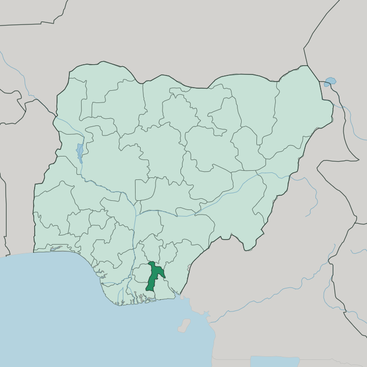
Towns & cities in Abia State
Pick a town or city — each links to where to stay.
Aba is where most travellers end up, close to the Ariaria International Market and the leather workshops that make the city its money. Umuahia, the quieter capital inland, suits anyone visiting the National War Museum or heading on to the Arochukwu cave. Pick Aba for trade and noise.
Pick Umuahia when you want to sleep near the Biafran War sites and the government offices rather than in the thick of the market crowds.
About Abia State
Abia is a factory state.
What is Abia State known for?
Aba, its largest city, stitches shoes and sews clothes for markets across the country, and Igbo traders call it Enyimba after the elephant. The name Abia itself is drawn from four of its old districts: Aba, Bende, Isuikwuato and Arochukwu. Umuahia holds the government and the National War Museum.
Down in Arochukwu, a gully cut through the rock leads to the Long Juju cave, once the shrine of the Aro oracle. It is Igbo country through and through.
Where is Abia State?
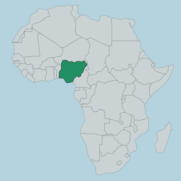
Abia is small. It lies in the country's south-east among fellow Igbo states, one of the more compact members of the Nigerian federation, hemmed in on every side by its neighbours. Imo lies to the west, Anambra to the north-west, Enugu and Ebonyi to the north-east, Cross River to the east and Rivers to the south.
Two rivers draw much of its outline. The Imo River runs along the western border with Imo State, and the Aba River traces the southern edge before joining it. The land itself changes as you move through it.
In the south, around the Rivers boundary, the ground sinks into the Niger Delta swamp forests, wet and low. Northward it lifts into the Cross-Niger transition forests, drier and greener, with the tableland town of Umuahia sitting up on higher ground. Aba, the industrial city, spreads along the west bank of the Aba River in the south.
Umuahia, the capital, stands well inland to the north, on the old railway that climbs up from Port Harcourt. Between them the state is densely settled farmland and small towns, thick with oil palm. Rivers and forest, not mountains, shape this corner of Igboland.
What is Abia State like?
Abia is Igbo country, and the Igbo language and trade shape daily life across it. The Igbo people fill the state almost entirely, and their instinct for enterprise runs through everything from the market stalls of Aba to the small workshops turning out shoes and cloth. Christianity is the common faith, and Sundays are loud with churches.
Older beliefs left their mark too. At Arochukwu the Aro people once ran the Long Juju oracle, a court whose verdicts pulled captives into the slave trade, and the cave that held it still draws visitors. Food here leans on the land.
Oil palm, yam and cassava feed the kitchens, and soups thick with palm oil sit at the centre of most meals. Aba is famous for its hustle. Its tailors and cobblers copy and undercut imported goods so briskly that "made in Aba" became a running joke and a point of pride at once.
It is a working culture, not a leisurely one.
What is the history of Abia State?
Abia is young as a state but old as a place. It was carved out of Imo State in 1991, one of many splits that multiplied Nigeria's states. Long before that, the Aro Confederacy ruled here from Arochukwu, until British troops broke it in the Anglo-Aro War at the turn of the twentieth century.
Resistance did not end. In 1929 the women of Oloko rose against colonial taxes in what became the Aba Women's War. Decades later the land around Umuahia became a last redoubt of Biafra during the Nigerian Civil War, and the bunker and war museum there keep that memory.
What is the climate of Abia State?
Abia runs hot and wet. It has a tropical climate with two seasons, a long rainy stretch from April to October and a drier spell over the rest of the year. The southern swamp forests near the Aba River soak up the heaviest rain, while the higher ground around Umuahia stays a little cooler.
Temperatures hold steady through the year, rarely swinging far in either direction. The harmattan haze blows down from the north in the dry months. Green is the default colour here.
How do you get to Abia State?
Most travellers reach Abia overland. The nearest big airport is at Port Harcourt in neighbouring Rivers State, an hour or two south by road, and the old railway line runs up from there through Aba to Umuahia. Roads fan out from Aba to Owerri, Umuahia, Enugu and the port cities of the delta, which is what made the city such a trading crossroads.
Within the state, shared taxis and buses link the two main towns. Coming from Lagos means a long haul east across the country.
Updated July 2026