Peru
Departamento de Ucayali, Peru — Towns & Travel Guide


Ucayali is Peru's second-largest region, a vast Amazon lowland of rivers and rainforest centred on the port of Pucallpa.
About Departamento de Ucayali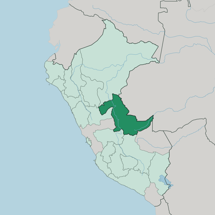
Towns & cities in Departamento de Ucayali
Pick a town or city — each links to where to stay.
Nearly every trip starts in Pucallpa. The city holds the region's beds, its airport and its river dock, so most travellers settle there and move on by boat to reach the smaller settlements upstream. Yarinacocha, the oxbow lake just to the northeast, is the quieter counterpart, its shore dotted with Shipibo-Conibo villages that sell painted cloth and pottery.
Out west sits Aguaytía. The road town waits below the Boquerón pass where the highway from the highlands finally drops into the forest. Choose Pucallpa for river access; choose Yarinacocha when you want water and Shipibo craft over city noise.
About Departamento de Ucayali
Ucayali is river country.
What is Departamento de Ucayali known for?
It takes its name from the Ucayali River, the great Amazon headwater that runs the length of the region and carries most of its traffic. Pucallpa, the capital, sits on the river's west bank and works as the region's port, market and only real city. This is the homeland of the Shipibo-Conibo, whose maze-like kené designs cover the pottery and cloth sold along the water.
Beyond the city the land is dense, low rainforest reaching east to the Brazilian border.
Where is Departamento de Ucayali?
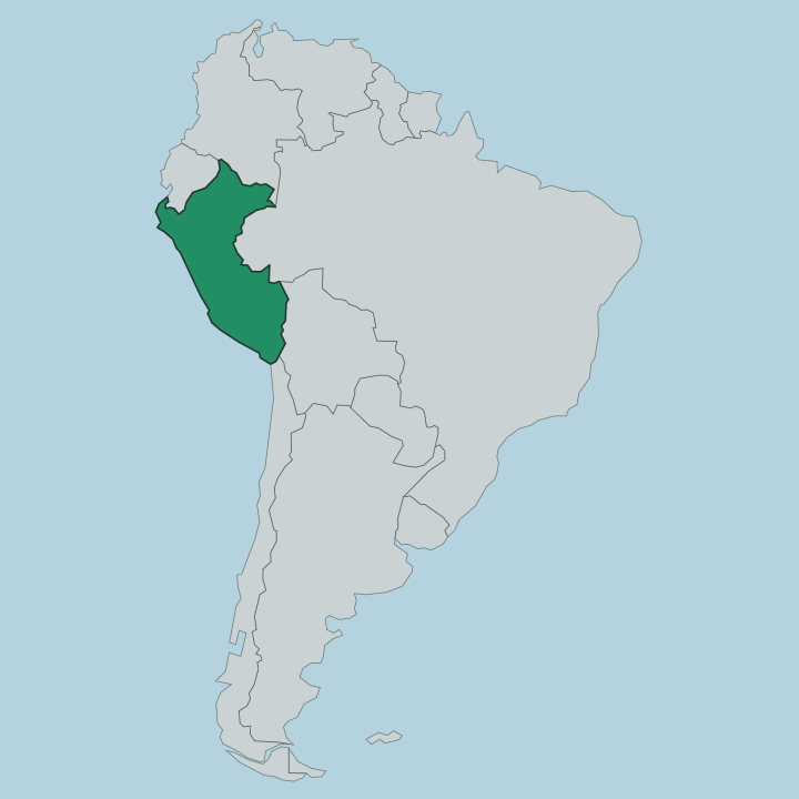
Ucayali fills the central Amazon lowland of eastern Peru, the second-largest of the country's regions after Loreto. It spreads over roughly 102,000 square kilometres of rainforest. The Brazilian state of Acre closes it off along the entire eastern edge.
Inland, Loreto lies to the north, Madre de Dios and Cusco to the south, and Huánuco, Pasco and Junín rise along the western wall toward the Andes. The Ucayali River is the spine. It forms far to the south, near the town of Atalaya, where the Urubamba and Tambo rivers meet, then runs north through a broad forested floodplain for well over a thousand kilometres.
Pucallpa stands on its west bank at barely a hundred metres above the sea, the land flat and hot in every direction. Off to the northeast lies Yarinacocha, a long oxbow lake the river left behind when it changed course. Downstream, past the region's northern limit, the Ucayali joins the Marañón to become the Amazon itself.
Water, not road, is the natural way through this country.
What is Departamento de Ucayali like?
The culture of Ucayali is Amazonian, not Andean, and the Shipibo-Conibo sit at the heart of it. They are a Pano-speaking people of the Ucayali River and its tributaries, and they never fell to the Inca. Their art is unmistakable.
Kené, the fine geometric pattern of red and black lines, covers their ceramics, their cloth and their skin, and its winding shapes are tied to a cosmology of song and vision. Much of that vision work centres on ayahuasca, the plant medicine of the forest, taken in ceremony rather than sold as spectacle. Many Shipibo now live in the city.
Large numbers have moved into Pucallpa and the villages around Yarinacocha for schools and clinics, so the painted cloth turns up in the city market just as it does out in the communities upriver. The everyday language is Spanish, spoken across Peru, but Shipibo and other native tongues carry on beside it. Food comes off the river.
Grilled paiche, the giant Amazon fish that also appears on the region's own flag, sits on plates beside plantain and river prawns. It is a warm, river-facing culture, worn plainly and lived out of doors.
What is the history of Departamento de Ucayali?
Long before any department existed, the Shipibo-Conibo held the middle Ucayali and turned back the Franciscan missions, most sharply in the revolt of 1766. The Spanish never truly settled the forest. Pucallpa grew slowly as a river outpost, cut off from the coast until a highway finally reached it from Lima in 1945 and opened the region to trade.
Ucayali itself was carved out of neighbouring Loreto and made a department in its own right in 1980, the youngest of Peru's Amazon regions.
What is the climate of Departamento de Ucayali?
Ucayali is hot and wet the year round. It sits in the Amazon lowland, so days hold near thirty degrees whatever the month, and the air stays heavy. What changes is the rain.
The wetter months build to a peak around March, when downpours swell the Ucayali River and its floodplain, while July runs noticeably drier and the water drops back. There is no cold season here. Expect humidity, sudden storms and green that never fades.
How do you get to Departamento de Ucayali?
Most travellers fly. Pucallpa's airport takes the short hop over the Andes from Lima, which is by far the quickest way in. The alternative is the Carretera Federico Basadre, the long paved highway that climbs from the capital, crosses the mountains at Tingo María and drops through the Boquerón pass into the forest at Aguaytía before reaching Pucallpa.
Inside the region the rivers do the rest of the work. From the docks at Pucallpa, boats run up and down the Ucayali to villages and towns the roads never reach.
Good for
Updated July 2026