Peru
Departamento de Junín, Peru — Towns & Travel Guide


Junín is central Peru's two-worlds department: high Andean grassland around Huancayo, dropping east into Amazon coffee country.
About Departamento de Junín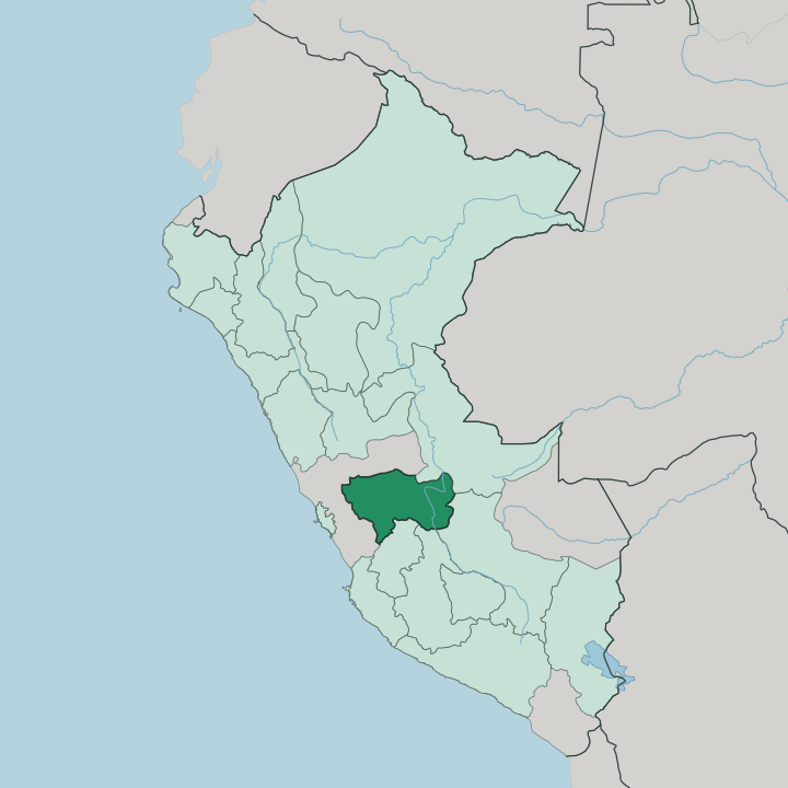
Towns & cities in Departamento de Junín
Pick a town or city — each links to where to stay.
Huancayo is the obvious base. The capital sits on the Mantaro Valley floor, and its Sunday feria and the branch-line train south make it the hub for the highland half of Junín. Jauja, the older town upvalley, trades bustle for a colonial plaza and a lagoon at the valley's head.
Tarma is the hinge east. Beyond it Chanchamayo opens into coffee country, where the plots run warm and green, beds thin out, and the western Amazon closes in around the road. Choose Huancayo for the valley and the fair; choose Tarma or Chanchamayo when you want the descent into the selva.
About Departamento de Junín
Two things, above all.
What is Departamento de Junín known for?
Junín is the Mantaro Valley, the broad Andean floor east of Lima where Huancayo anchors a weekly craft fair and the region grows much of its food. It is also the name Peru gives to a decisive cavalry charge that turned the war of independence, fought on the cold Junín plateau. Push east and the sierra falls into the selva.
There the coffee towns of Chanchamayo and Satipo sit in the western Amazon, a warm green world a day's road below Huancayo. Add Lake Junín, the highest large lake in the country, and the range is set.
Where is Departamento de Junín?
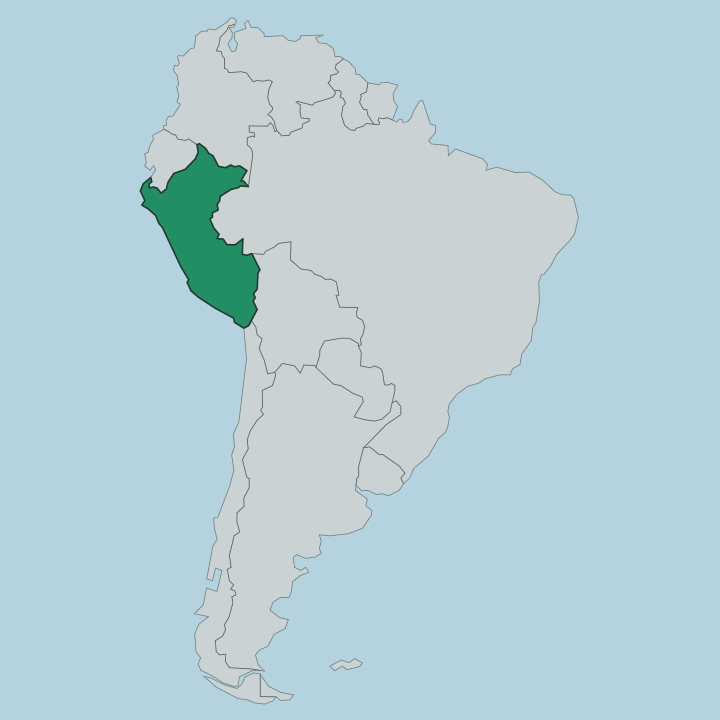
Junín occupies the centre of Peru, inland and east of Lima across the first great wall of the Andes. Its shape is a transect. In the west the land is cold, high grassland and glacier-topped ranges, and the wide Junín plateau spreads north toward Cerro de Pasco.
Here lies Lake Junín, called Chinchaycocha in Quechua, the largest lake wholly inside Peru and the highest of its size in the country, ringed by reed beds that the Reserva Nacional de Junín protects. The Mantaro River rises near that lake and swings south through the department's heart, carving the fertile Mantaro Valley where Huancayo, Jauja and Concepción stand between about ten thousand and eleven thousand feet. East of the divide everything changes.
The sierra breaks apart in a few dozen road miles and falls into the ceja de selva, the eyebrow of the jungle, and then into the western Amazon proper. Tarma marks the top of that descent; below it La Merced, Chanchamayo and Satipo lie in humid valleys of coffee, fruit and forest. The Mantaro eventually meets other headwaters to form the Ene River, one of the streams that feeds the Amazon.
From frozen puna to rainforest, Junín crosses nearly every life zone Peru has, and the road east loses more than two vertical miles on the way.
What is Departamento de Junín like?
The Mantaro Valley is Huanca country. The Huanca, or Wanka, farmed and fought across these highlands long before the Inca reached them, and their descendants still fill the Sunday market at Huancayo with woven textiles, silver filigree and carved mate gourds. Their own dialect of Quechua carries a hard sound the rest of Peru teases them for.
Festival is the valley's other language. Tarma is famous for the alfombras, carpets of dyed flower petals and sawdust that its people lay across the streets at Easter and Corpus Christi, and the whole Mantaro keeps a dense calendar of danced fiestas, the Huaylarsh and the Santiago among them. Drop east and the culture shifts as sharply as the land.
The Chanchamayo and Satipo valleys are the home of the Asháninka, the largest Indigenous people of the Peruvian Amazon, whose cushma robes and river-country life owe nothing to the sierra above. Coffee, planted here in the nineteenth century, binds the two worlds now. The bean that grows in the Junín selva rides the same road up to Huancayo that the wool and potatoes come down, and the department's food, from valley trout to jungle fruit, follows that vertical seam.
What is the history of Departamento de Junín?
The Huanca held the Mantaro Valley for centuries before the Inca absorbed them in the 1400s, and when the Spanish came the Huanca sided against Cusco. The name Junín, though, belongs to one August day. On 6 August 1824, on the cold plateau by Lake Junín, Simón Bolívar's cavalry broke a Spanish royalist force in a running charge fought with lance and sabre, no shot fired.
It broke the royalist grip on the central sierra and pointed the way to Ayacucho four months later. Peru named the department for the battlefield.
What is the climate of Departamento de Junín?
Altitude sets the weather here, not the calendar. On the high plateau around Lake Junín the air is thin and cold, with frost most clear nights and a dry season from May to September that draws hard blue skies over the Mantaro Valley. The rains arrive from December to March, turning Huancayo green and the plateau grasslands soft.
Drop east toward Chanchamayo and the thermometer climbs with every switchback, until the selva sits warm, wet and humid the year round. Two climates, one drive apart.
How do you get to Departamento de Junín?
Most people come overland from Lima. The Central Highway climbs from the coast over a pass above fifteen thousand feet, past La Oroya, the old smelting and rail junction where the routes fork, and down into the Mantaro Valley to Huancayo. Buses run the road all day.
Jauja has the department's airport, with a short hop up from Lima for those skipping the drive. From Huancayo one road carries on east through Tarma and down the switchbacks to the coffee towns of Chanchamayo and Satipo in the selva.
Good for
Updated July 2026