Peru
Departamento de Piura, Peru — Towns & Travel Guide


Piura is Peru's hot northwestern corner, where the Sechura Desert meets warm Pacific surf towns like Máncora.
About Departamento de Piura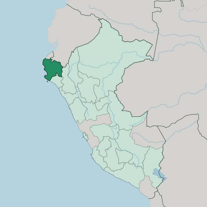
Towns & cities in Departamento de Piura
Pick a town or city — each links to where to stay.
Máncora is the obvious base for a first visit, a warm surf town strung along one long Pacific break in the far north of the region. The capital sits inland. The city of Piura anchors the dry interior beside the Piura River, the practical hub for the region's airport and long-distance buses.
Paita is the old working port, a deep-water fishing harbour on the Pacific west of the capital that hauls in much of the coast's catch. Sullana sits upriver on the greener Chira valley. It is farm country of rice and mango, north-west of the capital.
Choose Máncora for the beach; pick Piura, Paita, or Sullana when you want the working towns behind it.
About Departamento de Piura
Piura is the beach coast of northern Peru.
What is Departamento de Piura known for?
Sun draws most people here. The surf town of Máncora runs a long sandy break where surfers, backpackers, and kite-boarders share the same warm water. Away from the shore the land turns dry, with the Sechura Desert spreading south of the Piura River and equatorial scrub forest inland toward the Andes.
The city of Piura is the regional capital, founded by Francisco Pizarro in 1532 as the first Spanish town in Peru.
Where is Departamento de Piura?
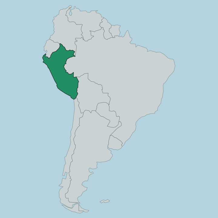
Piura fills the far north-western corner of Peru, wedged against the border with Ecuador and facing the Pacific Ocean along its whole western edge. It is one of the country's hottest and driest coastal regions. The Sechura Desert, Peru's largest, spreads across the south below the Piura River and reaches inland to the foothills of the Andes.
Two rivers shape the settled land. The Piura River curls down out of the mountains, past the capital and toward the desert, running full in the rains and shrinking almost to nothing in dry years. The Chira River, the region's most reliable, gathers the northern water and carries it to the Pacific near the port of Paita.
Between the rivers lie small green valleys of rice, cotton, and mango, a sharp contrast to the grey desert and thorn-scrub dry forest around them. The coast runs from the surf beaches of Máncora in the north down past the working ports of Talara and Paita to the fishing town of Sechura in the south. Inland and eastward the ground climbs.
The old highland towns of Ayabaca and Huancabamba sit up in the Andean foothills, cooler and wetter than the burning coast below. Lambayeque lies to the south, Cajamarca to the east, and Tumbes and Ecuador to the north.
What is Departamento de Piura like?
Piura wears its heat and its coast openly. Life leans outdoors. The region keeps a strong criollo culture of its own, distinct from the Andean highlands to the east, and it shows in the food, the music, and the crafts.
Ceviche is the everyday dish, raw fish cured in lime and eaten with sharp onion, and it sits at the centre of the northern table. Chicha, the fermented maize drink, pours alongside it in the market towns. Two dances carry the region's name outward.
The tondero, a courting dance of stamping feet and swirling cloth, grew up in these valleys, and the cumanana, a sung poetic duel of improvised verses, runs with it. Craft towns give Piura its handmade face. Catacaos, just south of the capital, is famous across Peru for delicate gold and silver filigree and woven straw hats, its long main street lined with workshops.
Chulucanas, inland toward the hills, turns out a burnished round pottery of black and earth tones that carries the town's name. The old highland towns keep older devotions. Ayabaca draws pilgrims from across the north each October to the shrine of the Señor Cautivo.
Between the surf towns, the market towns, and the mountain shrines, the region holds several worlds at once.
What is the history of Departamento de Piura?
Long before the Spanish arrived, the coast belonged to the Tallán people. The older Vicús culture had worked these valleys before them, leaving fine pottery and gold. Everything changed in 1532.
Francisco Pizarro founded San Miguel de Piura that year, on his march inland toward the Inca, making it the first Spanish city in Peru and in South America. The unhealthy first site was abandoned, and the town moved more than once before it settled at its present place beside the Piura River in 1588. From that inland base the Spanish pushed on to the conquest of the Inca empire.
What is the climate of Departamento de Piura?
Piura is hot and dry for most of the year, one of the warmest coasts in Peru. Rain is scarce from May to November. The short wet season falls between December and April, when the desert ravines can briefly run green.
Every few years an El Niño warming of the Pacific breaks the pattern and dumps heavy rain that swells the Piura River and floods the low ground. The Andean towns of Ayabaca and Huancabamba, up in the eastern foothills, stay cooler and greener than the burning coast the rest of the region shares.
How do you get to Departamento de Piura?
Most travellers fly into Piura's airport from Lima, an hour and a half down the coast by air. The city is the region's arrival point. From there buses fan out along the Panamericana, the coastal highway that threads the whole region north to south.
Beach-bound visitors often carry straight on to Máncora, a few hours up the road near the Tumbes border, or fly instead into the smaller airport at Talara closer to the northern beaches. Overland the region also connects north into Ecuador and south toward Lambayeque and Lima.
Good for
Updated July 2026