Peru
Departamento de Ancash, Peru — Towns & Travel Guide


Áncash is the Peruvian region of the Cordillera Blanca, where Huascarán and the Callejón de Huaylas draw trekkers north of Lima.
About Departamento de Ancash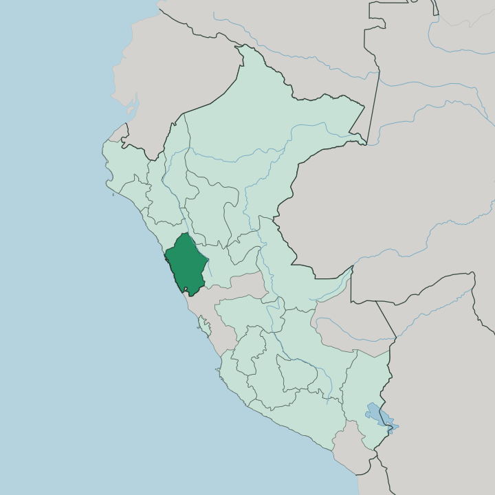
Towns & cities in Departamento de Ancash
Pick a town or city — each links to where to stay.
Huaraz is the base for almost every visit, the regional capital in the Callejón de Huaylas with the widest choice of beds and the tour operators who run the treks. North up the Santa River, Caraz sits closer to Huascarán National Park and moves at a slower pace. Yungay lies between them, rebuilt beside the ground the 1970 avalanche buried.
On the coast, Chimbote is a working fishing port rather than a resort town on the Pacific. Few come for the shore. Stay in Huaraz to acclimatise and set out from there; move north to Caraz when you want the quieter end of the valley.
About Departamento de Ancash
Áncash is high-mountain Peru.
What is Departamento de Ancash known for?
The Cordillera Blanca is the reason most travellers come, a wall of glaciated peaks that holds Huascarán, the highest mountain in the country. Between that white range and the drier Cordillera Negra runs the Callejón de Huaylas, the valley of the Santa River where Huaraz and the smaller towns sit. Beyond the trekking, the region carries one of the Americas' oldest ceremonial sites at Chavín de Huántar.
Chimbote holds the coast, a fishing port on the Pacific.
Where is Departamento de Ancash?
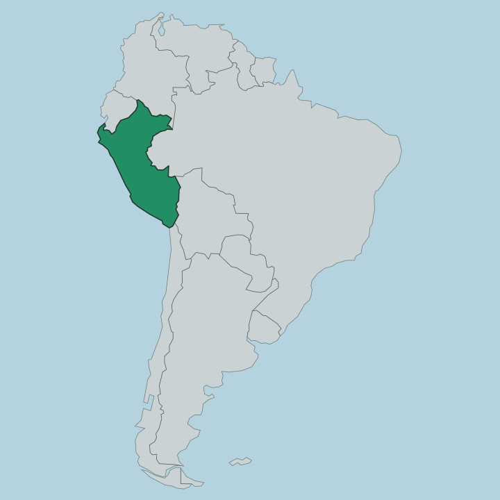
Áncash lies in western Peru, on the Pacific coast north of Lima. Two mountain ranges define it. The Cordillera Blanca on the east is a glaciated wall carrying Huascarán, the highest peak in Peru, along with Alpamayo and dozens of other summits above the snow line.
The Cordillera Negra to the west is lower and bare of ice, and between the two ranges the Santa River drains the trough known as the Callejón de Huaylas. That valley strings together the region's towns, from Recuay in the south down past Huaraz and Caraz. The river turns west near Caraz and cuts down toward the coast, reaching the Pacific at Chimbote.
West of the Cordillera Negra the land falls away to a dry coastal strip of river valleys and cane fields. East of the Cordillera Blanca the ground drops the other way, into the Conchucos valleys where Chavín de Huántar stands. Huascarán National Park protects the high spine of the Cordillera Blanca between those two flanks.
From glacier to shore is a short horizontal distance and a vertical drop of thousands of metres. Little of Áncash is flat.
What is Departamento de Ancash like?
The mountains set the rhythm of life in Áncash. Spanish is the common language, but roughly a third of áncashinos grow up speaking Ancash Quechua, and the two run together in the markets and small towns of the Callejón de Huaylas. The Andean year is marked by patronal festivals, and the region's culinary signature is pachamanca, meat and potatoes cooked in a pit of fire-heated stones.
Quechua names sit on the land itself, from the lakes below the glaciers to the peaks above them. The deeper current is far older. Chavín de Huántar, in the Conchucos valleys east of the Cordillera Blanca, was a ceremonial centre built more than three thousand years ago, and the Chavín style it gave its name to spread its carved stone imagery across much of the central Andes long before the Inca.
That inheritance frames how the region reads itself. Áncash is Andean to the core. Its towns look up at Huascarán the way coastal Peru looks out to sea, and the snow line is never out of view for long.
What is the history of Departamento de Ancash?
Áncash carries deep Andean history. Chavín de Huántar was raised around 1200 BC and drew pilgrims for centuries as a religious hub before the Chavín culture faded. Later the valley towns passed under Inca rule and then Spanish, and after independence Áncash became a department of Peru.
Its modern history turns on a single date. On 31 May 1970 an offshore earthquake shook loose the north face of Huascarán, and the avalanche that followed buried Yungay and killed tens of thousands across the Callejón de Huaylas, the deadliest natural disaster Peru has recorded. Much of the valley was rebuilt in the years after.
What is the climate of Departamento de Ancash?
Altitude rules the weather, not the season. In the Callejón de Huaylas the days stay cool and the nights cold year round, and what changes is the rain. The dry months from May to September bring clear mornings over the Cordillera Blanca and are when the trekking routes are walked; the wet season from December to March clouds the peaks and soaks the valleys.
Down on the coast at Chimbote it is warmer and rarely rains at all. On the glaciers above Huaraz, snow can fall in any month.
How do you get to Departamento de Ancash?
Most travellers reach Áncash overland from Lima. Long-distance buses climb the paved road up into the Callejón de Huaylas and terminate at Huaraz, a run of roughly eight hours by way of the coast and the mountain passes. The airport at Anta, in the Santa River valley northwest of Huaraz, takes short flights from Lima and cuts the journey to under an hour.
The coastal city of Chimbote sits on the Pan-American Highway for anyone travelling the shore. From Huaraz, local transport fans out up the valley to Caraz and into Huascarán National Park.
Good for
Updated July 2026