Russia
Kemerovo Oblast, Russia — Towns & Travel Guide


Kemerovo Oblast is Russia's Kuzbass, a coal-rich Siberian basin ringed by mountains, with Sheregesh's ski slopes to the south.
Find your area →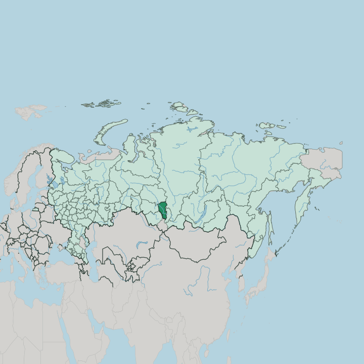
Towns & cities in Kemerovo Oblast
Pick a town or city — each links to where to stay.
 Russia
Kemerovo
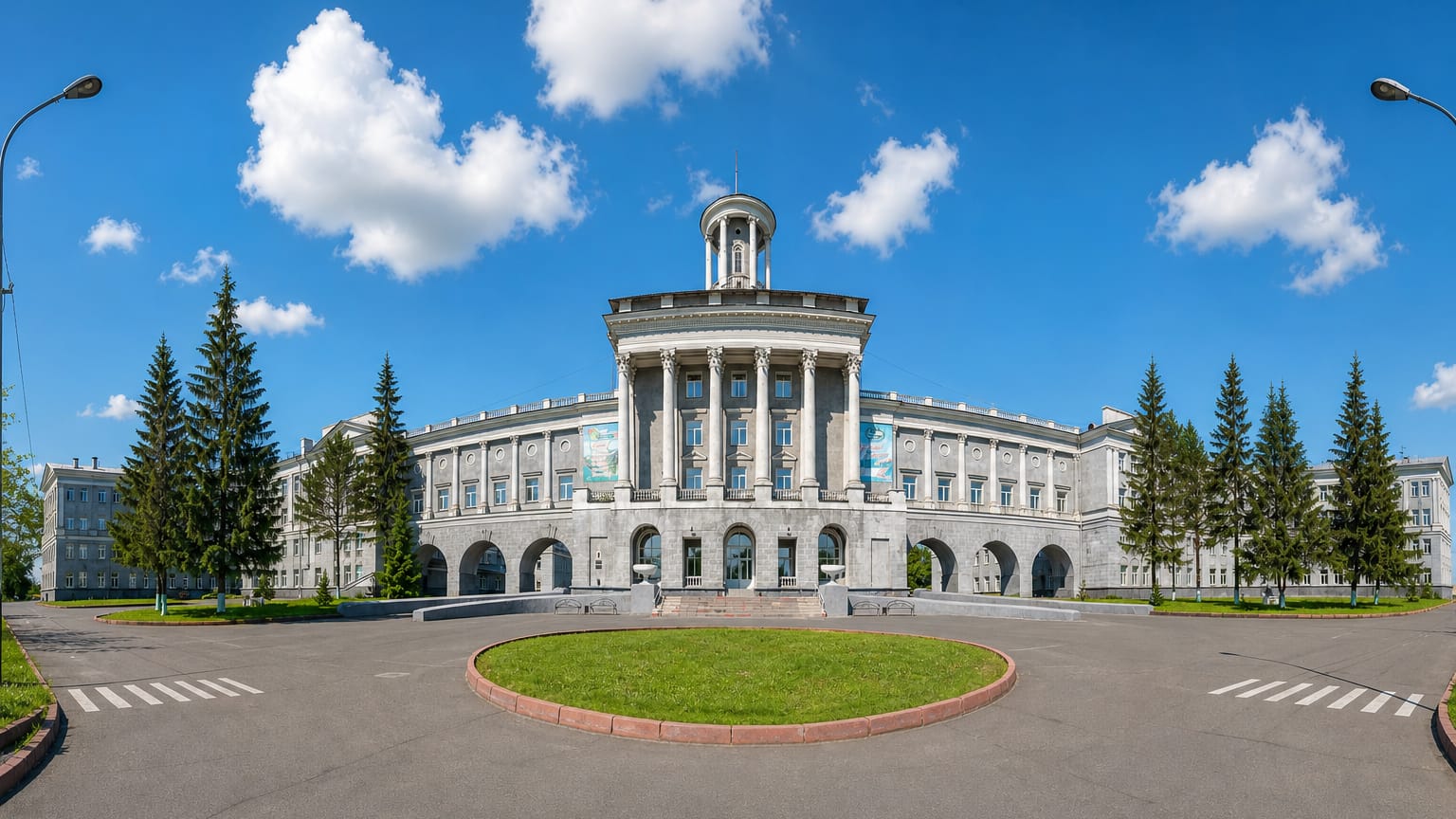
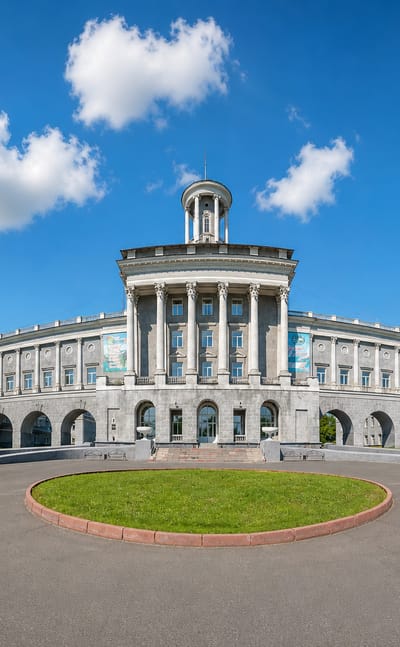
Coal country frames Kemerovo, a river city and the seat of Kemerovo Oblast, known for the Kuzbass State Museum of Local Lore and its riverside squares.Where to stay →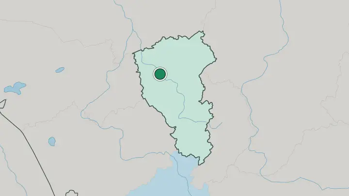
About Kemerovo Oblast
Coal built this place.
What is Kemerovo Oblast known for?
The oblast is better known by its nickname, Kuzbass, taken from the Kuznetsk Basin whose seams hold some of the largest coal deposits on Earth. That mining wealth drew Soviet industry and packed the region's people into a handful of cities rather than the countryside. Kemerovo governs it and Novokuznetsk forges its steel, while the southern mountains of Mountain Shoria pull skiers to the slopes above Sheregesh through the long winter.
Where is Kemerovo Oblast?
Kemerovo Oblast sits in southwestern Siberia, in the trough called the Kuznetsk Depression where the flat West Siberian Plain runs up against the South Siberian Mountains. Two ranges wall the basin. The Kuznetsk Alatau rises along the eastern edge, its ridges stretching some 300 kilometres, while the lower Salair Ridge closes off the west.
Between them the Tom River drains the whole basin from south to north. The Tom is a right tributary of the Ob, and it passes Novokuznetsk, then Kemerovo, before leaving the region toward Tomsk. The oblast borders Tomsk Oblast to the north, Novosibirsk Oblast to the west, Krasnoyarsk Krai to the northeast, the Republic of Khakassia to the east, and the Altai Republic and Altai Krai to the south.
Down in that southern corner the land climbs into Mountain Shoria, a forested upland of the Salair and Alatau spurs. Verkhny Zub, the region's highest peak, marks the mountainous eastern border. This is compact, land-locked country, small by Siberian measure and hemmed in on almost every side by hills.
What is Kemerovo Oblast like?
This is a worker's region, and it wears that plainly. Its cities grew around mine shafts and blast furnaces, so the culture here is one of shift changes, miners' holidays and monuments to labour rather than palaces. Most people are ethnic Russian, many of them descended from families brought east to dig the coal and pour the steel.
The name Kuznetsk itself means blacksmith, borrowed from the Shor people whom Russian settlers called the Blacksmith Tatars for their skill at working iron. The Shors are an indigenous Turkic people, and most of them still live in the south, in the Tom basin along the Kondoma and Mras-Su rivers, in the uplands of Mountain Shoria. Teleuts and Siberian Tatars belong here too.
Shamanism and Orthodoxy coexist among them. The everyday language is Russian across the oblast, though the Shor tongue survives in villages and in efforts to keep it taught. Mining shapes the calendar and the pride alike.
Miners' Day is the region's great summer celebration, and coal turns up in the city emblems as readily as in the ground beneath them.
What is the history of Kemerovo Oblast?
Russian history in the basin starts at a fort. Cossacks raised the Kuznetsk fort on the Tom River in 1618, on the site that grew into Novokuznetsk, to hold the frontier and gather tribute from the south. For centuries the coal went untouched.
That changed under Soviet planners, who tied the basin into the Ural-Kuzbass complex and drove mines, coke works and steel mills into the ground between the two world wars. Out of that industrial surge the oblast was carved from Novosibirsk Oblast in 1943, taking the working name Kuzbass from the Kuznetsk Basin it was built to exploit.
What is the climate of Kemerovo Oblast?
Winters here bite hard. The climate is sharply continental, with January settling far below freezing across the basin and the plains gripped by cold and snow for months. Summers are short but genuinely warm, July climbing into the high teens, which gives the taiga its brief green season.
The mountains change the rules: the western slopes of the Kuznetsk Alatau wring the rain from passing air and can gather well over a metre of precipitation a year, while the plains stay far drier. That heavy mountain snow is exactly what feeds the long ski season above Sheregesh.
How do you get to Kemerovo Oblast?
Most people reach Kemerovo Oblast by air. Kemerovo has its own airport on the edge of the capital, and Novokuznetsk is served by Spichenkovo airport in the south, the pair covering the two ends of the region. The Trans-Siberian mainline runs close by, so trains reach the basin easily from Novosibirsk to the west and Krasnoyarsk Krai to the east.
Skiers bound for Sheregesh usually fly into Novokuznetsk and finish the journey by road up into Mountain Shoria. Inside the oblast, road and rail thread the string of coal towns together along the Tom.
Common questions
What is the best area to stay in Kemerovo Oblast?
Kemerovo: the Kuzbass capital on the Tom.
Good for
Updated July 2026