Thailand
Changwat Loei, Thailand — Towns & Travel Guide


Loei is Thailand's mountain corner on the Mekong, a cool, forested province of misty peaks, Lao-flavoured towns and the riverside calm of Chiang Khan.
About Changwat Loei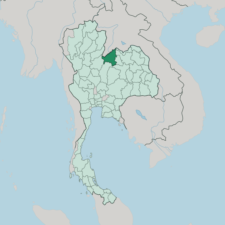


Towns & cities in Changwat Loei
Pick a town or city — each links to where to stay.
Most trips base in one of two places. Loei town sits in the central basin, a workaday provincial capital handy for the airport and for road trips out to the parks. The traveller's favourite is Chiang Khan.
Its single lane of century-old teak shophouses runs right along the Mekong, and guesthouses fill the weathered timber façades that look across the water to Laos. For the mountains, Phu Ruea and the foot of Phu Kradueng hold eco-lodges and campsites built for cold nights. Pick the river for atmosphere; pick Loei town for reaching everything else.
About Changwat Loei
Loei trades on cool air and high country.
What is Changwat Loei known for?
Thais know it as the coldest province in the land, where December frost can whiten the grass on Phu Ruea and Phu Luang. Its calling cards are the pine-topped plateau of Phu Kradueng, the slow riverside town of Chiang Khan on the Mekong, and the masked Phi Ta Khon spirit festival that fills the streets of Dan Sai each summer. High country is what marks Loei out.
Coffee, macadamia and passion fruit grow on the cool uplands that draw walkers up from the plains of Isan.
Where is Changwat Loei?
Loei fills the upper northwestern corner of Isan, the northeastern region of Thailand, pressed against the border with Laos. The Mekong draws its northern edge, and the Loei River, the tributary that gives the province its name, runs the length of the basin before joining the great river at Chiang Khan. Mountains wall in the rest.
Ranges roll away on every side, an outlier of the Phetchabun highlands that Thais call a sea of mountains, and the provincial seat sits low among them in a fertile bowl. Nong Khai and Udon Thani lie east, Khon Kaen and Phetchabun to the south, and the forested ridges of Phitsanulok close off the west. The high ground is the point. Phu Kradueng rises to a broad sandstone tableland capped with pine forest, protected as a national park, while Phu Ruea and Phu Luang lift their own cool summits nearby.
Between the peaks the land opens into valleys of paddy, orchard and coffee. Rivers cut down toward the Mekong through gorges and waterfalls. It is thin-populated country.
Much of the province stays under dry dipterocarp and deciduous forest, and the mix of cold nights and mountain soil is what lets macadamia, grapes and Arabica grow here where the lowland heat of Isan cannot follow.
What is Changwat Loei like?
Loei feels more Lao than Thai in its bones. The province took in families crossing from Laos over generations, and their Tai Dam and Phuan roots still shape the food, the dialect and the temple festivals. Isan rhythms mix with cooler-country habits here.
Sticky rice and fermented flavours sit beside the coffee and mulberry wine of the hills, and Buddhist merit-making orders the calendar much as it does across the northeast. Life runs slow. The riverside mornings at Chiang Khan, where monks walk the teak lane at dawn to collect alms of sticky rice, catch that unhurried temper better than anything.
Its wildest expression comes once a year at Dan Sai. There, the Phi Ta Khon festival sends young men parading in towering masks built from rice-steamer baskets and painted coconut sheaths, part of the older Bun Luang merit rite that honours the town's guardian spirits and the Buddha. It is loud, comic and sacred at once.
Craft leans practical rather than courtly, cotton weaving, basketry, and the carving of those ghost masks. Away from the festival the mood is rural and quiet, a frontier of orchards and pine ridges where the pace answers to harvest and weather rather than to any city.
What is the history of Changwat Loei?
Loei's story is a border story. Long before it was a province, this stretch of the Man River marked the frontier between two great kingdoms, and around 1560 the rulers of Lan Xang and Ayutthaya raised the stupa of Phra That Si Song Rak at Dan Sai to seal their friendship. The name means the shrine of the love of two lands.
Settlers had drifted down from the north, from the old Chiang Saen country, to farm the basins. The central government drew the district into a single province only in 1907, under King Chulalongkorn. Remoteness kept it quiet for a long while after.
What is the climate of Changwat Loei?
Loei runs colder than the rest of Thailand. The altitude does it: nights on Phu Ruea and Phu Luang can drop toward freezing in December, and thin frost sometimes silvers the grass on the high sanctuaries, a sight found almost nowhere else in the country. Three seasons turn here.
Cool, dry air settles from November into February, the hot months build through April, and the southwest monsoon brings the rains from June to October. Even the basin around Loei town stays milder than the baking lowlands of Isan below. Bring a jacket for the hills.
How do you get to Changwat Loei?
The province sits far from Thailand's main lines, and that distance shapes its character. Loei Airport takes short flights up from Bangkok, the quickest way in by a wide margin. Most others come overland.
Long-distance buses grind north through Isan on Highways 201 and 203, and the drive from the capital runs most of a day across the plateau. No train reaches the province; the nearest railheads are down at Udon Thani and Khon Kaen. From Udon Thani's airport it is a couple of hours by road, with Chiang Khan another hour on toward the Mekong.
Good for
Updated July 2026