Thailand
Changwat Nakhon Sawan, Thailand — Towns & Travel Guide


Nakhon Sawan is a province of central Thailand where the Ping and Nan rivers meet to form the Chao Phraya, beside Bueng Boraphet, its largest lake.
About Changwat Nakhon Sawan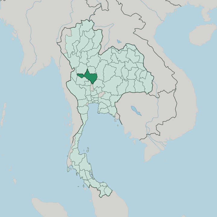


Towns & cities in Changwat Nakhon Sawan
Pick a town or city — each links to where to stay.
Almost everyone stays in Nakhon Sawan city, on the east bank at Pak Nam Pho, within reach of the confluence, the night market and the hilltop temple of Wat Khao Kop. Beds fill fast at new year. East of town, a few lakeside guesthouses sit along Bueng Boraphet for those who want herons at dawn over a boat engine's grumble.
West, toward Lat Yao and Mae Wong National Park, the plains give way to forest, waterfalls and quiet nights under the trees. Choose the city for the river and the festival; choose the hills or the lake for the rest.
About Changwat Nakhon Sawan
The name means heavenly city.
What is Changwat Nakhon Sawan known for?
Nakhon Sawan is where the Chao Phraya River is born, at the old river port of Pak Nam Pho, where the Ping and Nan rivers run together into one stream. Just east of town spreads Bueng Boraphet, the largest freshwater lake in Thailand, a shallow reed-fringed marsh that fills each winter with pelicans, storks and tens of thousands of migrating ducks. The other draw is human.
Each lunar new year the Chinese quarter stages one of the grandest dragon parades in the country.
Where is Changwat Nakhon Sawan?
Nakhon Sawan sits in the upper central plains of Thailand, where the lowlands of the great river basin begin and the last of the northern hills fall away. This is the meeting of the waters. Four rivers drain out of the northern mountains toward the plain, and two of them, the Ping River and the Nan River, join here at Pak Nam Pho to become the Chao Phraya, the river that runs on through Bangkok to the sea.
The Wang River has already fed into the Ping upstream, and the Yom River into the Nan, so the confluence at Nakhon Sawan gathers the drainage of half the north into a single channel. Below the town the Chao Phraya slides south across flat, well-watered paddy country. East of the city lies Bueng Boraphet, the largest freshwater lake in Thailand, a broad shallow marsh of reeds, lotus and open water left where an old floodplain never fully drained.
It is a shallow bowl. In the dry months it shrinks to mudflats and lily beds, then swells again when the monsoon rivers back up into it. The land is mostly level here, paddy and sugar cane running to the horizon, but the western edge is different.
There the ground climbs toward the Kamphaeng Phet border into the forested ridges of Mae Wong National Park, teak and bamboo hill country that shelters gaur and the odd tiger. Eight provinces ring Nakhon Sawan. Kamphaeng Phet and Phichit lie to the north, Phetchabun and Lop Buri to the east, Chai Nat and Sing Buri to the south, and Uthai Thani and Tak along the west.
What is Changwat Nakhon Sawan like?
For all its Thai farming country, Nakhon Sawan wears a strong Chinese face. Traders from southern China settled the river port generations ago, and their descendants still run much of old Pak Nam Pho. Its lunar new year is the town's great event.
The festival began after a cholera outbreak more than a century ago, when frightened townsfolk carried the images of the guardian deities Chao Pho and Chao Mae through the streets to drive the sickness out, and the sickness passed. That procession never stopped. For twelve days and nights each lunar new year the streets fill with red lanterns, firecrackers and lion dances, and the great golden dragon of Nakhon Sawan runs the length of the road, a serpent scores of metres long carried by dozens of men.
Faith runs quieter the rest of the year. Above the confluence rises Khao Kop, a low hill crowned by the temple of Wat Khao Kop, where at the close of Buddhist Lent monks descend a long stair in the Tak Bat Thewo alms procession while the town waits below with rice and food. Down on the water the old trade goes on in gentler form, longtail boats and fish farms where teak rafts and rice barges once queued.
Rice and sugar cane still set the working year across the plain. Out on Bueng Boraphet, fishing families work the reeds and net the shallows much as they always have. Everyday speech is Thai.
Between the shrines, the paddies and the dragon, the province keeps a mongrel character that is neither wholly Thai nor wholly Chinese.
What is the history of Changwat Nakhon Sawan?
The town guarding the confluence is old. Under the Sukhothai Kingdom it was Mueang Phra Bang, a southern frontier post watching the road to the plains, and in the Ayutthaya centuries it grew rich as a river junction where northern goods changed boats. Trade made the place.
After the Bowring Treaty of 1855 opened Siam to foreign commerce, Nakhon Sawan became the great up-country port where teak logs floated down from the north and rice went south to Bangkok. Then the railway and the roads came, and the boats gave way to trains and trucks.
What is the climate of Changwat Nakhon Sawan?
Nakhon Sawan bakes in the hot season. It has the three-season tropical climate of the inland plains, without a coast to soften it. From March the heat builds hard over the flat country, the fiercest of any Thai season, until the south-west monsoon breaks in around May.
Then the rains come. They fill the rivers and swell Bueng Boraphet through to October, spreading the lake far across its floodplain. The cool, dry months from November into February are the kind ones, clear and mild, and the season the wintering birds arrive on the lake.
How do you get to Changwat Nakhon Sawan?
Everything on the way north passes through. Nakhon Sawan sits on the main road and rail line out of Bangkok toward Chiang Mai, about 250 kilometres up the plain from the capital. Trains on the Northern Line stop here on the east bank of the river, and buses run all day from Bangkok's Mo Chit terminal up Highway 1, the old Phahonyothin road.
Flights are the weak link. The small airfield sees little scheduled traffic, so most travellers arrive overland, and the town works as a natural crossroads between the north and the central plains.
Good for
Updated July 2026