Thailand
Changwat Sa Kaeo, Thailand — Towns & Travel Guide


Sa Kaeo is a border province of eastern Thailand, its plains running east to the Cambodian frontier at the Aranyaprathet crossing.
About Changwat Sa Kaeo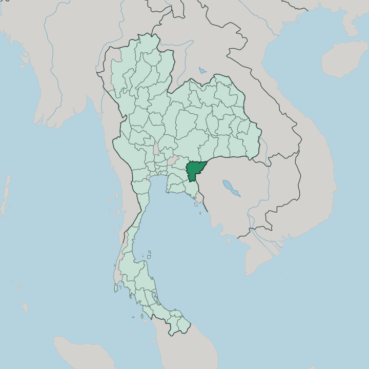


Towns & cities in Changwat Sa Kaeo
Pick a town or city — each links to where to stay.
Most travellers pause at Aranyaprathet, the border town where the trade and the crossing to Poipet concentrate. It makes the obvious first base. The provincial capital at Sa Kaeo town lies quieter to the west, beside the twin ponds that named it, and works well for the temples and caves of the interior.
For forest and waterfalls, look to the highland lodges near Pang Sida National Park, best in the butterfly months. Ta Phraya sits furthest east, out by the Khmer ruins. Choose by what pulls you inland.
About Changwat Sa Kaeo
Everything here bends toward the border.
What is Changwat Sa Kaeo known for?
The border crossing at Aranyaprathet, opposite the Cambodian town of Poipet, is the busiest between the two kingdoms, and beside it sprawls Rong Kluea Market, a warren of second-hand stalls and cross-border trade. Culture runs deeper inland. Prasat Sdok Kok Thom, the largest Khmer ruin in eastern Thailand, once held the inscribed stele that traced two and a half centuries of Angkor's god-kings, since carried off to the national museum in neighbouring Prachinburi.
To the north, Pang Sida National Park counts some 400 species of butterfly.
Where is Changwat Sa Kaeo?
Sa Kaeo occupies the eastern edge of Thailand, roughly 200 km east of Bangkok, where the central plain runs out against the Cambodian frontier. The border is long. For some 165 kilometres it follows the hills east and south, facing the Cambodian provinces of Banteay Meanchey and Battambang.
Along the northern rim rise the forested ridges of the Sankamphaeng Range and, further east, the sandstone wall of the Dângrêk Mountains that carries the line between the two countries. This upland holds Pang Sida National Park and Ta Phraya National Park, both folded into the Dong Phayayen-Khao Yai Forest Complex that UNESCO lists as World Heritage. The south is gentler.
There the land breaks into wavy plains and low hills toward the foothills of the Cardamom Mountains, much of it long cleared for cassava and sugar cane. Between the two, the middle of the province is flat and open. Khao Chakan interrupts it, a lone ridge of limestone riddled with caves and cave temples southwest of the capital.
Water gave the province both its name and its seat. Two ponds at the capital, Sa Kaeo and Sa Khwan, once supplied water held sacred enough for royal coronations, and the town grew up around them. The province split from Prachinburi to govern itself.
Bangkok lies a half-day's drive west.
What is Changwat Sa Kaeo like?
Two currents run through Sa Kaeo. The older is Khmer. Long before there was a Thai province here, the builders of Angkor raised sanctuaries in this borderland, and the greatest survivor, Prasat Sdok Kok Thom, still stands on its laterite platform east of the plain.
Its famous inscription, carved on a tall stele, set down the genealogy of the Khmer god-kings and the ritual that bound them to the land. That heritage did not stay in the past. Khmer speech, food, and faces are still common in the districts along the frontier, where families straddle a line drawn only in the last century.
The second current is trade. At Rong Kluea Market, hard against the crossing to Poipet, porters push handcarts of second-hand clothing and Cambodian goods through lanes that never quite empty. Bargaining is the daily language here.
Away from the border, life turns Thai and rural, ordered by the wat, the morning market, and fields of cassava and sugar cane that feed the mills. The forest keeps its own calendar. When the first rains break over Pang Sida National Park, clouds of butterflies gather at the damp roadsides, and the province turns the season into a festival that runs from May into July.
What is the history of Changwat Sa Kaeo?
This borderland has changed hands and rulers for a thousand years. In the eleventh century it lay within the reach of Angkor, whose priests left the Sdok Kok Thom inscription to record their god-kings. For most of the modern era it was simply the eastern marches of Prachinburi.
War on the far side of the border remade it. When the Khmer Rouge fell in 1979 and Vietnamese tanks rolled into Cambodia, hundreds of thousands fled across the line, and the camps at Sa Kaeo and Khao-I-Dang rose almost overnight to shelter them. Prachinburi gave it up in 1993.
What is the climate of Changwat Sa Kaeo?
The province keeps three seasons, not four. Heat builds through March and April, when the plain bakes and the reservoirs drop. Then the southwest monsoon arrives.
From about May into October it soaks the Sankamphaeng Range, sends the waterfalls of Pang Sida National Park into full flow, and draws out the butterflies that gather along the wet forest tracks. The cool, dry months from November into February are the easy time to travel, with clear skies over the border and mild nights in the uplands. Dust returns by spring.
How do you get to Changwat Sa Kaeo?
Most people arrive overland from Bangkok, a few hours west. Buses and minivans run all day down Highway 33 to the provincial towns and the border. The other way in is the rail.
The State Railway's Eastern Line has run out to Aranyaprathet since 1926, its slow trains crossing the plain from Bangkok to the end of the track near the frontier. There is no airport to speak of. Beyond Aranyaprathet the road carries straight on through the Poipet crossing into Cambodia, which is why so much traffic passes this way at all.
Good for
Updated July 2026