Turkey
Muş, Turkey — Towns & Travel Guide




Towns & cities in Muş
Pick a town or city — each links to where to stay.
Most beds sit in Muş itself. The provincial capital spreads at the southern foot of the Muş Plain, below its ruined castle and the 18th-century Alaeddin Bey Mosque, and it holds the widest choice of rooms. Malazgirt lies north across the plateau, a base for the battlefield and its castle.
Bulanık and Varto are small farm and mountain towns. Choose the capital for comfort, or the outlying towns for the plain and the highland villages.
About Muş
This is plain country.
What is Muş known for?
The Muş Plain unrolls across the province, the second-largest lowland of Eastern Anatolia after the Iğdır Plain, and the Murat River, the Eastern Euphrates, runs the length of it toward the west. Each spring wild red tulips open across the cultivated ground. North of the plain lies Malazgirt, where the Seljuk sultan Alp Arslan shattered a Byzantine army in 1071.
That fight, the Battle of Manzikert, opened Anatolia to the Turks. The capital keeps its old castle.
Where is Muş?
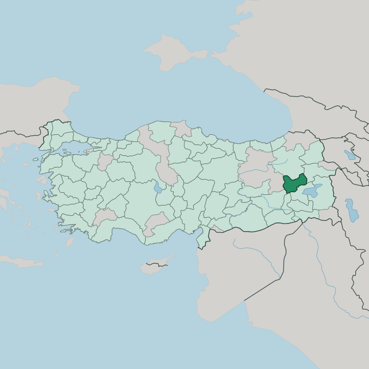
Muş sits in far eastern Turkey. It belongs to the Eastern Anatolia Region, the highest and coldest part of the country, and its heart is the Muş Plain, the second-largest lowland of that region after the Iğdır Plain. The plain is a broad, marshy basin, rimmed by the Şerafettin, Otluk and Yakupağa mountains.
Across it runs the Murat River, the Eastern Euphrates, a main headwater of the Euphrates, entering from the east and gathering the Karasu that drains off Mount Süphan before it leaves westward. The capital keeps to the plain's southern foot. Only that basin gives the province any real flat ground.
Mountains wall it on every side. Ağrı and Erzurum stand to the north, Bingöl to the west, and Diyarbakır and Batman fall away to the south. Eastward the land climbs toward Bitlis and the Lake Van basin. The Karaçavuş and Bilican ridges close the plain off toward the south, and the Bingöl massif rises behind Varto in the north-west.
At the plain's eastern end lies the İron Sazlığı wetland, a reedbed listed as an Important Bird Area, where the wild Muş tulip flowers on the damp cultivated ground each spring. This is high, thin-aired country.
What is Muş like?
Muş is Kurdish country. Kurmanji is the first language of most villages on the plain, spoken beside Turkish, while the highland district of Varto holds a distinct community of Zaza Alevis who speak Zazaki. Life still turns on the land, on wheat, sugar beet and grazing flocks.
Herding shapes the calendar as much as the harvest does. The province takes its emblem from a flower. The wild Muş tulip, a deep-red bloom of the plain, gives the town its symbol and fills the fields for a short spell each spring.
Older layers run deep here. The Muş Plain was Taron to the Armenians who farmed it for centuries, and the great Surp Karapet Monastery stood in the hills to the north-west until it was destroyed in 1915. Below the plain, the Ottoman stone arches of the Murat Bridge still cross the river.
Faith here is mixed, Sunni across the plain and Alevi up in Varto. Old cut-stone houses cluster below the castle. Folk halay dances, sung to the davul drum and the zurna, still mark the weddings and spring festivals of the plain villages.
The weekly markets still trade in wool, honey and grain from the plain.
What is the history of Muş?
The plain has changed hands often. It lay within Urartu around Lake Van, then for long centuries formed the Armenian district of Taron, whose monastery of Surp Karapet drew pilgrims from across the highlands. Everything turned in 1071.
At Malazgirt, north of the plain, the Seljuk sultan Alp Arslan defeated the Byzantines and opened Anatolia to Turkish settlement. The Ottomans later took the whole plateau. Its older world ended in 1915.
What is the climate of Muş?
Winter runs long on the plain. High on the Eastern Anatolian plateau, the Muş Plain traps cold air through the dark months, piling up heavy snow that can shut the mountain passes for weeks at a stretch. Summers turn short, hot and dry.
The days bake while the highland nights stay cool, a wide swing that marks this continental interior. Snowmelt swells the Murat River in spring and floods the tulip fields with green. Spring is the short reprieve.
How do you get to Muş?
For most travellers, Muş begins at the airport. Muş Airport, on the plain just outside the capital, carries the flights from Ankara and İstanbul that are the quickest way into this corner of eastern Turkey. A railway also reaches the town.
The eastern line from Elazığ runs through Muş on its way to the Lake Van ferry at Tatvan, though the trains are slow. By road, the D300 highway crosses the province from Bingöl in the west to Bitlis in the east. The mountains set the pace.
Good for
Updated July 2026