Argentina
Chaco Province, Argentina — Towns & Travel Guide


Chaco Province spreads flat across north-eastern Argentina, a subtropical plain of cotton fields, quebracho forest and the wild Bermejo River.
About Chaco Province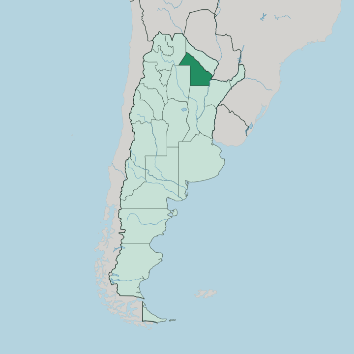
Towns & cities in Chaco Province
Pick a town or city — each links to where to stay.
Start in Resistencia. The capital and largest city sits close to the Paraná, its streets lined with open-air sculpture and its bus terminal the road hub for the whole province. Inland, Presidencia Roque Sáenz Peña draws visitors to its salty thermal baths and the surrounding cotton country.
The wild north-west is a different proposition: around El Impenetrable National Park the towns thin out and beds are few, so most travellers overnight in ranch lodges near the Bermejo River. Pick the interior for thermal water or dry-forest wildlife.
About Chaco Province
Cotton built Chaco.
What is Chaco Province known for?
The province grows a large share of Argentina's crop, and the plantations still shape the flat land between its towns. Resistencia, the capital, has turned itself into an open-air sculpture museum, with hundreds of carved and cast works standing along its streets and plazas. Further north-west the land turns to dense dry forest, the tangled scrub that gave El Impenetrable National Park its name, where jaguar, giant anteater and tapir still hold on along the Bermejo River.
Where is Chaco Province?
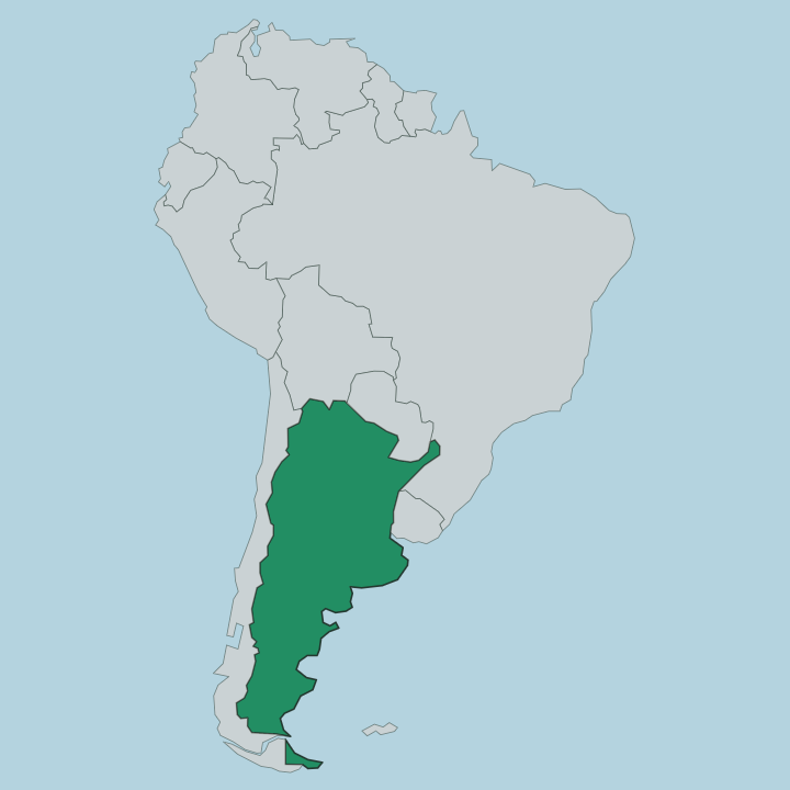
Chaco sits in north-eastern Argentina, deep in the Gran Chaco, the vast lowland plain that reaches on across into Paraguay and Bolivia. The land is famously flat. Its highest ground barely rises near Taco Pozo in the far west, and everywhere else the province stretches out as an almost level plain broken only by rivers, marsh and forest.
Water frames it on two sides. The Paraguay and the Paraná run down the eastern edge, and across the Paraná lies Corrientes, joined to the capital by a long bridge over the river. Resistencia stands close to that eastern water, on the Negro River just before it joins the Paraná.
To the west the country dries out. The eastern third is humid and green, thick with cotton and cropland, while the centre and west shade into thornier dry forest that grows harder to cross the further in you go. The Bermejo River cuts down the northern side of the province, splitting into branches and forming the wetlands and gallery forest that shelter El Impenetrable National Park.
Salta and Santiago del Estero lie to the west, Formosa to the north, Santa Fe to the south. Its rivers, not its hills, give the province its shape.
What is Chaco Province like?
Chaco is one of the most indigenous corners of Argentina, and it does not hide the fact. The Qom, Moqoit and Wichí peoples live across the province, and in 2010 Chaco became the second Argentine province to grant their languages official status alongside Spanish. Their crafts travel well.
Woven palm baskets, carved wood and pottery turn up in markets from the villages to the capital. Resistencia gives the province its most public face, a city that has spent decades filling its streets, plazas and boulevards with sculpture until the works number in the hundreds and the whole centre reads as an outdoor gallery. The wood itself carries meaning here, since the hard red quebracho that once drove the tannin and railway economy is the same timber many of the region's carvers still prize.
Life leans on the land. Cotton, cattle and forest shaped the towns, and the rhythm of the harvest still marks the year across the plain. It is a working province more than a polished one, closer to the fields and the river than to any tourist strip.
What is the history of Chaco Province?
The Gran Chaco resisted conquest. For centuries this plain lay beyond Argentine control, held by its indigenous peoples and defended as much by the hard dry forest as by any army. Settlement crept in from the east along the rivers, and forts, cotton and the tannin trade in quebracho wood slowly opened the interior to the state.
Chaco became a full province in 1951. For four years it carried the name Provincia Presidente Perón, until the historical name returned in 1955 after Perón's fall, and the frontier territory settled into its place among the provinces of Argentina.
What is the climate of Chaco Province?
Chaco is hot. The province runs subtropical, humid and green in the east near the Paraná but drier and harsher toward the west, where summer heat on the plain regularly climbs past forty. Rain falls mostly in the warm months and thins out inland, which is why the western dry forest around El Impenetrable National Park stays so tangled and hard to cross.
Winters are mild and short. The best months to travel are the cooler ones, when the heat eases off the plain.
How do you get to Chaco Province?
Most travellers reach Chaco through Resistencia, which has the province's airport and its flights down to Buenos Aires. The capital sits on the eastern edge, near where the Negro joins the Paraná, and a long bridge across the river ties it to Corrientes on the far bank. Roads fan out west from there.
National routes run inland to Presidencia Roque Sáenz Peña and on toward the dry forest, and the drive to El Impenetrable National Park is the long, remote leg that ends the journey. Buses link the main towns.
Updated July 2026