Democratic Republic of the Congo
Tshopo, Democratic Republic of the Congo — Towns & Travel Guide


Tshopo is a rainforest province of the Democratic Republic of the Congo, wrapped around the Congo River at Kisangani.
About Tshopo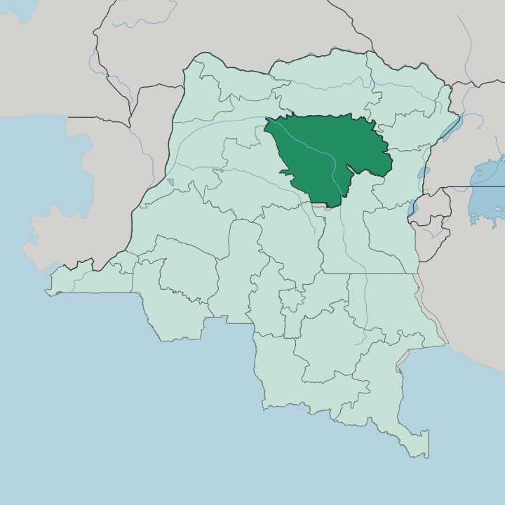


Towns & cities in Tshopo
Pick a town or city — each links to where to stay.
Kisangani is the only real base. The provincial capital sits where the Tshopo and Lindi rivers join the Congo, and its hotels are the sole cluster of beds in a province of forest. From there the Boyoma Falls and the Wagenia fishermen are a short trip downriver.
Upstream, the small Lualaba port of Ubundu marks the head of the cataracts, and the reserve town of Yangambi lies west along the water. You stay in Kisangani and travel out from it.
About Tshopo
Tshopo is known for the Boyoma Falls.
What is Tshopo known for?
Seven cataracts curve down the Lualaba River between Ubundu and Kisangani, the largest waterfall on Earth by volume of flow. On the last cataract the Wagenia fishermen still lower baskets from wooden tripods lashed into the rapids, a technique older than the colonial town. West of the capital lies the Yangambi Biosphere Reserve, a stretch of equatorial forest set aside for science under UNESCO.
This is deep Congo Basin, and the rainforest is the headline.
Where is Tshopo?
Tshopo fills a broad block of north-central Democratic Republic of the Congo, deep inside the equatorial forest of the Congo Basin. It is named for the Tshopo River. That river runs down to Kisangani, the provincial capital, and joins the Lindi just before both empty into the Congo.
The province is vast. It covers a little under two hundred thousand square kilometres of near-continuous rainforest, one of the largest provinces in the country. The equator crosses it.
Kisangani stands only a short way south of that line, in the eastern part of the central Congo Basin. Here the great river changes its name. The Lualaba arrives from the south, drops through the seven cataracts of the Boyoma Falls, and below them is called the Congo.
Tshuapa lies to the west, and the two Uele provinces sit along the north. Ituri and North Kivu press against the eastern edge, while Maniema and Sankuru close it off to the south. Roads are few and mostly poor across this forest.
The rivers do the work of highways, threading the towns together along the water. Everything in Tshopo bends toward the Congo.
What is Tshopo like?
Life in Tshopo runs along the river. The Congo and its tributaries carry the trade, the fish, and the news, and the towns cluster at the landings where the water meets the forest. At Kisangani the Wagenia fishermen work the rapids below the Boyoma Falls with wooden tripods and conical baskets, a fishing method passed down long before the city had a name.
French is the official language, but on the streets and markets Swahili and Lingala are the everyday tongues. The province holds many peoples. Mongo, Mbole, Lengola, Mangbetu and Wagenia communities live across its forest and its riverbanks, alongside others.
Music and river commerce set the rhythm. Kisangani grew as the commercial centre of the northern Congo, and it still draws the goods of the whole northeast to its port. Beyond the capital the forest thins the population fast, and small settlements sit far apart along the channels.
The Yangambi Biosphere Reserve adds another layer, a working research forest where foresters and scientists study the rainforest that surrounds nearly everything here. It is a place defined by water, trees, and the trade between them.
What is the history of Tshopo?
Henry Morton Stanley founded a post at the head of the falls in 1883, working for King Leopold II, and named it Stanley Falls Station. It grew into Stanleyville, the colonial capital of the northeast. The town took its present name, Kisangani, in 1966.
The province itself is young. Tshopo was carved out of the old Orientale Province in a nationwide reorganisation in 2015, keeping the name of the river that runs through its capital.
What is the climate of Tshopo?
Tshopo is hot, wet, and green the year round. Most of the province has a tropical rainforest climate, sitting almost on the equator, so heavy rain falls across the calendar rather than in one wet season. Humidity stays high day and night.
Only the northern edge shifts toward a monsoon pattern with a shorter drier spell. The forest never really dries out, and the Congo and its tributaries run full for most of the year.
How do you get to Tshopo?
Nearly everyone flies. Kisangani Bangoka International Airport, east of the city, is the province's air link to Kinshasa and the outside world, since almost no through-roads reach this forest. The other historic route is the Congo itself.
Riverboats work slowly up and down the great river between Kisangani and Kinshasa, a journey of many days. Once you arrive, the water still carries you onward to Ubundu, Yangambi, and the falls.
Updated July 2026