Colombia
Departamento de Boyacá, Colombia — Towns & Travel Guide


Boyacá is Colombia's high Andean heartland, where the Eastern Cordillera folds into cold plateaus, glacier peaks, and colonial towns.
About Departamento de Boyacá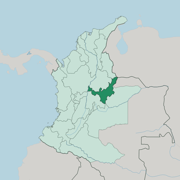
Towns & cities in Departamento de Boyacá
Pick a town or city — each links to where to stay.
Villa de Leyva is the town most travellers pick first, its enormous unpaved Plaza Mayor ringed by whitewashed colonial houses and one of the largest such squares anywhere in Colombia. Paipa trades plazas for thermal springs. Tunja, the capital, is the practical hub where the roads meet and the buses from Bogotá arrive.
For the glaciers you head to the mountain village of El Cocuy, where beds are few. Choose Villa de Leyva if you want colonial streets and easy day trips; choose El Cocuy only if you have come to climb.
About Departamento de Boyacá
What is Departamento de Boyacá known for?
Boyacá is the department where Colombia won its independence. Simón Bolívar's army broke the Spanish here in 1819, at Puente de Boyacá on the road down from Tunja, and the region has been called the land of freedom ever since. Beyond that battlefield lie cobbled colonial towns, snow peaks in the Sierra Nevada del Cocuy, and the largest lake in the country.
It sits high. Tunja, the capital, stands above 2,800 metres in the cold air of the Eastern Cordillera, and much of the department climbs higher still into páramo and glacier.
Where is Departamento de Boyacá?
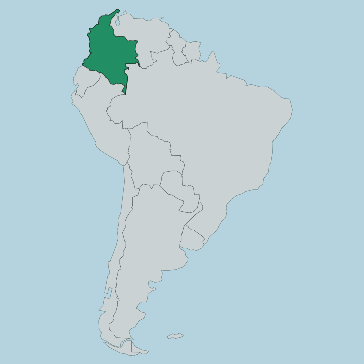
Boyacá lies in central Colombia, wrapped around the Eastern Cordillera, the easternmost of the three ranges into which the Andes split as they cross the country. It is high, cold country. Most of the department rides a broad plateau above 2,500 metres, and Tunja, the capital, sits in that thin air north-east of Bogotá on the main road to Venezuela.
The land rises from there. In the north-east the Sierra Nevada del Cocuy carries the glaciers and the department's roof, Ritacuba Blanco, which climbs past 5,400 metres of rock and ice. Water collects up here too.
Lake Tota, the largest lake in Colombia, fills a basin in the eastern highlands, and its cold blue water even keeps a small white-sand beach at Playa Blanca. West and south the plateau breaks toward the Magdalena valley, while eastward the cordillera falls away sharply into the flat llanos plains of the Orinoco basin. Boyacá shares its northern edge with Santander and reaches, in its far east, all the way to the frontier with Venezuela.
Little of it is level. The department is a stack of ridges, high basins, and páramo moorland, and altitude, more than any border, decides what grows and how cold the night turns.
What is Departamento de Boyacá like?
Boyacá is deeply rural, Catholic, and proud of it. Its people, the boyacenses, are known across Colombia for the ruana, the heavy woollen poncho woven against the highland cold, and the town of Nobsa still turns them out on hand looms. That cold, plain-spoken country temper runs through everything.
Carranga, a plucked-string peasant music full of dry rural humour, was born on these plateaus and still plays at village fairs. Faith holds the year together. Chiquinquirá is where much of it gathers.
Its basilica houses the painting of the Virgin declared patron saint of the whole country, and pilgrims climb up to Boyacá to see it. The roots reach further back than the churches, though. Before the Spanish, this plateau was the core of the Muisca world, whose goldwork and emeralds drew the conquistadors, and whose woollen mantas were the ancestor of the ruana still worn on the plateau.
Old towns keep the layers visible. Villa de Leyva has barely changed its colonial face, and near Tunja the fields are still worked in small plots much as they long have been.
What is the history of Departamento de Boyacá?
Long before Spain arrived, the plateau of Boyacá was the seat of the Muisca, whose zaque ruled from Hunza, the town the conquistadors renamed Tunja when Gonzalo Suárez Rendón founded it there in 1539. Through the colonial centuries Tunja grew into one of the richest cities of the Viceroyalty of New Granada. Then came the war.
On 7 August 1819 Bolívar's army destroyed the royalist force at Puente de Boyacá, sealing the independence of New Granada in a single afternoon, and the modern department took its present form in 1858.
What is the climate of Departamento de Boyacá?
Altitude, not season, sets the temperature in Boyacá. On the plateau around Tunja the air stays cool and thin all year, with days in the low teens and nights that drop toward freezing, while the glaciers of the Sierra Nevada del Cocuy stay frozen the year round. There is no summer here.
Rain comes in two spells, one around April to June and another around October and November, and the páramo above the towns is often wrapped in cold cloud and drizzle. Pack warm layers whatever the calendar says.
How do you get to Departamento de Boyacá?
Almost everyone reaches Boyacá overland from Bogotá. The capital's international airport is the arrival point, and from there it is a road climb north into the Eastern Cordillera, roughly two to four hours by bus or car depending on which town you want. Tunja is the hub the highways run through.
Buses fan out from it to Villa de Leyva, Paipa, Sogamoso, and Duitama, and the long haul on to El Cocuy and the glaciers takes most of a day.
Good for
Updated July 2026