Colombia
Departamento de Casanare, Colombia — Towns & Travel Guide


Casanare is Colombia's cattle-country department, an ocean of Llanos grassland east of the Andes, ruled by the capital at Yopal.
About Departamento de Casanare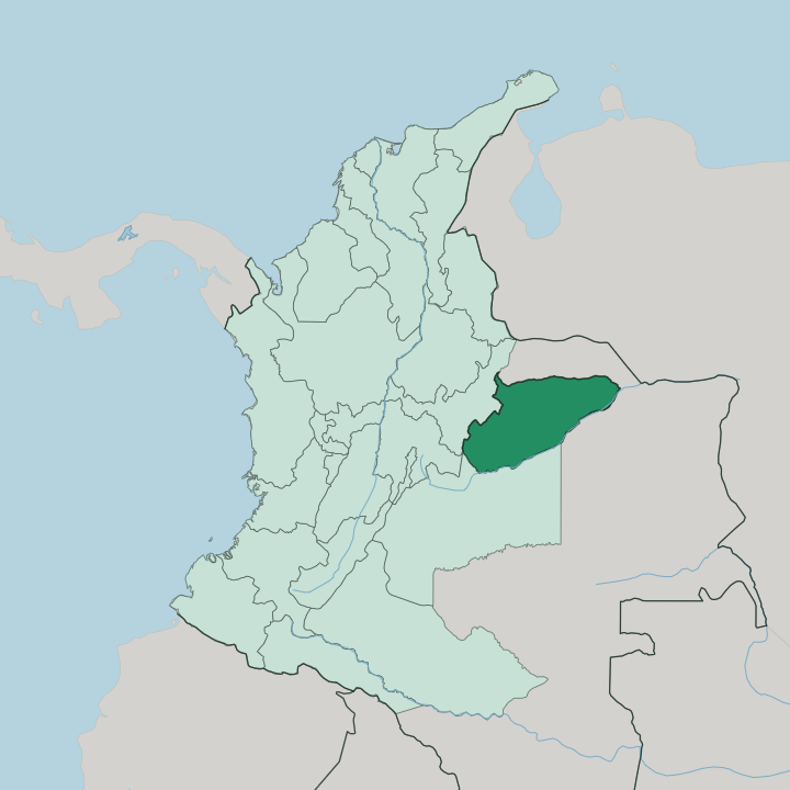
Towns & cities in Departamento de Casanare
Pick a town or city — each links to where to stay.
Yopal is the natural base, a working plains town at the foot of the Cordillera Oriental where the paved roads and the flights from Bogotá land. It suits you for a first night. The real stays lie out on the hatos, the vast cattle ranches that double as wildlife reserves deep in the grasslands, reached only after hours of dirt track from the capital.
Hato La Aurora keeps rustic rooms among flooded pastures where jaguar and anaconda still range. Comfort or wilderness. Choose Yopal for connections and a soft bed; choose a hato when you have come for the capybara, the horses and the open Llanos themselves.
About Departamento de Casanare
Casanare is cowboy country.
What is Departamento de Casanare known for?
Its name is bound up with the llaneros, the horseback cattle herders who work the flat savanna, and with the joropo they play on harp, cuatro and maracas. The land itself is the draw, a sea of grass in the Orinoquía that floods in the rains and bakes in the dry months. Oil and natural gas from the Cusiana fields near the Andean foothills made the department rich, while herds of capybara, deer and caiman gather at the water holes of ranches like Hato La Aurora.
Yopal, the capital, is where most journeys into the plains begin.
Where is Departamento de Casanare?
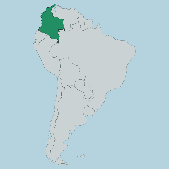
Casanare fills the central eastern flank of Colombia, one of the great departments of the Orinoquía. The land is almost all plain. West of it the Cordillera Oriental of the Andes climbs steeply out of the grass, and the department's western edge runs along that wall of mountains where the rivers are born.
Everything else is Llanos, flat savanna stretching east toward the Orinoco basin. Rivers do the work of borders here. The Casanare River traces the northern boundary, and the wide Meta River closes the department off to the south and east.
Between them the Cusiana and the Cravo Sur run down off the mountains and out across the plain, feeding the wetlands that make the savanna flood. It is a big department, roughly the size of Denmark, yet one of the emptiest in the country. The town of Yopal sits in the west, tucked against the piedemonte where the foothills meet the flat.
From there the plain simply runs on. Most of Casanare is grass, water and sky, and the mountains are the only edge that is not a river.
What is Departamento de Casanare like?
Casanare belongs to the llaneros, and their life on horseback shapes everything the department calls its own. The plains are cattle land, and the men who work them ride out at dawn to move herds across pasture that runs to the horizon. Their music is the joropo, driven by the harp, the cuatro and the maracas, sung in praise of horses, herds and the hard beauty of the flooded savanna.
It is fast, foot-stamping and proud. The department shares this culture with its neighbours across the Orinoquía, the wider llanero world that spills over into the plains of Venezuela. Cattle came with the Spanish and never left.
Ranching has been the spine of Casanare for centuries, and the hato, the great open ranch, is both a workplace and a way of life. Food follows the herd, above all mamona, whole beef roasted slowly on stakes over an open fire. The Spanish language carries the songs and the stories, as it does across Colombia.
Life here is tied to the seasons of rain and drought more than to any city, and the rhythm of the water sets the rhythm of the work.
What is the history of Departamento de Casanare?
Spanish colonists and Jesuit missions first pushed cattle onto these plains in the seventeenth century, and ranching has held the land ever since. For a long time Casanare was a remote frontier of Boyacá, a district of grass reached only by hard roads down from the Andes. That changed with oil.
The Cusiana and Cupiagua fields discovered near the foothills in the early 1990s turned a poor cattle province into one of Colombia's energy heartlands. Casanare became a department in its own right in 1991, its borders drawn by the great rivers of the Meta and the Casanare.
What is the climate of Departamento de Casanare?
Casanare runs hot the year round, a tropical lowland with two seasons rather than four. The split is water. From roughly May to October the rains pour down and the rivers off the Cordillera Oriental burst their banks, turning great tracts of the Llanos into shallow lake and marsh.
The dry months from December to March harden the ground, shrink the water holes, and pull the wildlife into tight crowds that make the savanna easiest to watch. It is either flooding or parching. That yearly swing between deluge and drought governs the ranches, the roads and the herds alike.
How do you get to Departamento de Casanare?
Most visitors fly into Yopal, whose El Alcaraván Airport is a short hop from Bogotá across the mountains. It is quick by air. The overland route from Bogotá takes most of a day by road, dropping off the Cordillera Oriental through Monterrey before the pavement runs out onto the plains.
Once you reach Yopal, the reserves lie far beyond the last paved road, so getting to a hato means hours more by jeep across dirt tracks that the wet season can swallow whole. From the capital, road links thread out to the ranch towns and the river crossings of the Llanos.
Good for
Updated July 2026