Colombia
Departamento del Chocó, Colombia — Towns & Travel Guide


Chocó is Colombia's Pacific rainforest department, the only one touching two oceans, drenched by some of Earth's heaviest rain.
About Departamento del Chocó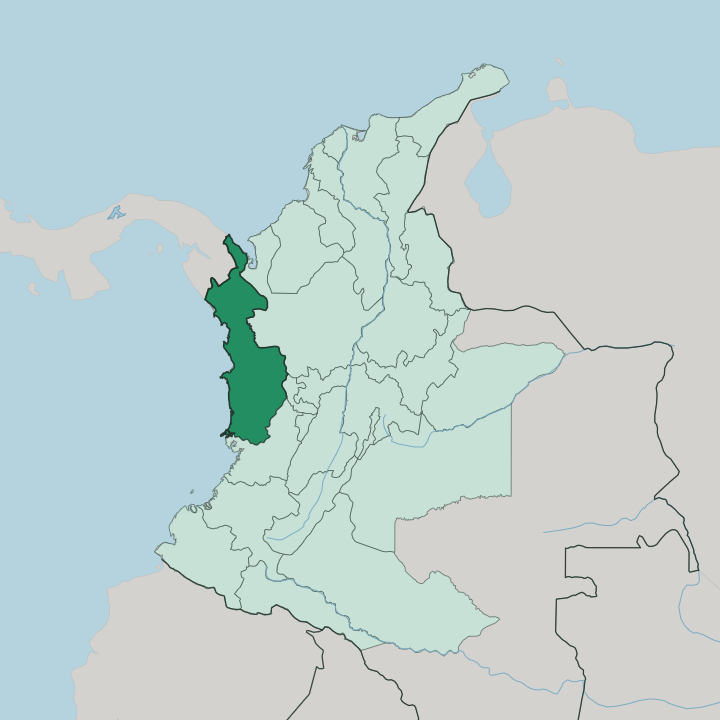
Towns & cities in Departamento del Chocó
Pick a town or city — each links to where to stay.
Quibdó, the capital on the Atrato River, is the practical base for the interior and the one place in the department with a genuine spread of rooms to choose from. Most come for the coast. Nuquí, on the Gulf of Tribugá, is where the whale-watching lodges cluster, strung down the beaches at Guachalito, Termales and Arusí.
Bahía Solano lies north. Its bay pairs a working port with quick access to Utría National Natural Park and the reef diving just offshore. Choose Quibdó for the town and the river; choose the coast for the surf, the jungle and the whales.
About Departamento del Chocó
Rain defines Chocó above all else.
What is Departamento del Chocó known for?
The municipality of Lloró records some of the highest annual rainfall measured anywhere on the planet, and the forest that this water feeds ranks among the most species-dense on Earth. It is the only Colombian department with coasts on both the Pacific Ocean and the Caribbean Sea. Its people are overwhelmingly Afro-Colombian, descended from those who worked the gold and platinum washings of the Atrato and San Juan basins.
Add the humpback whales that calve off Nuquí and Bahía Solano, and the department's draw becomes clear.
Where is Departamento del Chocó?
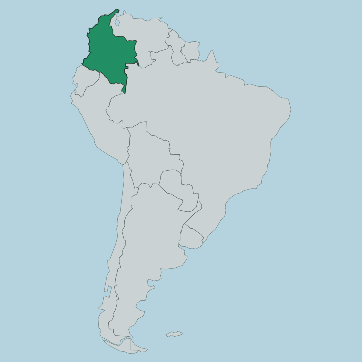
Chocó fills the far west of Colombia, the wet Pacific lowlands pressed between the ocean and the Andes. It is the only Colombian department to reach two seas. Its long western edge runs down the Pacific Ocean, while a shorter northern shoulder opens onto the Caribbean Sea at the Gulf of Urabá, and the whole of Colombia's land border with Panama lies inside it.
That northern border is the Darién Gap, the roadless forest that breaks the Pan-American Highway. Behind the coast rises the Serranía del Baudó, a low coastal range that walls off the shore from the interior. Inland, the land drops into a hot, flooded trough.
Three great rivers drain that trough. The Atrato runs north toward the Caribbean, carrying one of the heaviest freshwater flows of any river its length. The San Juan runs south and west to the Pacific, and the Baudó threads the coastal hills between them.
Quibdó, the capital, sits on the Atrato where the river becomes the department's main highway. Roads are few. In much of Chocó the river is the road, and a canoe or a launch is how people move between towns.
What is Departamento del Chocó like?
Chocó is the heart of Afro-Colombian Colombia. More than four in five choqueños trace their line to Africans brought to work the gold and platinum of the Atrato and San Juan rivers, and that inheritance shapes the music, the food and the faith of the department. Drums carry it.
The chirimía chocoana, a brass-and-percussion sound built on the clarinet and the tambora drum, fills the streets of Quibdó each September for the Fiestas de San Pacho, the patron-saint festival that turns the capital over to dance for weeks. Alongside that Afro-Colombian majority live the Emberá and Wounaan, Indigenous peoples of the forest and the upper rivers who keep their own languages, canoes and crafts. Life here bends to the water and the rain.
Houses stand on stilts above ground that floods, roofs are pitched steep to shed the downpour, and the day's rhythm follows the river more than the clock. Fish, plantain and rice anchor the table, cooked with coconut along the coast. It is one of the poorest departments in the country and one of the richest in living culture, and the two facts sit side by side.
What is the history of Departamento del Chocó?
Spanish colonists came for metal. From the 17th century they pressed enslaved Africans into the gold and platinum washings of the Atrato and San Juan valleys, and it is their descendants who make up the bulk of the department. The Emberá and Wounaan had held these forests long before that.
Chocó was governed for centuries as part of larger provinces, and only became a department of Colombia in its own right in 1947. Isolation ran deep. Cut off by the Serranía del Baudó and reachable mainly by river, it stayed apart from the rest of the country far longer than most of Colombia did.
What is the climate of Departamento del Chocó?
It rains here like almost nowhere else. Chocó lies in the wettest belt of the Americas, where warm Pacific air meets the wall of the Baudó range and dumps rain across most of the year. Lloró and Quibdó post annual totals among the highest ever recorded on Earth, and afternoons bring downpours you can set a watch by.
It is hot and humid throughout, with little swing between seasons and only a brief, relative lull in the first months of the year. Bring waterproofs, not an umbrella.
How do you get to Departamento del Chocó?
You fly, almost always. Roads into Chocó are few and slow, so most visitors arrive by air from Medellín, the nearest big hub to the east. Quibdó has the department's main airport for the interior, while Nuquí and Bahía Solano each have their own coastal strips served by light aircraft.
Beyond the runways the rivers take over. From Quibdó the Atrato is the working highway north, and along the Pacific a launch is how you reach the beaches and lodges that no road connects.
Good for
Updated July 2026