Algeria
Wilaya de Relizane, Algeria — Towns & Travel Guide


Wilaya de Relizane is a landlocked province of northwestern Algeria where the Oued Mina joins the Chéliff below the Dahra and Ouarsenis mountains.
About Wilaya de Relizane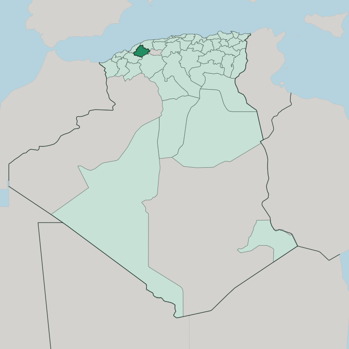


Towns & cities in Wilaya de Relizane
Pick a town or city — each links to where to stay.
The city of Relizane holds nearly all the province's beds, a market town in the Mina plain where the National Route 4 and the western railway cross. Rooms elsewhere follow business, not sights. Oued Rhiou, the second town, sits east along the Chéliff where the road runs on to Chlef and Algiers.
Travellers drawn by the medersa and the old quarters climb north to Mazouna, though a day trip from the capital serves most. The provincial capital is the only base for more than a single night.
About Wilaya de Relizane
Farmland defines it.
What is Wilaya de Relizane known for?
The province spreads across the Bas Chélif and Mina plains, a fertile corridor of olive groves and citrus orchards whose harvests feed the food-processing works around the provincial capital. Mazouna, in the Dahra hills to the north, holds a different fame: a town of Quranic scholars whose 17th-century medersa drew students of theology. The Chéliff, Algeria's longest river, gathers the Oued Mina near the city of Relizane and carries their combined flow toward the sea.
Where is Wilaya de Relizane?
Relizane Province lies inland in northwestern Algeria, a landlocked wilaya with no coast of its own. Its shape is set by three bands running east to west. The Dahra mountains wall off the north, a coastal massif that screens the province from the Mediterranean and holds the town of Mazouna among its folds.
The Ouarsenis rises to the south, a high massif whose foothills reach down to the town of Ammi Moussa. Further west stand the distinct Béni Chougrane hills, a separate Tell Atlas massif shared with Mascara. Between the two mountain walls runs the open middle: the Bas Chélif and Mina plains, a fertile corridor of low ground where most of the province's people and farms sit.
Water gives the plain its shape. The Chéliff, the longest river in Algeria, crosses the province from east to west, and near the city of Relizane it takes in the Oued Mina flowing up out of the Ouarsenis. Their valleys carry the olive groves, citrus orchards and cereal fields that feed the lowland. Chlef province lies to the east along the Chéliff, Mostaganem to the northwest between Relizane and the sea, while Mascara, Tiaret and Tissemsilt ring the southern and western edges.
It is farming country. Every road and rail line here threads the plain between the Dahra and the Ouarsenis.
What is Wilaya de Relizane like?
Arabic is the language of Relizane, spoken day to day in the Algerian dialect of the western plains. Its culture is that of rural Algeria, built around the farming calendar of the Chéliff valley and the olive and citrus harvests that follow the seasons. The old towns keep their own weight.
Mazouna, in the Dahra to the north, is known across the region as a town of scholars, and its late-17th-century medersa taught theology and Islamic law with a name once set beside Kairouan and Zeytouna. Learning was the town's trade. Its founding sheikh, Sidi M'Hamed Bencharef, is said to have taught there for 64 years, and the medersa's library still guards manuscripts from that age.
Under the Ottomans the same town governed the whole west, the first seat of the Beylik before power moved on to Mascara. Down in the plains the rhythm is agricultural. Weekly souks still gather the farming villages, trading the olives, oranges and grain grown between the two mountain walls. Oran, the great western city, lies a couple of hours' drive west, and its markets and its music tug at the whole plain.
What is the history of Wilaya de Relizane?
The land is old. A Roman town called Mina stood near the modern city in the 2nd and 3rd centuries, part of Mauretania Caesariensis. Much later, under the Ottomans, Mazouna became the first capital of the Beylik of the West in 1563, before that seat passed to Mascara and finally to Oran.
The province itself is a modern line on the map, carved out of Mostaganem in 1984 when Algeria redrew its wilayas.
What is the climate of Wilaya de Relizane?
Summers here are long and punishing. The lower Chéliff plain is one of the hotter corners of northern Algeria, its air still and dry from late spring into autumn, when the Oued Mina shrinks to a thread. Winters turn cool and wetter, and most of the year's rain falls between autumn and spring.
Up in the Dahra and Ouarsenis, altitude rewrites the picture entirely. The Dahra and Ouarsenis catch more cloud and cooler nights than the baking floor of the plain below.
How do you get to Wilaya de Relizane?
Relizane has no airport of its own with scheduled flights. Most travellers land at Oran to the west or Chlef to the east, then drive in on the National Route 4, the old Algiers-Oran highway that runs straight through the province. The railway helps too.
Trains on the Algiers-Oran line call at the city of Relizane and at Oued Rhiou along the Chéliff. From either airport it is a couple of hours by road across the plain.
Good for
Updated July 2026