Greece
South Aegean, Greece — Towns & Travel Guide


South Aegean is the Greek region of the Cyclades and Dodecanese, fifty islands strung across the southern Aegean Sea.
About South Aegean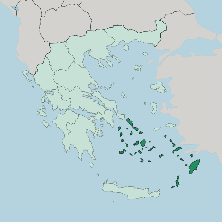
Towns & cities in South Aegean
Pick a town or city — each links to where to stay.
 Greece
Ródos
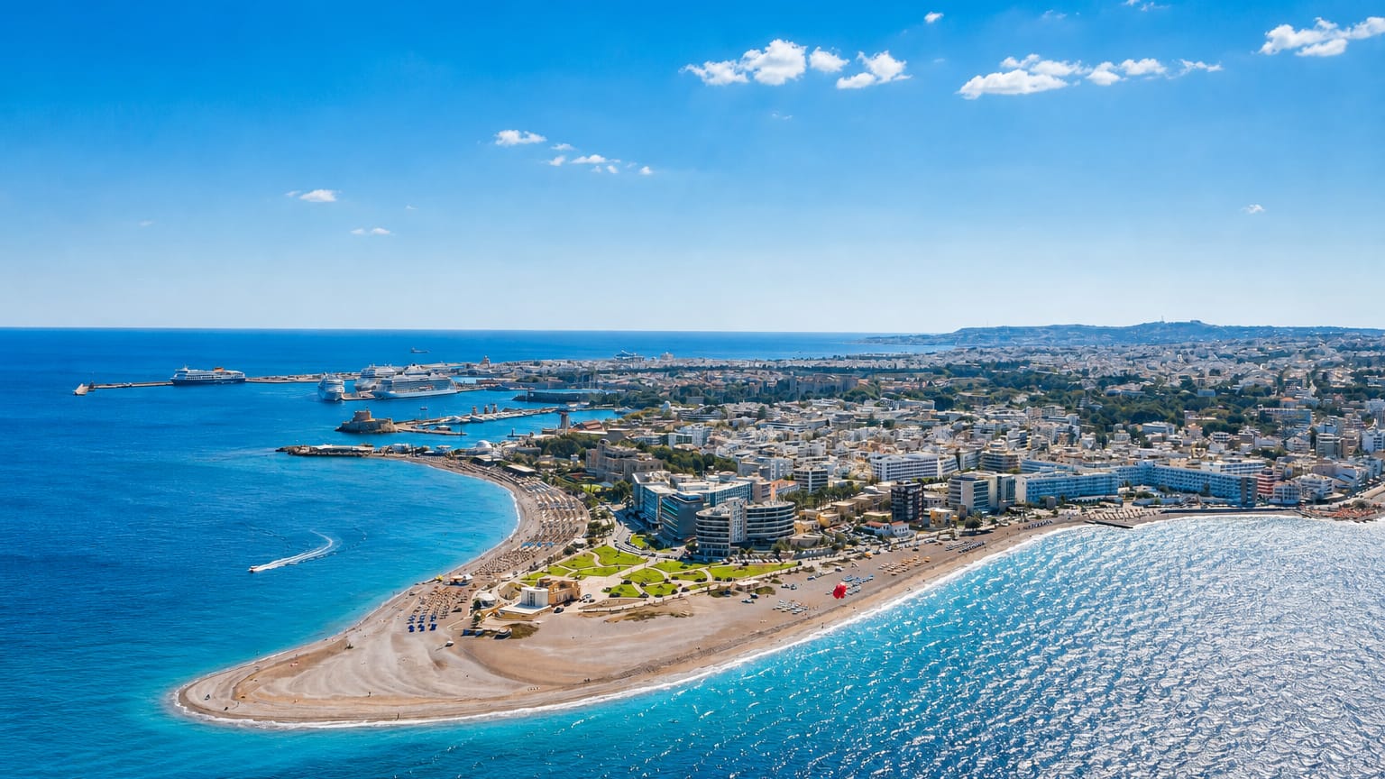
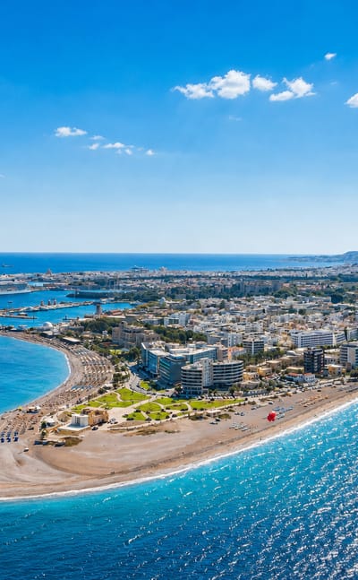
Medieval walls enclose the old town of Ródos, the main city of Rhodes in the South Aegean and historical capital of the Dodecanese islands.Where to stay →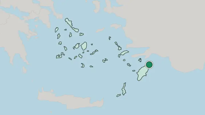
About South Aegean
This is island Greece.
What is South Aegean known for?
The region gathers two archipelagos: the Cyclades around Syros and the Dodecanese further south-east around Rhodes. Whitewashed cubic houses, blue-domed churches and old stone windmills give the Cyclades their instantly recognisable look, seen most famously on Santorini and Mykonos. Rhodes answers with a walled medieval town, and Kos with thermal springs.
Ferries thread the fifty inhabited islands together across open water.
Where is South Aegean?
South Aegean is not one landmass but an archipelago, spread across the central and south-eastern reaches of the Aegean Sea. Its dry land amounts to only a small fraction of Greece, yet the region stretches over a vast expanse of water and holds fifty inhabited islands between its two groups. It has no mainland at all.
Two island groups make it up. The Cyclades sit in the centre of the Aegean, a tight ring of islands that once seemed to circle the sacred isle in their midst. Further south-east lie the Dodecanese, strung along the Turkish coast down toward Rhodes, the largest island and the far anchor of the whole region.
Between the two groups the sea opens wide. Ermoupoli, on Syros, is the administrative seat, set roughly in the middle of the Cyclades. Water is the region's true territory.
The Aegean itself is an arm of the wider Mediterranean Sea, and these islands are its high points, the exposed tops of a drowned mountain landscape. Santorini is the most dramatic of them, a caldera left when an ancient volcano collapsed into the sea. Others rise as bare limestone ridges straight from the water.
Nothing here is more than a short walk from a shore, and every island is a coastline first.
What is South Aegean like?
Two building traditions share the region. The Cyclades gave the world an instantly readable style: cube-shaped houses under thick white lime, blue-painted domes, narrow paved lanes and stone windmills set to catch the wind. That whitewash is partly disinfectant and partly heat-shield, and it turned islands like Santorini and Mykonos into the picture most people carry of Greece.
Syros breaks the pattern. Its capital, Ermoupoli, rose during the Greek Revolution of the 1820s into the busiest port of the young Greek state, and it built in marble and neoclassical stone rather than plaster. Grand mansions, a marble town hall and an Italian-style opera house still line its squares.
The Dodecanese carry yet another layer. Rhodes keeps a walled medieval city raised by the Knights of St John, and the Italian decades of the twentieth century left administrative palaces and restored castles across the group. The common thread is the sea.
Greek is the language throughout, and island life has long leaned on fishing, sponge-diving and boat-building. Festivals cluster around saints' days and harvests, and each island guards its own recipes, its own dialect words, its own patron saint.
What is the history of South Aegean?
The two halves of the region took different roads to Greece. Cyclades soil, with Syros, joined the new Greek state in the 1830s, and Ermoupoli boomed as its first great port. The Dodecanese stayed apart far longer.
Rhodes had passed from the Knights of St John to the Ottomans in 1522, and in 1912 the whole Dodecanese group fell under Italian rule, formalised at the Treaty of Lausanne of 1923. Only in 1947, by the Treaty of Paris, did Rhodes and its neighbours finally pass to Greece. One region, two pasts.
What is the climate of South Aegean?
The region runs hot, dry and bright. Summers are long and rainless, and what little rain does fall arrives between October and March, leaving many islands semi-arid and nearly treeless. Sun dominates the calendar.
The defining feature of an Aegean summer is the meltemi, a strong dry northerly wind that blows down the Cyclades from about May into September and peaks in high summer. It cools the air, roughens the sea and keeps the water a touch colder than the heat would suggest. Winters stay mild along these southern shores.
How do you get to South Aegean?
Reaching the region means a flight or a boat. Rhodes, Kos, Mykonos and Santorini all have their own airports, with Diagoras on Rhodes taking direct international flights alongside the domestic hop from Athens. For the rest, ferries do the work.
Boats from the mainland ports of Piraeus and Rafina fan out across the Cyclades and on to the Dodecanese, and a dense inter-island network links the fifty inhabited islands to one another. The meltemi can delay a summer crossing. Once you land, the sea is the only road on.
Good for
Updated July 2026