Iraq
Muhafazat Salah ad Din, Iraq — Towns & Travel Guide


Salah ad Din is a governorate of north-central Iraq on the Tigris, holding Tikrit, Samarra's spiral minaret, and ancient Assur.
Find your area →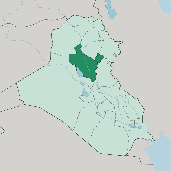
Towns & cities in Muhafazat Salah ad Din
Pick a town or city — each links to where to stay.
 Iraq
Iraq
Sāmarrā’
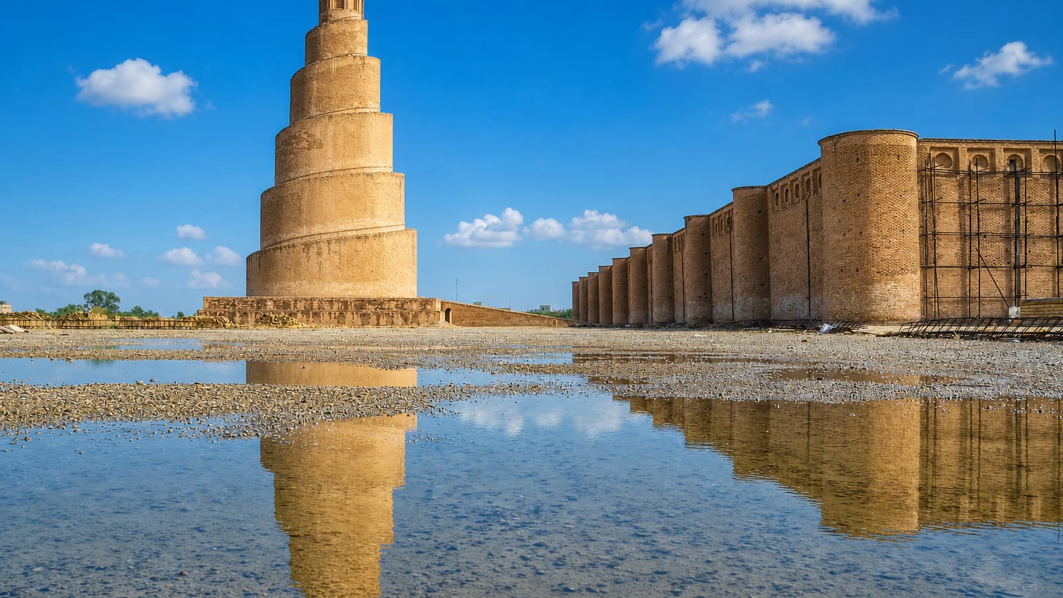
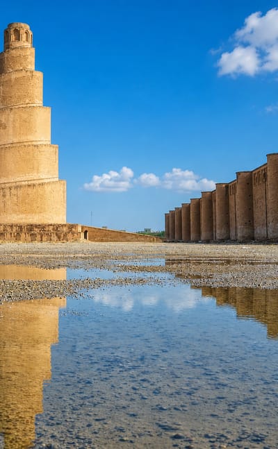
The spiral minaret of the Great Mosque of Samarra rises over the Tigris in Sāmarrā', an Abbasid capital in Saladin Governorate and a World Heritage Site.Where to stay →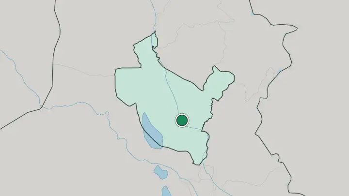
About Muhafazat Salah ad Din
Two names carry this governorate.
What is Muhafazat Salah ad Din known for?
One is Tikrit, its capital on the west bank of the Tigris and the birthplace of the medieval commander Saladin, for whom the whole province is named. The other is Samarra, the larger city downstream, where the Great Mosque's corkscrew Malwiya minaret and the golden-domed Al-Askari Shrine draw pilgrims and archaeologists alike. Both cities sit on the Tigris north of Baghdad, and the river ties the province together from the Assyrian ruins at Assur down to the Abbasid palaces of Samarra.
Where is Muhafazat Salah ad Din?
Salah ad Din occupies north-central Iraq, straddling the middle Tigris on its way south from Mosul toward Baghdad. The river is the spine of the province. It threads past Tikrit on the west bank and Samarra downstream, watering a floodplain of wheat, barley, and date groves that farmers here work as their forebears did.
Away from that green corridor the land dries out fast. Semi-desert plains run west toward Al-Anbar, while to the east the Hamrin Mountains rise as the westernmost ripple of the Zagros, a low fold of ridges crossing the north of the province before dropping to the Tigris. The capital, Tikrit, stands on the river roughly 160 km north-west of Baghdad, and Samarra sits downstream from it.
Between and around them, the governorate divides into eight districts, among them Samarra, Balad, Baiji, Al-Daur, and Al-Shirqat, where the Assyrian ruins of Assur overlook the water. North lies Kirkuk, and Diyala borders the province to the east near the Hamrin ridges. The Tigris does the shaping.
Its banks hold the cities, its floodwater feeds the fields, and the drier plateau beyond it thins toward the desert on either side.
What is Muhafazat Salah ad Din like?
This is a Sunni Arab heartland, and Arabic is the everyday language along the Tigris. The province takes its name from Saladin, the twelfth-century commander born at Tikrit who fought the Crusaders and founded the Ayyubid dynasty, and that inheritance is worn with pride. Tribal identity runs strong.
Families in the river towns describe themselves as people of the Tigris, tied to the water that irrigates their fields and carries their history. Farming shapes the rhythm of life, with wheat, barley, and dates coming off the floodplain each season. Yet the province's monuments belong to faiths and empires far older than its present makeup.
Samarra holds one of Shia Islam's holiest sites, the Al-Askari Shrine, where the tenth and eleventh Imams are buried, and it still draws pilgrims from across the Shia world. The same city was an Abbasid imperial capital, and its Great Mosque once ranked as the largest in the world. Upstream at Assur lie the ruins of the first capital of Assyria, sacred to the god the city was named for.
Layer sits on layer here. A single stretch of riverbank carries Assyrian temples, Abbasid palaces, and a living Shia shrine, and the people who farm around them belong to yet another chapter.
What is the history of Muhafazat Salah ad Din?
History here is measured in millennia. At Assur, on the west bank of the Tigris in the Al-Shirqat district, stood the first capital and religious centre of the Assyrian Empire, a city already ancient in the third millennium BC. Centuries later Samarra rose downstream when the Abbasid caliph al-Mu'tasim founded a new imperial capital there in 836, and for a span it ruled provinces stretching from Tunisia to Central Asia.
Tikrit gave the world Saladin around the year 1137. The modern governorate is younger than any of them, carved out of Baghdad province in the twentieth century and named for its most famous son.
What is the climate of Muhafazat Salah ad Din?
Summers scorch. Under a hot, dry continental regime the Tigris valley bakes well past 45°C from June through September, and the semi-desert plains west of the river turn dusty and hard. Winters are cool and short, and what rain the province gets falls mostly between November and March, feeding a single wet season rather than a steady drizzle.
That thin rainfall leaves farms leaning heavily on the Tigris and its irrigation, so the green ribbon along the river stays sharply divided from the parched plateau on either side.
How do you get to Muhafazat Salah ad Din?
Almost everyone comes overland from Baghdad. The province has no major international gateway of its own, so travellers fly into the capital to the south and drive north on the highway that shadows the Tigris toward Tikrit and Samarra. The road follows the river the whole way.
Samarra lies about 125 km north of Baghdad and Tikrit a further stretch beyond it, with the same route continuing north past Baiji toward Mosul. Within the governorate, road and river link the district towns strung along the Tigris.
Common questions
What is the best area to stay in Muhafazat Salah ad Din?
Samarra: the Malwiya minaret and the Al-Askari Shrine.
Good for
Updated July 2026