Iran
Chaharmahal and Bakhtiari Province, Iran — Towns & Travel Guide


Chaharmahal and Bakhtiari is a highland province in Iran's central Zagros, where snowmelt feeds the Karun and the Bakhtiari nomads still migrate.
About Chaharmahal and Bakhtiari Province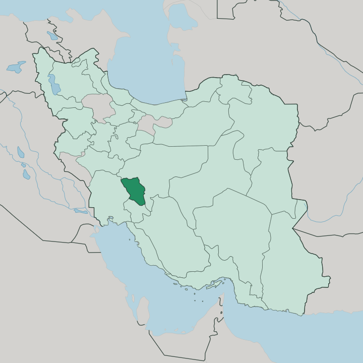
Towns & cities in Chaharmahal and Bakhtiari Province
Pick a town or city — each links to where to stay.
Shahr-e Kord is the natural base, the provincial capital and the highest such seat in Iran, within reach of Zard-Kuh, the Choghakhor wetland and the Bakhtiari valleys. Two smaller bases sit deeper in the Zagros. Chelgerd, the seat of Kuhrang, lies below Zard-Kuh among the snowfields, the Koohrang spring and the Karun's first waters.
Borujen holds the eastern plateau beside the Choghakhor wetland, where migrant birds settle each spring. Choose the capital for comfort. Choose Chelgerd or a Bakhtiari homestay when you want the mountains at the door.
About Chaharmahal and Bakhtiari Province
Two things define this province: water and the Bakhtiari.
What is Chaharmahal and Bakhtiari Province known for?
Its highlands are the source of the Karun, Iran's most water-rich river, and of the Zayandeh Rud that flows on to Isfahan. Springs and waterfalls break out across the Zagros slopes. The Bakhtiari, a Lur people of black tents and long seasonal migrations, have grazed these mountains for centuries.
Shahr-e Kord, the provincial capital, sits higher than any other in Iran. Snow lingers late here.
Where is Chaharmahal and Bakhtiari Province?
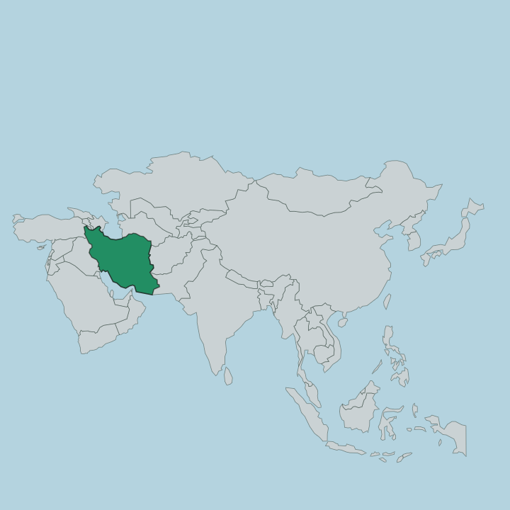
Chaharmahal and Bakhtiari lies in the southwest of Iran, folded into the central Zagros Mountains. It covers 16,332 square kilometers of ridge and valley. Isfahan Province wraps its northern and eastern edges, while Khuzestan drops away to the west and Kohgiluyeh and Boyer-Ahmad to the south. This is high country.
Zard-Kuh, the tallest massif of the central Zagros, rises to 4,221 meters in the west of the province, and its snows cap the skyline above Kuhrang for much of the year. Shahr-e Kord, the capital, stands higher than any other provincial seat in Iran, on a cold plateau ringed by peaks. Water is what sets the province apart.
The Karun, the longest and most voluminous river in Iran, gathers its first streams here, and the Zayandeh Rud that sustains Isfahan rises on the same slopes. Springs, snowmelt and steep gorges feed both. Waterfalls spill off the Zagros at Koohrang and Sheikh Alikhan, and the Choghakhor wetland spreads across the eastern plateau where migrant birds pause.
Little of the land sits low. From the yellow rock of Zard-Kuh to the reed beds of Choghakhor, almost every valley drains toward one of the two rivers that carry Bakhtiari water down to the plains of Isfahan and Khuzestan.
What is Chaharmahal and Bakhtiari Province like?
The province takes half its name from the Bakhtiari, one of the largest nomadic peoples of Iran. They speak a Bakhtiari dialect of Luri, a southwestern Iranian tongue closer to old Persian than to the Persian of Tehran. Each spring whole clans drive their flocks up from the warm lowlands of Khuzestan to the cool summer pastures of the Zagros, and each autumn they return the same way.
That twice-yearly migration is the rhythm of the land. Black goat-hair tents still pitch on the high meadows. The journey was filmed in 1924, when the Americans Merian Cooper and Ernest Schoedsack followed a Bakhtiari clan across the Karun and over Zard-Kuh for the documentary Grass.
Craft carries the same identity. Bakhtiari women weave bold kilims and gabbeh rugs, and the men's chogha, a sleeveless coat of white wool striped in black, is the province's signature garment. At festivals the choob-bazi stick dance is fought out in pairs to the sorna and dohol.
Not everyone still migrates. Many Bakhtiari have settled in Shahr-e Kord, Borujen and the farming villages of the plateau, trading tents for houses while keeping the language, the weaving and the music that came down from the mountains.
What is the history of Chaharmahal and Bakhtiari Province?
The name splits in two. Chahar Mahal means the four districts of the settled farmland around Shahr-e Kord, while Bakhtiari marks the tribal mountains beyond. For centuries the Bakhtiari khans ran those highlands as a power in their own right.
Their most famous hour came in 1909, when Sardar As'ad led Bakhtiari horsemen out of the Zagros, marched on Tehran and helped restore the constitution after the shah had suspended it. The two halves were later joined into a single province of Iran.
What is the climate of Chaharmahal and Bakhtiari Province?
Altitude rules the weather. Winters here are long and bitterly cold, with heavy snow piling on Zard-Kuh and the Kuhrang heights, and Shahr-e Kord ranks among the coldest towns in all of Iran. Summers are dry and warm by day but cool once the sun drops behind the ridges.
Rain is sparse. Most of the year's water arrives as snow, and it is that snowpack, melting slowly through spring, that keeps the Karun and the Zayandeh Rud running long after the clouds have gone.
How do you get to Chaharmahal and Bakhtiari Province?
Roads do the work here. No passenger railway reaches the province, and the airport at Shahr-e Kord sees little scheduled traffic, so nearly every visitor arrives overland. The usual approach is from Isfahan, whose international airport lies about two hours to the north by car or by the regular buses that run up to the plateau.
From the west, mountain roads climb up from Khuzestan, the same routes the Bakhtiari once walked with their herds. From Shahr-e Kord, local roads fan out to Kuhrang, Borujen and the Zard-Kuh valleys.
Good for
Updated July 2026