Iran
Mazandaran Province, Iran — Towns & Travel Guide


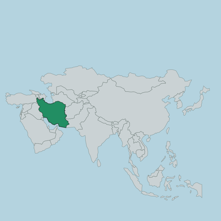
Mazandaran lines Iran's Caspian Sea coast, where the forested Alborz mountains fall to sandy beaches and green rice paddies.
About Mazandaran Province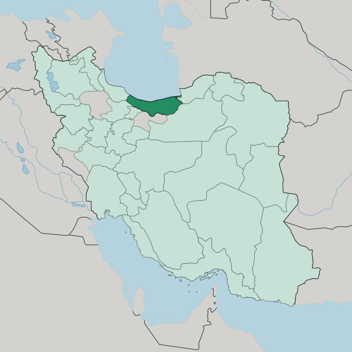
Towns & cities in Mazandaran Province
Pick a town or city — each links to where to stay.
Most trips base on the coast, then dip inland for the forest and the peaks. Sari, the provincial capital, sits inland on the Tajan River and holds the bazaar, the old clock tower and the rail link to Tehran. West along the shore, Ramsar stacks its hotels and mineral spas up a green hillside above the Caspian.
Chalus and the resort strip at Namak Abrud sit where the Chalus Road drops out of the Alborz. Babolsar draws beachgoers to its pier and promenade. Beaches lie north, forests and peaks south.
About Mazandaran Province
Iranians know Mazandaran as the green north.
What is Mazandaran Province known for?
The province runs as a narrow strip between the Caspian Sea and the wall of the Alborz mountains, and the ancient Hyrcanian forests cover the slopes in between. Rice paddies, tea gardens and citrus orchards fill the coastal plain. Mount Damavand, the highest peak in Iran, rises at its southern edge.
Sari is the capital. Beaches, hot springs and cool forest towns pull crowds from Tehran every summer.
Where is Mazandaran Province?
Mazandaran is a coastal province, long and thin. It runs for roughly 300 kilometres along the southern shore of the Caspian Sea, never more than a couple of hours wide. The land climbs fast.
From the sandy beaches and rice plains it rises within a few kilometres into the Alborz mountains, whose ridgeline forms the province's whole southern wall and separates the wet Caspian side from the dry Iranian plateau beyond. Mount Damavand, a snow-capped volcano and the highest point in Iran, stands on that mountain rim above the town of Amol. The Hyrcanian forests, a broadleaf woodland that has survived since before the last ice age, blanket the slopes between shore and summit.
Six provinces ring Mazandaran. Golestan lies to the east, Semnan and Tehran across the mountains to the south, and Gilan along the coast to the west. Dozens of short rivers tumble off the Alborz to the sea, among them the Haraz, which cuts the gorge that the Haraz Road follows down from the plateau, and the Tajan, which reaches the Caspian past the provincial capital at Sari. Nowhere is the sea far away.
What is Mazandaran Province like?
Mazandaran feels different from the Iran of the plateau, and locals are quick to say so. Its people speak Mazanderani, also called Tabari, a Caspian language of the northwestern Iranian branch that stayed largely apart from the Arabic and Turkic borrowings that reshaped Persian elsewhere. Persian is understood everywhere, but Tabari is the tongue of the home and the village.
Rice rules the table. The plain is one of Iran's great rice bowls, and the local cooking leans sour and herb-heavy, built around Caspian whitefish and tart sour-orange sauces. Green is the theme of daily life.
Tea gardens climb the foothills around Ramsar, citrus groves scent the coast road, and the forest yields wood, mushrooms and cool retreats from the summer heat. Every summer the province fills with visitors from Tehran, who cross the Alborz passes for the beaches, the cooler forest and the mountain air. Older customs hold on.
Village weddings, Tabari music and the poetry attributed to the Tabari mystic Amir Pazevari all keep the dialect alive. It is a green, rain-fed corner of the country, and it knows it.
What is the history of Mazandaran Province?
For most of its recorded past this coast was called Tabaristan, the land of the Tapurians. Forests and gorges kept invaders out. The Bavandid dynasty ruled the highlands from the year 651 and kept Zoroastrian and Iranian custom alive long after Arab armies had taken the rest of Iran.
Amol was the medieval capital and a seat of Shia learning. The name Mazandaran replaced Tabaristan around the 11th century. In 1782 Agha Mohammad Khan briefly made Sari his capital before the crown passed to Tehran.
What is the climate of Mazandaran Province?
Two climates sit back to back here. The Caspian coast is humid and subtropical, warm in summer and mild in winter, with rain falling in every month. West is wetter than east: the hills around Ramsar catch some of the heaviest rainfall in Iran, feeding the Hyrcanian forest, while the eastern plain near the Golestan border stays drier.
Cross the Alborz crest and everything changes. The high country turns cold and snowbound, and Damavand keeps its snowcap through the summer.
How do you get to Mazandaran Province?
Most visitors drive over the mountains from Tehran. Three passes climb the Alborz and drop to the coast: the Chalus Road through the Kandovan tunnel, the Haraz Road past Damavand, and the Firoozkooh route to the east. Traffic on the Chalus Road can crawl on summer weekends.
Trains on the Trans-Iranian Railway wind down through Qaemshahr to Sari. Small airports at Sari, Nowshahr and Ramsar handle domestic flights from Tehran and a few other Iranian cities.
Good for
Updated July 2026