Kenya
Kirinyaga, Kenya — Towns & Travel Guide


Kirinyaga is a county in central Kenya on the southern slopes of Mount Kenya, holding the Mwea rice plains and the mountain's Kikuyu namesake.
About Kirinyaga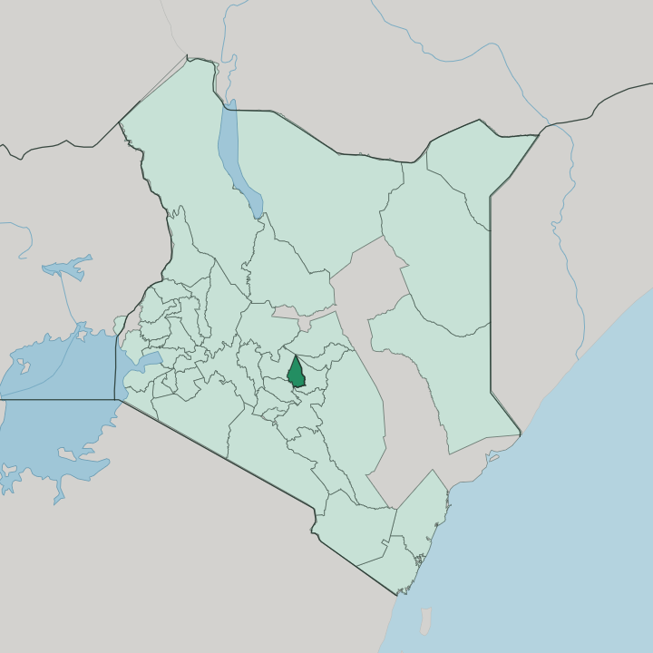


Towns & cities in Kirinyaga
Pick a town or city — each links to where to stay.
Most visitors base at Sagana. The small town sits on the Tana River, where riverside camps run rafting and kayaking trips through the rock gorge just downstream and shuttle guests up from Nairobi at dawn. Kerugoya, the county town, keeps the steadiest supply of plain hotels, along with the banks, markets and matatu stages of a headquarters.
For the mountain itself, a few forest lodges hold the southern edge of Mount Kenya, near the foot of the quiet Kamweti route. Down in the rice plains around Wanguru, the land is all paddies and few travellers stay. Choose Sagana for the river; choose Kerugoya for services.
About Kirinyaga
What is Kirinyaga known for?
Rice made Kirinyaga's name. The Mwea Irrigation Settlement Scheme, spread across the hot plains in the south of the county, grows the greater share of all the rice eaten in Kenya, fed by canals drawn from the Thiba and Nyamindi rivers. Up on the cooler slopes of Mount Kenya the crop changes to coffee and tea, planted in tight green rows across the ridges.
The mountain itself gives the county both its skyline and its name: Kĩrĩnyaga is the Kikuyu word for Mount Kenya. Sagana, on the Tana River, draws rafters to its white water.
Where is Kirinyaga?
Kirinyaga sits in central Kenya, on the southern and south-western flanks of Mount Kenya, about 120 kilometres north-east of Nairobi. The county climbs from the hot Mwea plains in the south to the ice and rock of the mountain's summit, so its whole shape is a slope. Batian, the highest peak of Mount Kenya, marks the northern corner.
Rivers fall from there in every direction. The Nyamindi and the Thiba run down through the county toward the Tana, gathering the meltwater and rain of the upper slopes. Sagana, the old road-and-rail town, stands where the Tana River leaves the highlands.
Three neighbours ring the county. Embu County lies along the east and south, Murang'a County to the south-west, and Nyeri County across the ridges to the north-west. The Tana, Kenya's longest river, drains the whole southern face of the mountain and gives Sagana its other name. Elevation, not distance, sets the county apart.
In a single short drive the land shifts from cool tea ridges to the flat paddies of Mwea, and the temperature climbs with every kilometre lost. That gradient decides what grows where.
What is Kirinyaga like?
Kirinyaga is Kikuyu country, and the mountain stands at the centre of it. In the old creation story the god Ngai lives on Mount Kenya, which the Kikuyu call Kĩrĩnyaga, the mountain of brightness; from there he settled the first man, Gĩkũyũ, and the first woman, Mũmbi, on its slopes. Homesteads once faced the peak.
Prayers turned toward it. That orientation gave the whole community its bearings, and the county still carries the mountain's Kikuyu name. Daily life here is farming life.
The upper ridges are worked in coffee and tea by smallholders, while the Mwea lowlands are given over to rice, and the rhythm of planting and harvest sets the calendar. Open-air markets pull the county together. Kagio holds one of the largest, a sprawl of produce, secondhand clothes and livestock on its trading days.
Kikuyu is the language of the home and the market, English and Swahili the language of the school and the office. Food leans on the land: githeri of maize and beans, and the rice of Mwea on the plate more often than anywhere else in Kenya.
What is the history of Kirinyaga?
The Kikuyu reached these foothills in the sixteenth century, farming up toward the forest line of Mount Kenya. Britain claimed the country as a protectorate in 1895, and settlers took the high, well-watered land the Kikuyu had cleared. That grievance fed the Mau Mau revolt.
When the colonial government declared its emergency in 1952, fighters of the Land and Freedom Army melted into the Mount Kenya forests above Kirinyaga, and the county became one of the war's hard fronts. Kerugoya grew up as the colonial and then district headquarters, and Kirinyaga took its own place among Kenya's counties after devolution in 2013.
What is the climate of Kirinyaga?
Kirinyaga's weather is stacked by height, not by season. The Mwea plains in the south stay hot and dry for much of the year, while the coffee and tea ridges higher up are cool and green, and the upper forest of Mount Kenya is cold and often wet in cloud. Rain comes in two spells.
The long rains fall from March into May, the short rains around October to December, in the twin-peak pattern of the highlands astride the equator. Rainfall thins as the land drops toward Mwea, which is why the rice there leans on irrigation rather than the sky.
How do you get to Kirinyaga?
Nearly everyone arrives by road from Nairobi. The tarmac climbs north-east from the capital, some 120 kilometres, crossing the Tana River at Sagana before forking to Kerugoya, Kutus and the Mwea rice towns. Nairobi's Jomo Kenyatta airport is the way in from abroad, a few hours' drive south.
There is a railway too. The old metre-gauge line to Nanyuki runs through Sagana, a slower way up from Nairobi than the highway. Within the county, matatus knit the market towns to Kerugoya.
Good for
Updated July 2026