Kenya
Murang'A, Kenya — Towns & Travel Guide


Murang'a is a county in central Kenya, the highland cradle of the Kikuyu people, below the forested Aberdare Range.
About Murang'A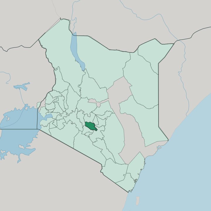


Towns & cities in Murang'A
Pick a town or city — each links to where to stay.
Murang'a town, the colonial-era Fort Hall, is the practical base, a ridge settlement above the Mathioya valley holding the county offices, the market, and most of the guesthouses. Kenol and Makuyu line the busy A2 in the warm lower east, handy for a road halt. Ndakaini's tea country has countryside lodges facing the Aberdare Range.
The Tana's rapids at the county's north-eastern corner draw whitewater rafting to camps on the Murang'a bank, below Sagana town in Kirinyaga across the river. Town for errands, hills for calm.
About Murang'A
What is Murang'A known for?
Murang'a is the cradle of the Kikuyu people. Their origin story places the first man and woman at Mukurwe wa Nyagathanga, a sacred grove near Gaturi that draws pilgrims to the shrine the Gikuyu revere. Coffee and tea grow on its red ridges.
Behind a wall on the Thika River, the reservoir at Ndakaini gathers the rain of the Aberdare Range and pipes most of Nairobi its drinking water. Rivers do the carving here.
Where is Murang'A?
Murang'a lies in the central highlands of Kenya, north of the capital at Nairobi. The county is ringed by neighbours: Kiambu to the south, Nyeri to the north, Nyandarua across the mountains to the west, and Kirinyaga, Embu and Machakos along the eastern and south-eastern edge. Its western wall is the Aberdare Range, a long forested ridge that shuts the county off from the Rift Valley beyond.
From that high crest the land tilts east and south-east, dropping through cultivated ridges to warmer, drier plains. The fall is steep. Nearly the whole county is hill country, corrugated into parallel ridges and deep valleys.
Rivers do the shaping. The Mathioya, Maragua, Chania and Thika all rise in the Aberdare forest and run east across the county, cutting the ridges apart on their way to the Tana, the longest river in Kenya, which gathers them at the eastern edge. Between the streams the soils are deep and red, the volcanic earth that makes the coffee and tea grow.
Elevation climbs steadily from the hot lower east toward the cold forest crest on the Nyandarua side. That range in height packs several climates into one county. Across Murang'a's ridges, a river is never far off.
What is Murang'A like?
Murang'a is Kikuyu country to its core. The people trace their whole nation to this ground, to Gikuyu and Mumbi, the first couple who settled at Mukurwe wa Nyagathanga and raised ten daughters. Those daughters became the mothers of the ten Kikuyu clans.
That founding story is not a museum piece here. It still orders clan names and family lines across the ridges, and the Gikuyu language fills the markets and the tea-buying sheds. Faith sits beside it.
Christianity took deep root in the county's mission-era schools and churches. Daily life runs on the land. Most families work smallholdings of coffee and tea, and the rhythm of picking and pulping shapes the week across the county.
Murang'a also carries a harder memory. Its ridges were a heartland of the Mau Mau revolt against British rule, and the forests of the Aberdare Range that sheltered the fighters lie along its own western edge. Independence-era politics drew heavily on this county's people.
Trading centres string along the ridge roads, each with its market day, its matatu stage, and its rows of dukas. The pace is rural, not urban.
What is the history of Murang'A?
Long before any colonial map, this was the Kikuyu heartland, its ridges thick with farms. The British built a garrison post here in the early 1900s and named it Fort Hall, after the administrator Francis Hall. It ran Kikuyuland as Fort Hall.
In the 1950s these ridges and the Aberdare forests above them were a centre of the Mau Mau revolt that pushed Kenya toward independence. The town shed its colonial name for Murang'a after independence, and the modern county took its present shape under devolution in 2013.
What is the climate of Murang'A?
Altitude sets the weather here, not the seasons of the north. The high western edge below the Aberdare Range stays cool and wet, while the lower eastern plains toward the Tana run hot and much drier. Rain comes twice a year.
The long rains fall between March and May and the short rains return around October to December, filling the rivers that feed the county's coffee and tea. June and July turn cold on the heights.
How do you get to Murang'A?
There is no airport in the county. Nearly everyone comes by road from Nairobi, an hour or so north, driving the Thika superhighway and then the A2 that runs up the spine of central Kenya. The A2 enters over the Chania River near Kenol, then climbs on toward Sagana and Mount Kenya.
Murang'a town sits a short way off that road, up on its ridge. Long-distance flights land at Jomo Kenyatta International, on Nairobi's edge. Matatus run the route all day.
Updated July 2026