North Korea
Hwanghae-bukto, North Korea — Towns & Travel Guide


Hwanghae-bukto is North Korea's inland breadbasket, the rolling farm country and old Koryŏ heartland spread south of Pyongyang toward the Yellow Sea.
About Hwanghae-bukto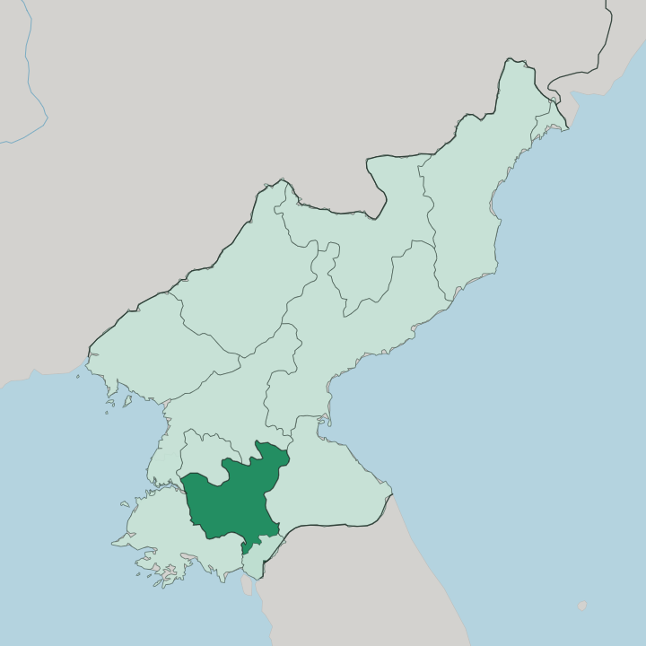
Towns & cities in Hwanghae-bukto
Pick a town or city — each links to where to stay.
Sariwŏn is the obvious base. The capital sits below Mount Kyŏngam, where the Folk Customs Street reconstructs an idealised old-Korean quarter of tiled roofs, a folk restaurant, and a hilltop pavilion. Most travellers here are passing between Pyongyang and the Kaesŏng demilitarized zone, and Sariwŏn breaks that drive at its midpoint.
You come for a farm-country pause. Songnim, the iron-and-steel port on the Taedong, is industrial and rarely a stop. Choose Sariwŏn for the folk street and the mountain walk, and treat the surrounding counties as day country reached from the city.
About Hwanghae-bukto
Hwanghae-bukto is the grain bowl of North Korea.
What is Hwanghae-bukto known for?
Its wide alluvial flats along the Chaeryŏng and Taedong rivers grow much of the country's rice and maize, so the province reads as farm country first. Sariwŏn, the provincial capital, anchors it as the road, rail, and river junction where the harvest gathers. The land itself is gentle.
Low ridges of the Ahobiryŏng chain rise in the east, while the west opens onto the plains that feed Pyongyang. History marks it too, for the old Koryŏ capital at Kaesŏng sits on the southern edge, with royal tombs scattered through the hills.
Where is Hwanghae-bukto?
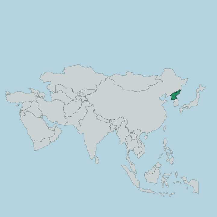
Hwanghae-bukto fills the middle of the peninsula's western side, wrapped around the drainage that empties into the Yellow Sea. Pyongyang and South Pyongan lie to the north, Kangwŏn to the east, and South Hwanghae to the west. Its southern edge runs down to Kaesŏng and the demilitarized zone that splits the peninsula.
The shape of the land is a story of water. The Taedong River crosses the north past Songnim, and the Chaeryŏng, its largest tributary, drains the broad western flats of the Chaeryŏng Plain. Those plains are why the province exists as a distinct place.
When the old Hwanghae Province was split in 1954, the divide followed the terrain, keeping the hillier inland north here and handing the flatter coastal south to Haeju. So the west of Hwanghae-bukto is open farmland, low and fertile, threaded by rivers that small craft work up toward Sariwŏn. The east climbs.
Ridges of the Ahobiryŏng range roll up toward the Kangwŏn border, and counties such as Suan, Koksan, and Sinpyŏng sit in upland valleys rather than on the plain. No coastline touches the province at all, which is rare for a Korean division and shapes everything from its crops to its winters.
What is Hwanghae-bukto like?
This is old Korean heartland, and the weight of it comes from Koryŏ. The dynasty that unified the peninsula in 918 ruled from Kaesŏng on the province's southern rim, and the hills around still hold the tombs of its kings, among them Wang Kŏn, its founder, and King Kongmin. That royal past sits oddly beside the province's other, stage-managed face.
Sariwŏn's Folk Customs Street, built under Kim Jong-il, stages a romanticised version of that heritage in fresh tile and timber, with old cannons and a history museum arranged for the visiting tour groups who come through. Yet farming shapes daily life far more than the monuments do. The Hwanghae dialect is spoken across the fields and the market towns, and the rhythm of the year still follows the rice and maize of the western plains rather than any city clock.
Grain rules the calendar. Sariwŏn even guards a small culinary boast, a name for the country's best makkŏlli, the cloudy rice beer that belongs to a grain-growing province like this one. Beyond the set pieces, the living culture here is agricultural and provincial, bound to the land that the Taedong and the Chaeryŏng water.
What is the history of Hwanghae-bukto?
The province is younger than the land it covers. It was carved out in 1954, when the single Hwanghae Province was split in two and Sariwŏn was made the capital of the northern, inland half. What came before runs far deeper.
Under Koryŏ the region lay in the orbit of the royal capital at Kaesŏng, and earlier still the Koguryŏ kingdom threw up hill fortresses such as Taehŭngsan here to shield Pyongyang from the south. Kaesŏng itself was folded into the province, then promoted out again to a special city, so the border has shifted in living memory. The modern towns grew with the railway that reached Sariwŏn in 1906.
What is the climate of Hwanghae-bukto?
Hwanghae-bukto has a humid continental climate, hot in summer and sharply cold in winter, sharpened by the fact that no sea moderates its inland core. The great event of the year is the summer monsoon. From June to September the bulk of the rain falls, drenching the Chaeryŏng and Taedong plains and occasionally bringing typhoons up from the Pacific.
Winters are dry and bitter. Cold air spilling off the Asian mainland freezes the fields and the rivers, and the eastern uplands around Suan and Koksan run colder still than the western flats. It is a farmer's calendar, wet when the rice needs it and hard afterward.
How do you get to Hwanghae-bukto?
Almost everyone arrives from Pyongyang by road. The Pyongyang-Kaesŏng Motorway runs the length of the province from north to south, and Sariwŏn sits close to its midpoint, roughly seventy kilometres and an hour and a half from the capital. Rail matters as much as the road.
Sariwŏn is a junction on the Pyŏngbu line linking Pyongyang toward Kaesŏng and the southern border, and branch lines fan off into the Hwanghae interior. There is no airport for visitors and no coast to arrive by. Most travellers see the province as a scheduled stop on the drive down to the demilitarized zone, not a destination reached on its own.
Updated July 2026