North Korea
North Hamgyong Province, North Korea — Towns & Travel Guide


North Hamgyong is North Korea's northernmost province, wedged against China and Russia where the Tumen River meets the Sea of Japan.
About North Hamgyong Province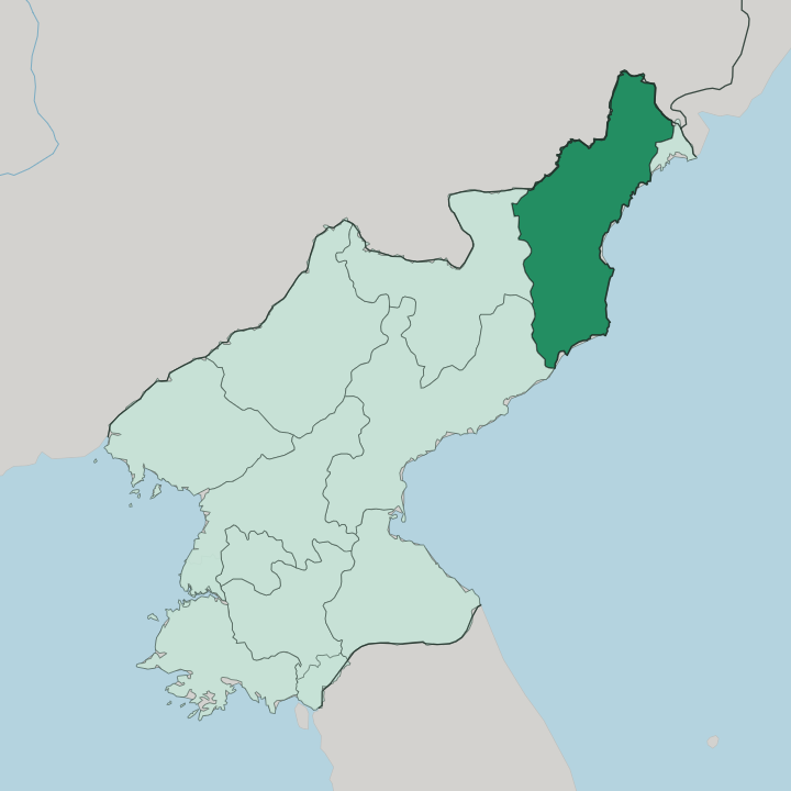
Towns & cities in North Hamgyong Province
Pick a town or city — each links to where to stay.
Chongjin is the only realistic base. Independent travel is not an option here, and foreign visitors reach North Hamgyong only on tightly guided itineraries that funnel through the capital. The city holds what lodging exists, set between its harbour on the Sea of Japan and the steel plants that gave it the City of Iron name.
Kimchaek down the coast and Hoeryong up on the Tumen River are places you pass through on an escorted route rather than settle into. Lodging in North Hamgyong is thin, and Chongjin holds nearly all of it. Choose Chongjin if you come at all; the rest is seen from a vehicle.
About North Hamgyong Province
What is North Hamgyong Province known for?
North Hamgyong is the far northeastern corner of North Korea, cold and mountainous and hard against the borders with China and Russia. Chongjin anchors it. The provincial capital earned the nickname the City of Iron for its steelworks and shipyards, and it sits third among the country's cities by size.
The Tumen River draws the northern edge, with Hoeryong and Musan strung along its banks facing China. Everything here leans on the Sea of Japan to the east and the Hamgyong Mountains that wall off the interior.
Where is North Hamgyong Province?
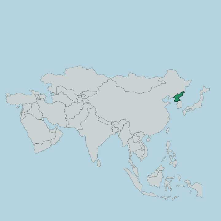
North Hamgyong occupies the northernmost tip of North Korea, the corner that pushes hardest into the Asian mainland. It is fenced by water and rock. The Tumen River draws the whole northern boundary, separating the province from China's Jilin lands and, along a short final stretch near the river's mouth, from Russia before the water empties into the Sea of Japan.
That sea forms the entire eastern flank, giving the province its ports at Chongjin and Kimchaek. Inland the ground climbs fast. The Hamgyong Mountains and the Machon range fold across the interior, throwing up steep ridges and narrow valleys that leave little flat land for farming. Ryanggang Province lies to the west across those heights, and South Hamgyong Province to the southwest.
The Tumen itself rises far to the west on the slopes of Mount Paektu, the volcano on the Chinese border, then runs east and north past Musan and Hoeryong before turning down to the coast. Rugged terrain and a long cold frontier have kept this the most remote and thinly settled quarter of the country, closer to Vladivostok than to Pyongyang.
What is North Hamgyong Province like?
This is North Korea's industrial and frontier northeast, and its character is shaped by iron, cold, and distance. Chongjin makes the point plainly. The city grew up around steel mills and shipyards, and the smoke and cranes of the City of Iron define its skyline as much as any monument does.
Korean is the language, spoken here in the northern Hamgyong dialect that outsiders in Pyongyang have long treated as blunt and provincial. Life runs hard. The province carries a heavy weight of state mythology alongside its factories.
Hoeryong, on the Tumen River, is honoured as the birthplace of Kim Jong Suk, the guerrilla fighter married to Kim Il Sung, and its revolutionary site draws organised pilgrimages. Mining towns like Musan and port cities like Kimchaek fill out a working landscape of ore, rail lines, and cold-water harbours rather than anything built for visitors. Because the region sits so far from the capital and so close to China, it has also been the country's most porous edge, and the place most marked by the famine of the 1990s.
What a traveller sees is a guarded, functional corner of the nation, seen entirely under escort.
What is the history of North Hamgyong Province?
North Hamgyong was carved out in 1896, when the old Hamgyong Province was split into northern and southern halves. Its modern shape came from industry. Under Japanese rule the coast at Chongjin and Songjin, now Kimchaek, was built up for steel and shipping to feed the empire's northern reach toward Manchuria.
After 1945 the province became a pillar of the North Korean iron economy, and Kimchaek took its present name in 1951 to honour a Korean People's Army general. Rason, the ice-free port near the Russian border, was later spun off as a special economic zone.
What is the climate of North Hamgyong Province?
North Hamgyong has one of the harshest climates in Korea. Winters here are long and bitter. Cold Siberian air pours down over the Hamgyong Mountains and the Tumen River valley, freezing the inland counties for months and dusting the high ground with snow.
Summers turn short, warm, and wetter, when most of the year's rain arrives along the Sea of Japan. The mountains wring so much moisture from the air that the sheltered valleys around Musan stay drier and colder than the coast at Chongjin.
How do you get to North Hamgyong Province?
Reaching North Hamgyong is difficult, and never done alone. Access runs through Chongjin. Orang Airport outside the capital handles the rare flight, while electric railways thread down the coast to link Chongjin with Rason near the Russian border and southward to Pyongyang.
Foreign visitors arrive only on state-approved tours, usually crossing from China at the Tumen River or flying in from the capital. The far northeast is the hardest part of an already closed country to enter.
Good for
Updated July 2026