North Korea
Ryanggang, North Korea — Towns & Travel Guide


Ryanggang is North Korea's highest, coldest province, a border highland under Mount Paektu where the Yalu River divides Korea from China.
About Ryanggang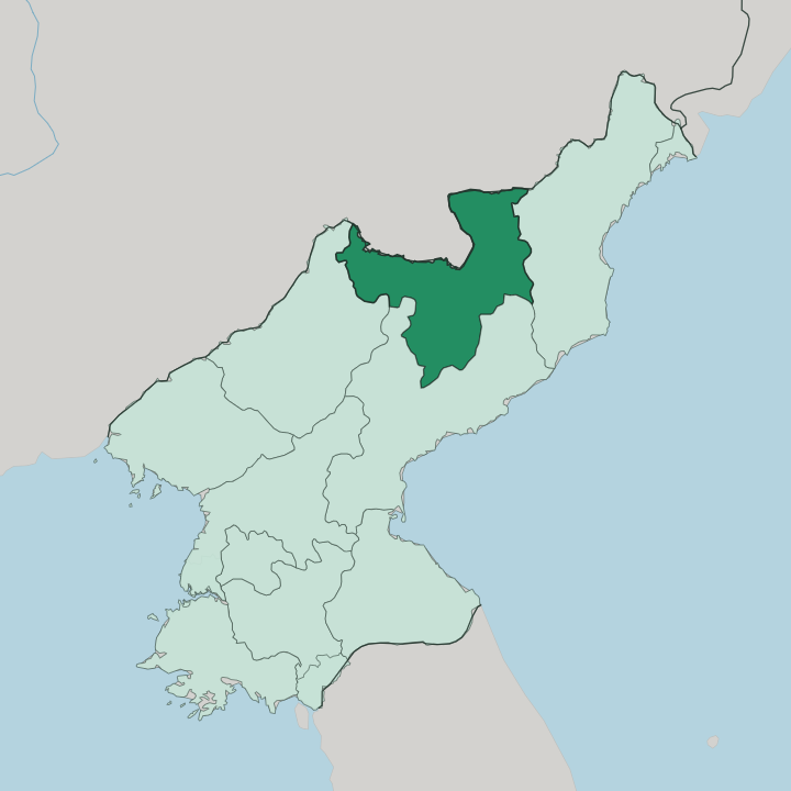
Towns & cities in Ryanggang
Pick a town or city — each links to where to stay.
Two towns hold nearly all of Ryanggang's beds. They serve opposite purposes. Samjiyon is the tourist base for Mount Paektu, a rebuilt resort town in the mountain's foothills where a cluster of new hotels went up beside the ski slopes.
Hyesan is the working capital on the Yalu River, an administrative and river-transport hub rather than a resort. Choose Samjiyon if you have come to climb to the crater lake and stand on the peak; the town exists to send visitors up the mountain. Elsewhere on the Kaema Plateau, beds run out fast.
About Ryanggang
One mountain defines the province.
What is Ryanggang known for?
Mount Paektu, the highest peak on the Korean Peninsula, rises in the far north of Ryanggang and holds a place in the country's founding mythology that few other landscapes can match. The Yalu River pours off its slopes and runs west along the Chinese frontier, past the provincial capital at Hyesan, where timber cut in the highland forests is still rafted downstream. Samjiyon sits in the mountain's foothills as the base for reaching it.
Between them stretches the Kaema Plateau, a treeless highland cold enough to grow the potatoes the region is famous for.
Where is Ryanggang?
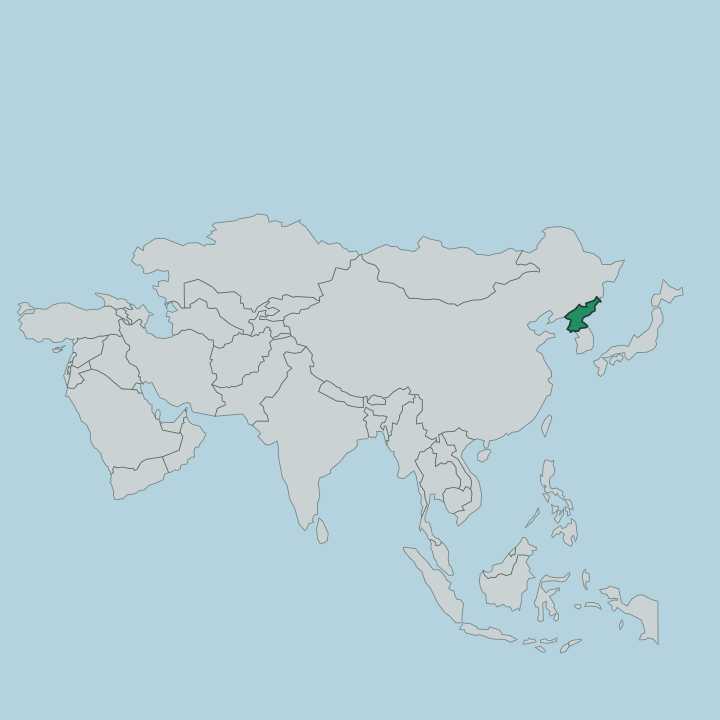
Ryanggang occupies the roof of North Korea, a block of high country wedged against the Chinese frontier in the far north of the peninsula. No coast reaches Ryanggang at any point. China lies across the whole northern edge, and three North Korean provinces close it in on the other sides: North Hamgyong to the east, South Hamgyong to the south, and Chagang to the west.
The border with China is a river border for its full length. The Yalu River defines the northwestern edge and the Tumen River the northeastern, and both of these rivers rise on the same mountain. That mountain is Mount Paektu, the tallest on the Korean Peninsula, standing on the line between Ryanggang and China.
A crater lake called Heaven Lake fills its summit caldera, split down the middle between the two countries. South and east of the peak the land settles into the Kaema Plateau, a vast treeless upland often called the roof of Korea, its floor riding well above the valleys of the rest of the country. Rivers have cut deep gorges into that plateau on their way down to the frontier.
Hyesan, the capital, sits low on the Yalu where the water runs shallow, close enough to touch the Chinese bank across the stream. This is the highest and most remote corner of the country, far from any coast, hemmed in by water and rock.
What is Ryanggang like?
Culture in Ryanggang is inseparable from Mount Paektu. The mountain sits at the heart of the state's founding story, cast as the cradle of the anti-Japanese guerrilla struggle, and Samjiyon was rebuilt in part to frame pilgrimages to it. Monuments and a revolutionary museum stand in the town to tell that version of the past.
Korean is the language, as everywhere in the country. Away from the peak, this is highland farm and forest culture, shaped by cold and altitude rather than by cities. The Kaema Plateau grows potatoes, and Taehongdan county has made the crop close to an identity; the highland's short, cool summer suits it where lowland rice cannot follow.
Timber is the other living. Log rafts still come down the Yalu to Hyesan from the forests around Paektu, some of the richest in the country. Life here is thin and hard-wintered, spread across remote counties rather than gathered into a metropolis.
The province wears its border geography plainly. Across a narrow river lies China, and the two banks have watched each other for as long as the frontier has run here.
What is the history of Ryanggang?
Ryanggang is a young province. It was carved out in 1954, when the North Korean government split the highland north off South Hamgyong and made a separate administrative unit of the upper Yalu and Tumen basins around Mount Paektu. Hyesan became its capital.
The choice was deliberate: pulling this strategic border highland, forested and mineral-rich, under one provincial government tightened control over the frontier and the guerrilla-war terrain that the state holds sacred. Before 1954 there was no Ryanggang at all; the map simply reached south into Hamgyong.
What is the climate of Ryanggang?
Ryanggang is the coldest province. Height and distance from the sea give the Kaema Plateau a subarctic climate, with long and bitterly dry winters and a short green summer that rarely climbs out of the low twenties. Around Samjiyon and the Paektu highlands the January cold can settle far below minus twenty.
That very chill is what lets the highland grow its potatoes where warmer crops fail. Snow lies deep and long on the plateau, and the season for climbing Mount Paektu is a narrow one.
How do you get to Ryanggang?
Getting here is the hard part. For foreign visitors the practical route to Mount Paektu is a flight from Pyongyang to the airport at Samjiyon, since the province sits in the far northern corner of North Korea, high and off to one side of everything. The land approach follows the rail line up to Hyesan on the Yalu, and from the capital a road climbs the roughly 67 kilometres on to the mountain.
Snow and altitude close much of that route for a good part of the year. There is no coast and no sea route; every way in crosses the highlands.
Good for
Updated July 2026