North Korea
Hwanghae-namdo, North Korea — Towns & Travel Guide


Hwanghae-namdo is North Korea's western granary, a low farming province on the Yellow Sea with Haeju as its port capital.
About Hwanghae-namdo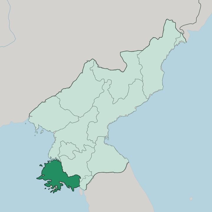
Towns & cities in Hwanghae-namdo
Pick a town or city — each links to where to stay.
Haeju is the one obvious base. The provincial capital sits on Haeju Bay under Suyangsan, and its harbour is the only western port that stays open through the freeze. Inland there is little for a traveller to sleep in.
The Chaeryong plain and the orchard county of Kwail are working farmland, thin on beds and closed to casual movement across this border province. Choose Haeju if you want the coast; the interior you pass through rather than stay in.
About Hwanghae-namdo
Grain.
What is Hwanghae-namdo known for?
Hwanghae-namdo is the bread-basket of North Korea, a rare stretch of the country where the land lies flat enough to farm at scale. The Chaeryong plain runs green with rice through the summer, watered by the Chaeryong River as it drains north toward the Taedong. Haeju anchors the coast, the largest port in the country's south outside Wonsan and the one western harbour that does not ice over in winter.
Ancient dolmen and Koguryo tombs are scattered across the same fields the harvesters work.
Where is Hwanghae-namdo?
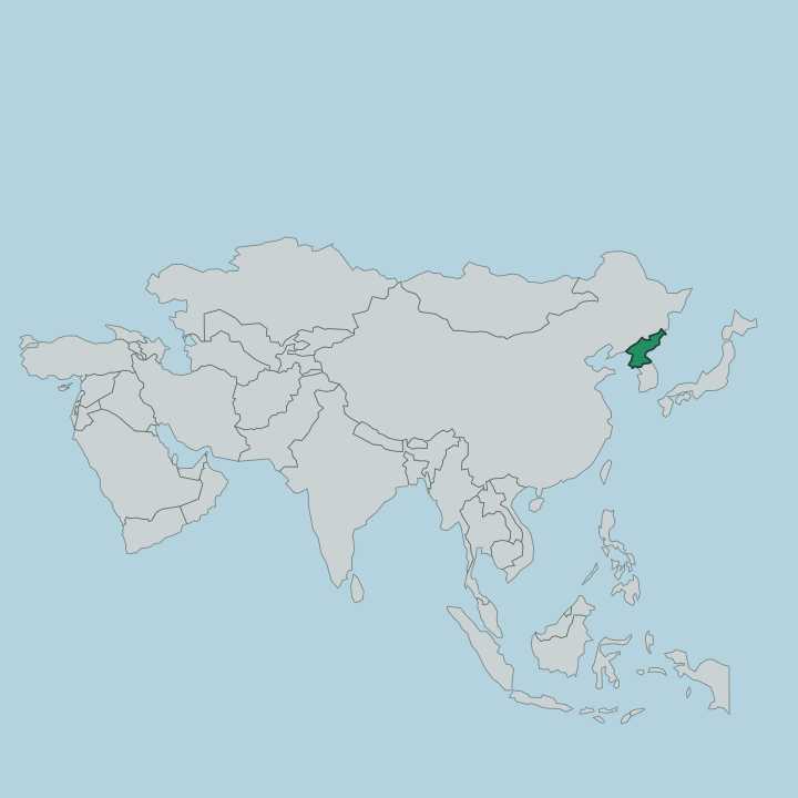
Hwanghae-namdo fills the south-western corner of North Korea, a broad apron of lowland tipping down to the Yellow Sea. It is unusual for the country. Most of North Korea buckles into mountains, but this province stays flat, which is exactly why it grows the nation's grain.
The Chaeryong plain spreads across the interior. It is drained by the Chaeryong River, which runs north through the lowland to join the Taedong, and Haeju sits on the south coast where the Yongdang Peninsula curls out across Haeju Bay to shelter the harbour. Water and boundaries close the province in on three sides.
The Yellow Sea forms the whole western and southern edge, its shoreline broken by small islands such as Kirin-do and Sunwi-do. North Hwanghae Province lies over the northern and eastern border. To the south, the land runs up against the Korean Demilitarized Zone, the fortified strip that separates North from South Korea, so the province is a frontier as much as a farm belt. Suyangsan rises behind Haeju to 946 metres, its waterfall dropping off the ridge above the city.
Beyond the beaches the sea is shallow, tidal and studded with the contested islands of the west.
What is Hwanghae-namdo like?
This is old country. Long before the modern border cut across it, the fields of Hwanghae-namdo were being farmed and buried in, and the land still carries the marks. Iron Age dolmen sit out in the open.
Koguryo-era tombs pierce the low hills, the painted chambers of Anak among them, and stone pagodas and Buddhist relics survive at temple sites across the province. Farming is the through-line of the culture. The rhythm of the year is the rhythm of the rice, planting in spring and the mass harvest of autumn.
Haeju holds the scholarly side of that past. The Puyong Pavilion stands in the city, and just outside it the Sohyon Academy recalls Yi I, the Confucian scholar born nearby in the sixteenth century. Korean is the language, as everywhere in the country, and daily life bends around the collective farm and the border.
Movement is controlled here, more tightly than in much of North Korea, because the demilitarized zone runs along the southern edge. What a visitor sees is a landscape of orchards, paddies and monuments, worked hard and watched closely.
What is the history of Hwanghae-namdo?
The province is young. The land is not. Hwanghae-namdo was created in 1954, when the older Hwanghae Province was split into a northern and a southern half, and Haeju became the capital of the south.
The name Hwanghae means Yellow Sea, borrowed from the water on its western flank. Long before either division, this was the settled heart of the Koguryo kingdom, whose tomb-builders left the painted chambers at Anak that still draw archaeologists. The Korean War then froze a new line across the province's southern fields, and the demilitarized zone has marked that edge ever since.
What is the climate of Hwanghae-namdo?
The province runs to a monsoon rhythm. Winters are cold and dry under continental air off the mainland, while the summers turn hot and wet, and most of the year's rain arrives in one drenching push between July and August that floods the paddies of the Chaeryong plain. That wet, warm summer is what makes the grain grow.
The Yellow Sea softens the extremes along the Haeju shore, and the port stays free of ice when other western harbours freeze. Spring is the busy planting window before the rains.
How do you get to Hwanghae-namdo?
Access is hard and tightly permitted. Foreign travel into North Korea funnels through Pyongyang, and Hwanghae-namdo is reached overland from there, a road and rail journey of roughly 100 kilometres south to Haeju. The Hwanghae Chongnyon rail line joins Haeju to Sariwon on the trunk network, and the capital's port handles coastal shipping on the Yellow Sea.
Because the demilitarized zone runs along the southern boundary, the province is a controlled border area, and independent movement is not possible. Everything comes through Pyongyang first.
Good for
Updated July 2026