North Korea
Kangwŏn-do, North Korea — Towns & Travel Guide


Kangwŏn-do is North Korea's mountainous east-coast province: the Diamond Mountain and the port of Wŏnsan on the Sea of Japan.
About Kangwŏn-do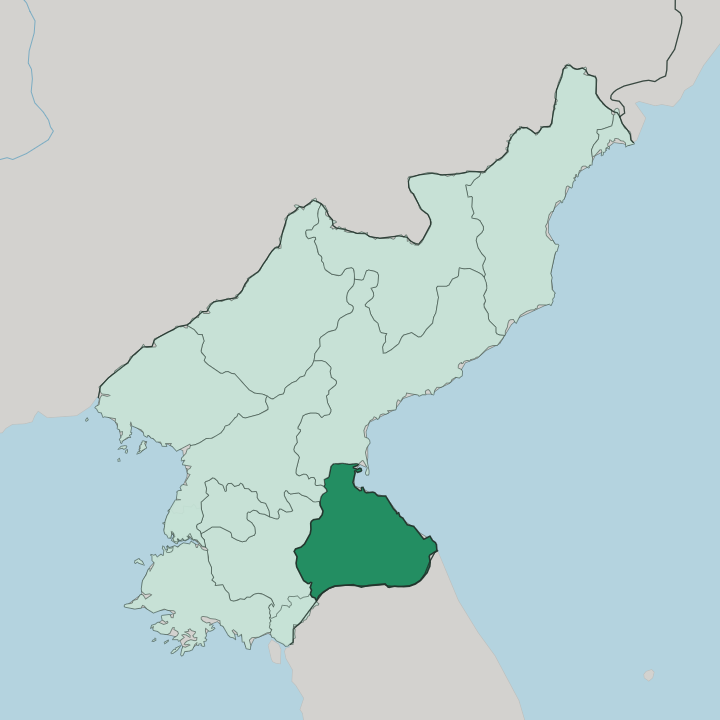
Towns & cities in Kangwŏn-do
Pick a town or city — each links to where to stay.
Wŏnsan is the obvious base. The provincial capital sits on a sheltered bay of the Sea of Japan, with its harbour, its sandy Kalma peninsula, and the Songdowŏn strand within reach of the centre. From there the province opens two ways.
The Masikryŏng ski grounds lie in the hills a short drive inland, and the road south runs toward Mount Kŭmgang and the county of Kŭmgang. Choose Wŏnsan for the coast and the connections; look toward the mountains when the T'aebaek ridge and the Diamond peaks are what you came for.
About Kangwŏn-do
One name carries the province: Kŭmgang.
What is Kangwŏn-do known for?
Mount Kŭmgang, the Diamond Mountain, stands in the south of Kangwŏn-do and has drawn painters and pilgrims for centuries with its twelve thousand granite peaks, its waterfalls, and its old Buddhist temples. The rest of the province is defined by the sea and the ridge behind it, the T'aebaek Mountains falling steeply toward the East Korean coast. Wŏnsan is the working heart of it all, the provincial capital and the main port on the Sea of Japan.
Beyond the city, the mountains and the shoreline are the reason to come.
Where is Kangwŏn-do?
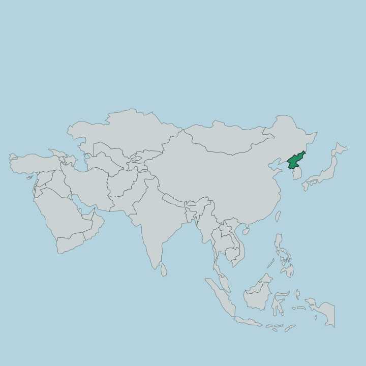
Kangwŏn-do runs down the eastern side of North Korea, a strip of coast and mountain facing the Sea of Japan. It covers about 11,255 square kilometres. The T'aebaek Mountains form its spine, dividing the province into a western upland and a narrow eastern shore, and the highest of those mountains is Mount Kŭmgang, the Diamond Mountain, which reaches 1,638 metres above the coast.
To the north lies the province of South Hamgyŏng, to the west North Hwanghae and the interior, and to the south the region around Kaesŏng. The mountains are close. From the ridge to the water is rarely a long way, and the ground drops fast toward the East Korean shore.
The southern edge of the province is unusual. It runs up against the Korean Demilitarized Zone, the fortified strip that has split the peninsula since the war, and beyond that lies the South Korean province of Gangwon that was once part of the same territory. Wŏnsan stands on the coast in the north of Kangwŏn-do, on a bay of the Sea of Japan, sheltered by the low Kalma peninsula.
The sea has shaped the province as much as the mountains have. Almost everything of interest lies either on that eastern shore or up in the ridge behind it.
What is Kangwŏn-do like?
Kangwŏn-do's culture is bound up with one mountain above all others. Mount Kŭmgang has been painted, written about, and walked as a place of pilgrimage since long before the peninsula was divided, and its Buddhist heritage is old. Phyohun Temple, in the inner valleys of the Diamond Mountain, traces its founding to the year 670.
Monks kept hermitages among the granite peaks and the ravines. That religious landscape is the province's oldest cultural inheritance, tied to the specific rocks and waterfalls of Kŭmgang rather than to any city. The coast tells a different story.
Wŏnsan grew up as a port and a naval town, opened to trade in 1880, and its life has always faced the Sea of Japan and the fishing grounds off the East Korean shore. Korean is the language spoken throughout the province, as across North Korea. The split between the two halves runs through the culture as well as the map.
Uplands hold the temples and the old pilgrim routes; the shore holds the harbours, the beaches, and the working sea. Both belong to the same narrow province, and neither makes sense without the other.
What is the history of Kangwŏn-do?
The old province of Kangwŏn was formed in 1395, one of the Eight Provinces of Korea under the Joseon dynasty, and it took its name from its two chief cities of the time. Division broke it apart. In 1945 the 38th parallel cut the peninsula in two, and Kangwŏn was split between the Soviet-occupied north and the American-occupied south.
The traditional capitals of Wonju and Chuncheon both fell on the southern side, so in 1946 the northern half was reorganised and its capital fixed at Wŏnsan on the coast. What had been one province became two, and the modern Kangwŏn-do of North Korea took the shape it still holds.
What is the climate of Kangwŏn-do?
The T'aebaek ridge splits the province's weather in two. On the western, inland side of the mountains the winters run cold and dry, sheltered from the sea. The eastern shore is milder and wetter, its air moderated by the Sea of Japan that laps against Wŏnsan and the whole coast.
Summers bring the heavier rain, carried in off the water, while the high country around Mount Kŭmgang holds snow that made the Masikryŏng slopes possible. The ridge stays harsher.
How do you get to Kangwŏn-do?
Wŏnsan is the way in. The provincial capital sits at the end of the Kangwŏn railway line, which climbs over the mountains from Pyongyang to reach the coast, and Kalma airport serves the city on its own peninsula. Access to North Korea is tightly controlled, so travel here means an organised route through Pyongyang rather than a free arrival.
From Wŏnsan the roads then run south along the Sea of Japan toward Mount Kŭmgang and up into the T'aebaek hills to Masikryŏng. Everything funnels through the capital first.
Good for
Updated July 2026