South Korea
Sejong-si, South Korea — Towns & Travel Guide


Sejong-si is South Korea's planned administrative capital, built from farmland in the country's centre to house its relocated ministries.
About Sejong-si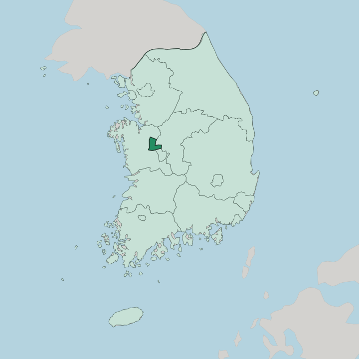
Towns & cities in Sejong-si
Pick a town or city — each links to where to stay.
Sejong-si has few beds for its size, and most of them sit near the administrative core. Business travel drives the demand. The cluster of hotels around the Government Complex Sejong and the Sejong Bus Terminal suits anyone here for the ministries or passing through by coach.
Many visitors instead base themselves in neighbouring Daejeon, the far larger metropolis just south, and make the short trip in by road. Stay in the administrative core if the government complex or the lake park is your reason for coming; choose Daejeon when you want a full city around you.
About Sejong-si
What is Sejong-si known for?
Sejong-si is South Korea's de facto administrative capital. The government built it on purpose. Dozens of national ministries and agencies moved out of Seoul to this planned city in the centre of the country, easing the crush on the capital and pulling investment inland.
Its landmark is the Government Complex Sejong, a chain of low buildings joined by a rooftop garden that runs for several kilometres above the offices. The Miho River threads through the greenbelt around them.
Where is Sejong-si?
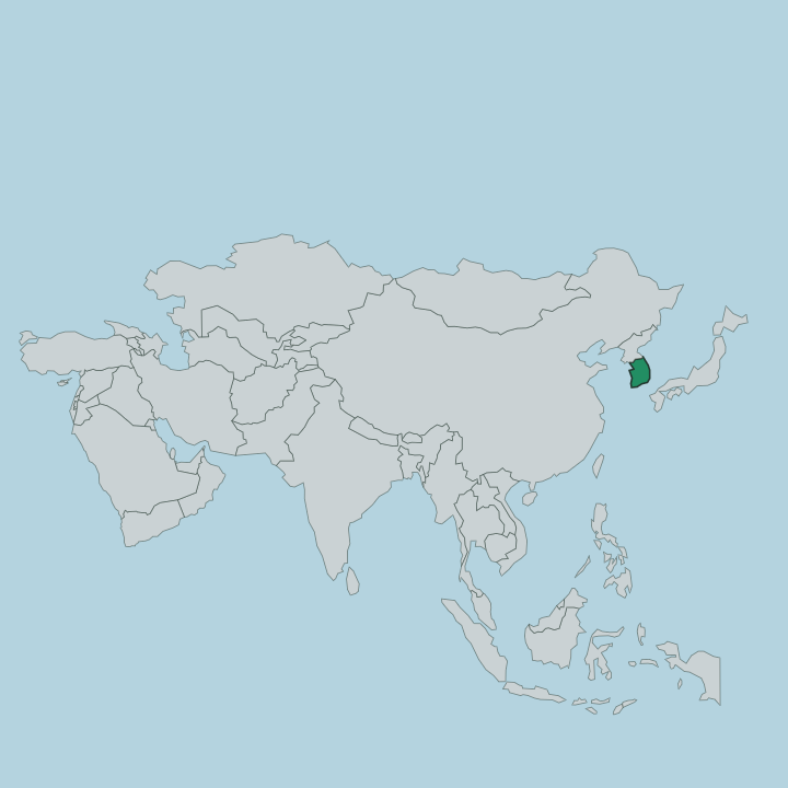
Sejong-si sits near the middle of South Korea, about 121 kilometres south of Seoul in the west-central Hoseo region. Sejong-si covers little ground. The city was carved mostly from South Chungcheong Province, with a slice of North Chungcheong added, and it now forms a self-governing island between them.
South Chungcheong wraps around its western side, North Chungcheong lies to the east, and the metropolis of Daejeon presses up against Sejong-si's southern edge with its far larger population close at hand. The land here is gentle rather than dramatic. Low hills, river valleys and old rice plains fill it, and the planners kept much of that ground as greenbelt.
Rivers shape Sejong-si. The Miho River runs across the city, a tributary that joins the larger Geum River nearby, and its floodplain shapes much of the open space between the built-up districts. More than half of Sejong-si's area was set aside for forest, parks and wetland.
That deliberate emptiness is the point. A ring of green holds the administrative districts apart from one another, so the whole place reads as a scatter of neighbourhoods in a valley rather than one dense block.
What is Sejong-si like?
Sejong-si carries the name of King Sejong the Great, the fourth Joseon king who gave Korea its written alphabet. The choice was pointed. Sejong finalised Hangul in the 1440s so that ordinary people, not only the scholar class, could read and write, and a city meant to serve the whole nation took his name for exactly that spirit.
The place feels engineered rather than grown, because it was. This is a purpose-built city, and its culture is the culture of a working capital. Public servants and their families make up much of the population, and daily life orbits the ministries, the research institutes and the schools that came with them.
The showpieces are civic ones. Sejong Lake Park draws walkers and cyclists to an artificial lake, the National Library stands out for its slanting glass form, and the rooftop garden atop the government complex doubles as a public promenade. There is little of the old-town heritage that fills longer-settled Korean cities.
What Sejong-si offers instead is a designed landscape, still filling in, where the architecture and the greenbelt were drawn together from the start.
What is the history of Sejong-si?
Sejong-si is young. It began as a plan to move the capital's functions out of an overcrowded Seoul, and ground was broken on the empty Chungcheong farmland in 2007. In 2012 the special self-governing city was formally created, stitched together from all of the old Yeongi County plus townships taken from Gongju and Cheongwon.
Ministries then relocated in waves through the following years. What had been rice fields became a working seat of national government within a single decade.
What is the climate of Sejong-si?
Sejong-si has the humid continental climate of inland central Korea, with sharply divided seasons. Winters bite. January is cold and dry, often falling below freezing, with clear skies drawn down from the Asian interior.
Summers swing the other way: hot, humid and wet, as the East Asian monsoon dumps most of the year's rain across July and August onto the Miho River valley. Spring and autumn are the short, mild windows between those two extremes.
How do you get to Sejong-si?
Sejong-si has no high-speed rail station of its own. You arrive through its neighbours. Most travellers take a KTX train from Seoul to Osong Station just to the north, then finish the trip on a bus rapid transit line into the administrative districts, a ride of well under an hour from the capital.
Cheongju International Airport, a short drive east, handles the nearest flights, and express coaches run direct from Seoul and other cities to the Sejong Bus Terminal. Once inside, the dedicated BRT network links the scattered neighbourhoods.
Good for
Updated July 2026