South Korea
Gangwon, South Korea — Towns & Travel Guide


Gangwon fills the mountainous north-east of South Korea, where the Taebaek range walls off the East Sea coast.
About Gangwon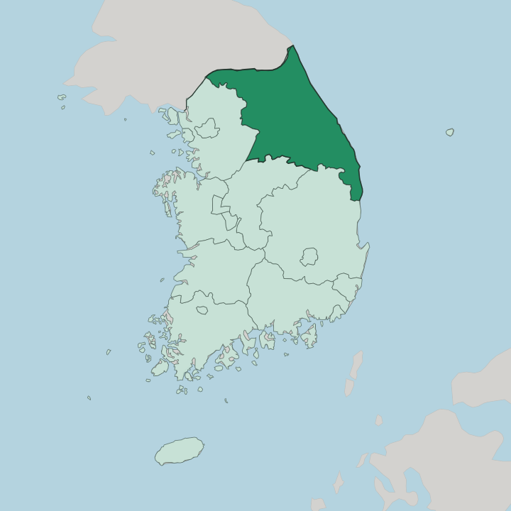
Towns & cities in Gangwon
Pick a town or city — each links to where to stay.
The mountains decide. Choose your base by which side of the Taebaek range you want, coast or interior. Sokcho sits at the foot of Seoraksan National Park and makes the obvious base for the peaks and the shore at once.
Gangneung strings along the East Sea with wide beaches, a seafood market and a coffee-house culture of its own. Chuncheon, the capital, holds the western lakes. Pick Sokcho for the mountains, Gangneung for the shore, or Chuncheon if you want the lake country and the quickest run out of the province.
About Gangwon
Mountains and snow define Gangwon.
What is Gangwon known for?
The Taebaek range runs the length of the province, and the peaks around Pyeongchang carried the 2018 Winter Olympics. East of that ridge the land drops fast to the East Sea, where Gangneung and Sokcho open onto long beaches and the seafood ports of the Yeongdong coast. Chuncheon is the provincial capital, set among lakes in the western hills, while Seoraksan National Park draws hikers to the granite spires above Sokcho.
Where is Gangwon?
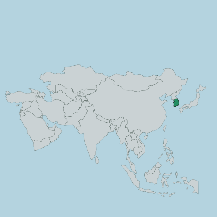
Gangwon occupies the north-eastern quarter of South Korea, a wedge of high country between Seoul and the sea. The Taebaek Mountains are its spine. This range runs north to south down the length of the province, dividing it into two halves that feel like separate worlds, and it climbs to peaks such as Seoraksan above the coast.
West of the ridge lies Yeongseo, an inland country of forested hills, river valleys and the lakes around Chuncheon. East of it lies Yeongdong, a narrow strip where the mountains fall almost straight into the East Sea. The coast there is steep and rocky.
Gangneung, Sokcho and the other ports cling to that shore. The East Sea forms the whole eastern edge of the province. To the west sits Gyeonggi and the pull of Seoul, and to the south the Gyeongsang and Chungcheong provinces.
The northern boundary is different in kind. There the Military Demarcation Line cuts across the province, and beyond it the other half of old Gangwon lies inside North Korea. That line, not a river or a ridge, marks the top of the province.
What is Gangwon like?
Gangwon trades on its mountains and its coast in almost equal measure. Winter is its calling card. The snow that falls heavily on the Taebaek highlands built the ski resorts around Pyeongchang, and those slopes hosted the 2018 Winter Olympics that put the province on the wider map.
The rest of the year the pull shifts east to the water. Gangneung has turned its stretch of the East Sea into a coffee-house shoreline, roasting and pouring along Anmok Beach, and its seafood markets draw people down from the capital for the day. Seoraksan National Park is the great outdoor set piece, a mass of granite ridges and Buddhist temples above Sokcho that fills with hikers in the autumn colour.
Korean is the language here, as across South Korea. Gangneung keeps older traditions alive too, most of all its Danoje festival, a rite that gathers each early summer. Mountain temples, coastal shrines and highland farms give the province a character that leans rural and outdoor rather than urban.
What is the history of Gangwon?
Gangwon was drawn as one of the eight provinces of Joseon-era Korea in 1395, and it took its name from its two leading towns of the day, Gangneung and Wonju. It held together for centuries. The division of 1945 cut it in two along the 38th parallel, and after the Korean War armistice of 1953 the boundary was redrawn along the Military Demarcation Line, leaving the northern half inside North Korea.
Chuncheon has served as the capital of the southern province ever since.
What is the climate of Gangwon?
The Taebaek Mountains split Gangwon's weather in two. Inland Yeongseo has the harder winters, cold and dry in the sheltered valleys around Chuncheon. The coastal Yeongdong side stays milder, warmed through the cold months by the East Sea.
Snow is the province's signature: the highlands around Pyeongchang are among the snowiest ground in the country, which is why the ski resorts and the winter games settled here. Summers are warm and wet, with the heaviest rain falling on the mountains.
How do you get to Gangwon?
Most visitors reach Gangwon overland from Seoul. The high-speed line built for the 2018 Winter Olympics runs east from the capital through Pyeongchang to Gangneung on the coast, turning what was a long mountain drive into a short ride. Chuncheon has its own rail link back toward Seoul across the western hills.
Once inside the province the Taebaek Mountains shape every route, and the roads bend and climb to cross from the Yeongseo interior to the Yeongdong coast.
Good for
Updated July 2026