South Korea
Gyeongsangnam-do, South Korea — Towns & Travel Guide


Gyeongsangnam-do is South Korea's south-eastern coastal province, wrapped around the Nakdong River and the port of Busan.
About Gyeongsangnam-do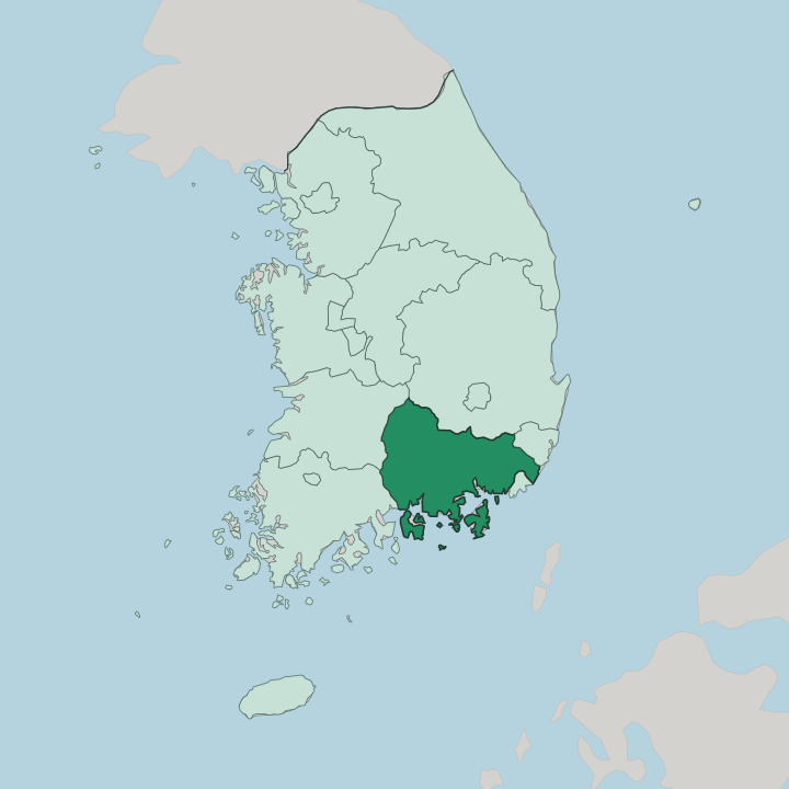
Towns & cities in Gyeongsangnam-do
Pick a town or city — each links to where to stay.
Start in Changwon. It makes the easiest first base, with the province's densest cluster of full-service hotels and the KTX line running straight through it. For the coast, most travellers pick Tongyeong or the island city of Geoje, where the marine park and the ferry piers put the whole southern archipelago within reach of a morning boat.
Jinju sits inland on the Nam River, good for the old fortress quarter and its lantern festival. Namhae leans rural. Pick Changwon for transport, the southern ports for the islands, and Jinju or Namhae when you want the quieter, older side of the province.
About Gyeongsangnam-do
Two things define the province: shipyards and mountains.
What is Gyeongsangnam-do known for?
Changwon is the capital and the country's planned industrial heartland, and the coast from Geoje round to the Nakdong delta carries much of Korea's shipbuilding and petrochemical output. The other half is scenery. Jirisan, the tallest mainland peak, rises in the west, and the ragged southern shore around Tongyeong scatters into hundreds of islands.
Haeinsa, up in the Gaya mountains, holds the Tripitaka Koreana. Industry and coastline share the same map.
Where is Gyeongsangnam-do?
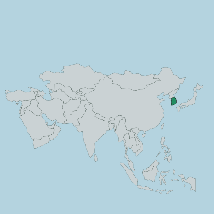
Gyeongsangnam-do fills the south-eastern corner of the Korean Peninsula, the seaward end of the historic Yeongnam region. The Nakdong River, the longest in South Korea, drains almost the whole province. It runs down through the middle and spills into a broad delta plain around Gimhae before reaching the sea.
That plain is some of the best farmland in the country, built from silt the river has carried down for millennia. Mountains hem the rest in. The tail of the Taebaek range comes down the eastern side, and along the western border the Sobaek mountains climb to Jirisan, whose Cheonwangbong summit is the highest point on the Korean mainland at 1,915 metres.
Rivers thread between the ridges. The Namgang, the Nakdong's main tributary here, curls past Jinju before joining the parent stream. South of all that lies the coast.
It opens onto the Korea Strait, the shoreline breaking into a maze of bays, peninsulas and islands that runs west toward Jeolla. Geoje, off Tongyeong, is the second-largest island in the country. Busan sits just over the eastern boundary, the great port the whole province orbits.
North Gyeongsang lies over the ridges to the north. Mountains behind, sea in front, and the Nakdong running between them.
What is Gyeongsangnam-do like?
Two currents run through the province, one very old and one very new. The old one is Buddhist and martial. Haeinsa, high in the Gaya mountains at Hapcheon, has guarded the Tripitaka Koreana since 1398, the entire Buddhist canon cut into more than eighty thousand woodblocks, and the temple's storage halls earned it UNESCO recognition in 1995.
The martial thread belongs to Jinju. Its fortress on the Nam River was the scene of two brutal sieges during the Japanese invasions of the 1590s, and every autumn the river fills with floating lanterns that recall those who died there. The new current is industrial.
Changwon was laid out from scratch in the 1970s as a planned manufacturing city, and the yards of Geoje build some of the largest ships afloat. The food leans to the sea. Tongyeong, nicknamed the Naples of the East, is known across the country for its seafood, and the oyster and mussel farms strung across the southern bays feed markets far beyond the province.
Temples, shipyards and fishing ports keep unlikely company here.
What is the history of Gyeongsangnam-do?
This was the land of Gaya. A loose confederacy of small states grew up in the Nakdong valley from around the first century, trading iron and outlasting its neighbours for centuries before the kingdom of Silla absorbed it in the 500s. The wider Gyeongsang region was split in two in 1407, along the Nakdong itself, and the western half became the province.
Jinju held the provincial seat for centuries, then it passed to Busan in 1925. Changwon carries it now.
What is the climate of Gyeongsangnam-do?
The province runs warm by Korean standards. Its southern edge sits low on the Korea Strait while the high ground to the north blocks the cold, dry winds that pour off the continent in winter, so the coast stays milder than the interior. Summers are hot and wet, soaked by the East Asian monsoon and the odd late-summer typhoon spinning up from the strait.
Spring and autumn are the dry, settled seasons that draw walkers onto Jirisan. The mountains take the province's snow; the coast rarely sees it.
How do you get to Gyeongsangnam-do?
Almost everyone flies into Gimhae International Airport, which sits on the Nakdong just west of Busan and serves the whole province. From there the KTX high-speed line threads inland to Changwon and on to Jinju, so the two main cities are a short train ride from the runway. The southern ports take longer.
Buses run down to Tongyeong, and ferries fan out from the piers to Geoje and the smaller islands beyond. Busan's terminals back all of it up.
Good for
Updated July 2026