South Korea
Chungcheongbuk-do, South Korea — Towns & Travel Guide


Chungcheongbuk-do is South Korea's only landlocked province, a mountain-and-lake interior wrapped around Cheongju in the middle of the peninsula.
About Chungcheongbuk-do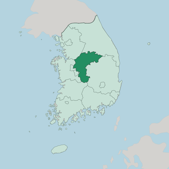
Towns & cities in Chungcheongbuk-do
Pick a town or city — each links to where to stay.
Cheongju holds the widest choice of beds and the airport, so most trips start there. The rest is smaller towns. Chungju and Jecheon sit near the great reservoir in the north, the usual bases for cruising Chungju Lake, while Danyang is the picture town wedged between the water and the peaks of Woraksan.
Boeun to the south is where you sleep before walking up to Beopjusa under Songnisan. Pick Cheongju for a city base; pick the lake and mountain towns when the scenery is the reason you came.
About Chungcheongbuk-do
No coast.
What is Chungcheongbuk-do known for?
Every other region of South Korea touches the sea, but Chungcheongbuk-do sits inland in the middle of the peninsula, ringed by the Sobaek Mountains to the east and lower ridges to the north. Water still defines it, only in the form of lakes and the Namhan River rather than surf. Cheongju anchors the province, a city remembered as the place where the Jikji was printed with movable metal type in 1377.
Mountains fill much of the rest, from Songnisan in the south to the lake country around Danyang in the north-east.
Where is Chungcheongbuk-do?
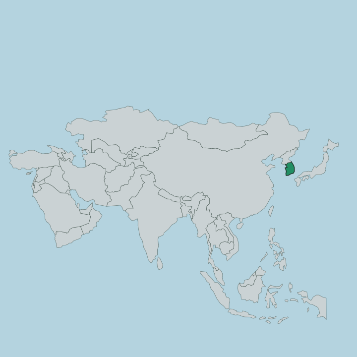
Chungcheongbuk-do fills the south-centre of the Korean Peninsula, well back from either coast. It is the only landlocked province in the country. Every side is another province rather than water: Gyeonggi and Gangwon lie to the north, Gyeongsangbuk-do to the east, Jeollabuk-do to the south, and Chungcheongnam-do with Sejong and Daejeon to the west.
The land itself is mostly upland. The Sobaek Mountains run along the eastern rim, a long spine of the Baekdudaegan range that carries the high parks of Sobaeksan and Woraksan, while lower ridges close off the north. Between the ranges sits a basin drained toward the Namhan River, the southern branch of the Han that gathers the province's water and carries it north-west toward Seoul.
Cheongju spreads across the flatter western basin, the one broad plain in a province otherwise folded into hills. In the north-east the river was dammed to make Chungju Lake, the largest lake in the country, its arms reaching between the mountains at Danyang and Jecheon. Songnisan rises in the south near Boeun, its granite crown of Cheonhwangbong topping out just above 1,058 metres.
Mountains, a river, and a great reservoir do most of the shaping here, and the sea plays no part at all.
What is Chungcheongbuk-do like?
The province wears its heritage in wood and metal rather than in glass towers. Its proudest claim is small enough to hold in one hand. In 1377 monks at Heungdeoksa on the edge of Cheongju finished the Jikji, a Buddhist anthology printed with movable metal type some seventy-eight years before Gutenberg set his Bible, and the city has built its identity around that page ever since.
The surviving volume now sits in Paris, but Cheongju keeps the memory alive with an Early Printing Museum and a printing festival. Mountain Buddhism runs just as deep. At the foot of Songnisan stands Beopjusa, one of the oldest temple complexes in central Korea, whose five-storey Palsangjeon is the only wooden pagoda of its kind left in the country.
Ginseng and tobacco built the rural fortune of these valleys, and the roadside markets still sell the pale roots by the basket. Local speech carries the slow, softened Chungcheong dialect, gentler than the clipped talk of Seoul. Food leans plain and hearty.
Diners in Chungju linger over dakgalbi and freshwater fish pulled from the lake, and the calm, unhurried manner of the interior is a point of pride for the people who live here.
What is the history of Chungcheongbuk-do?
The old Chungcheong province split in two in 1896, and the northern inland half became Chungcheongbuk-do. Its roots go deeper. Cheongju was already a printing centre under Goryeo, and the Jikji came off its presses in 1377, while Beopjusa near Boeun had been founded centuries earlier still, in 553, under the kingdom of Silla.
The Namhan River made these hills a corridor rather than a backwater, floating timber and grain down toward the capital. Two provinces from one, but a deep past behind both.
What is the climate of Chungcheongbuk-do?
Being landlocked gives the province a sharper, more continental swing than the coast. Winters bite. With no sea to soften the air, cold settles into the basins around Cheongju and frost holds long in the shaded valleys of the Sobaek Mountains, where Danyang sees some of the heaviest snow in the region.
Summers turn hot and wet under the East Asian monsoon, and the rains of the changma swell Chungju Lake before autumn clears to crisp, bright days over the ridges. Four distinct seasons, felt to the full.
How do you get to Chungcheongbuk-do?
Most travellers reach the province by rail through Osong, the KTX junction where the high-speed lines to Busan and to Gwangju branch apart just west of Cheongju. Trains from Seoul run the distance in well under an hour. Cheongju International Airport handles domestic flights and a scattering of regional international routes, a quieter alternative to the crowded gateways around the capital.
Expressways lace the basin and climb into the hills toward Chungju and Danyang. No coast means no ferries here.
Good for
Updated July 2026