South Korea
Gyeongsangbuk-do, South Korea — Towns & Travel Guide


Gyeongsangbuk-do is South Korea's largest province, holding the Silla heartland of Gyeongju and the Confucian towns of the Nakdong valley.
Find your area →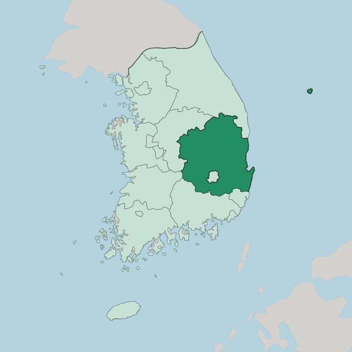
Towns & cities in Gyeongsangbuk-do
Pick a town or city — each links to where to stay.
Gyeongju is the base most first trips revolve around, walkable between the burial mounds of Tumuli Park and the pond at Anapji. Andong suits a slower visit. It sits close to the Hahoe Folk Village and the seowon academies strung along the upper Nakdong River, a quieter world of tiled roofs and scholarship.
Pohang is the coastal option, a working steel port with the Homigot cape reaching into the Sea of Japan. Daegu, the metropolitan city ringed by the province, is the transport hub where arrivals begin. Choose by what you came for. Gyeongju for the ruins, Andong for the old Confucian towns, or the coast when you want the sea.
About Gyeongsangbuk-do
This is Silla country.
What is Gyeongsangbuk-do known for?
For nearly a thousand years Gyeongju ruled the peninsula from here, and its royal tombs, temples and the Bulguksa complex still draw travellers to the south-east of the province. Andong carries the other half of the story, a town of Confucian academies and the thatched houses of Hahoe Folk Village. Pohang runs on steel, Gumi on electronics, and the mountains between them hide old monasteries.
The past is closer here than almost anywhere else in South Korea.
Where is Gyeongsangbuk-do?
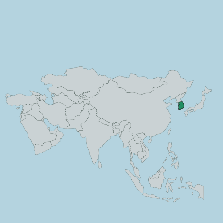
Gyeongsangbuk-do fills the north-east corner of the Yeongnam region, in eastern South Korea. It is the largest of the country's provinces. Mountains wall it on two sides.
The Taebaek range runs down the east along the Sea of Japan, and the Sobaek range curves across the west and north, so the province sits in a basin between them. The Nakdong River drains that basin. South Korea's longest river rises in the Taebaek highlands and winds south through the middle of the province, gathering the streams that water Andong, Sangju and the old farming valleys before it passes on toward Busan.
The east faces open water. The Sea of Japan, which Koreans call the East Sea, laps a coast of small ports from Uljin down to Pohang. Far offshore lies Ulleungdo, a steep volcanic island administered from here, and the rocky islets of Dokdo further out again.
Daegu, a metropolitan city governed separately, sits like an island of its own in the province's south. South Gyeongsang borders it below, and Gangwon lies to the north. The result is a large, mountain-framed province that turns its face to the eastern sea.
What is Gyeongsangbuk-do like?
Two old worlds shape the province. One is Buddhist and royal, the Silla inheritance of Gyeongju, where kings were buried under grass mounds and the sculptors of Bulguksa carved a grotto Buddha that still faces the dawn over the eastern sea. The other is Confucian and scholarly, centred on Andong.
There the yangban gentry built seowon academies to teach the Confucian classics, and Dosan Seowon, founded by the philosopher Yi Hwang, became one of the most revered schools in the whole of Korea. That world is still lived, not just displayed. At Hahoe Folk Village families keep the tiled and thatched houses their ancestors raised, and each autumn the masked Byeolsingut dancers act out their old satires of the aristocracy.
Food carries the same conservatism. Andong is known for its salted mackerel, carried inland in the days before refrigeration, and for a fiery distilled soju that shares the town's name. The mountains hold the quieter side of the culture, the mountain temples and hermitages of the Silla monks.
It is a province that has guarded its past on purpose.
What is the history of Gyeongsangbuk-do?
It began with Silla. The kingdom was founded here in 57 BC, and from its capital at Gyeongju it grew until, in 668, it had unified most of the Korean peninsula under one crown. That golden age left the tombs, pagodas and temples that still define the south-east.
Silla fell in 935. Under the later Joseon dynasty the region's weight then shifted from the ruined court to the Confucian gentry of Andong and the Nakdong valley. The province's name splices two old towns, Gyeongju and Sangju.
In 2016 its government moved from Daegu, which had long housed it, north to a new complex at Andong.
What is the climate of Gyeongsangbuk-do?
The province has a marked continental streak. Ringed by the Taebaek and Sobaek mountains, its inland basin around Daegu turns into one of the hottest corners of South Korea in high summer, when the monsoon rains arrive humid and heavy. Winters bite in return, colder and drier than the coast, with frost settling in the sheltered valleys.
The narrow eastern shore along the Sea of Japan runs milder, its swings softened by the water. Spring and autumn are the clear, dry seasons that suit the temples and mounds.
How do you get to Gyeongsangbuk-do?
Most travellers reach the province by rail. The Gyeongbu high-speed line runs KTX trains from Seoul down to Dongdaegu in Daegu, the metropolitan hub that most trips through the region pass, in about an hour and a half. From there branches carry on to Singyeongju station for Gyeongju and out to the steel port of Pohang on the coast.
Andong sits on its own line to the north-west. Local trains and buses then thread the Nakdong valley and climb into the mountain temples.
Common questions
What is the best area to stay in Gyeongsangbuk-do?
Daegu: arriving and connecting onward.
Good for
Updated July 2026