Kazakhstan
Atyrau Region, Kazakhstan — Towns & Travel Guide


Atyrau Region wraps the northeast Caspian, where the Ural River splits Europe from Asia and feeds Kazakhstan's oil.
About Atyrau Region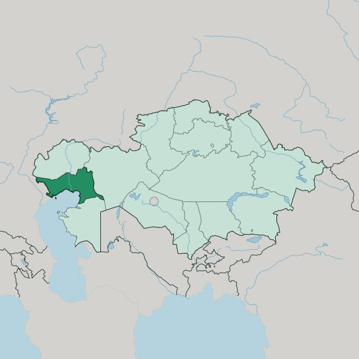
Towns & cities in Atyrau Region
Pick a town or city — each links to where to stay.
Beds cluster in one place. Atyrau, the capital at the mouth of the Ural River, holds nearly all the region's hotels, and its riverside strip near the pedestrian bridge is where business and leisure visitors settle. Out east, Kulsary is a working oil town that serves the Tengiz field, so its rooms fill with engineers rather than tourists.
If you want the region's continents-in-a-day novelty, base yourself in Atyrau and cross the Ural on foot from Asia to Europe; if you have business at Tengiz, Kulsary puts you closest to the fields.
About Atyrau Region
Oil made this region.
What is Atyrau Region known for?
The Tengiz and Kashagan fields, drilled into the Caspian Depression, give Atyrau Region the highest output of any part of Kazakhstan, and the capital at Atyrau runs on that industry. Before the derricks came sturgeon, and the Ural River delta was famous for the black caviar that once supplied a large share of the world's supply. The Ural also carries a stranger distinction: its channel is the traditional line between Europe and Asia, so the region sits on two continents at once.
Where is Atyrau Region?
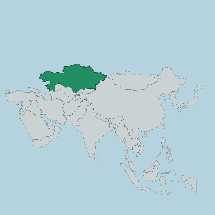
Atyrau Region occupies the far west of Kazakhstan, curving around the northeast corner of the Caspian Sea. It is the country's second-smallest region, yet it stretches across flat, treeless steppe in every direction. The land sits low.
Much of it belongs to the Caspian Depression, one of the lowest tracts on the continent, where the ground dips below the level of the world's seas and the horizon runs unbroken toward the salt flats and reed beds of the shore. The Ural River is the spine of all this. It enters from the north and threads south through the steppe to a broad delta at the Caspian, splitting the capital of Atyrau into two banks.
Kazakh geographers call the river Zhayyq, and by the old convention its channel marks the boundary between Europe and Asia, which places the western half of the region on one continent and the eastern half on the other. Russia's Astrakhan Oblast lies over the western border, and the neighbouring Kazakh regions of West Kazakhstan, Aktobe and Mangystau ring the rest. Out east, past Kulsary, the Emba River drains its own share of the plain toward the sea.
What is Atyrau Region like?
This is Kazakh country, deeply so. Kazakhs make up more than nine in ten people across the region, and the language and steppe customs of the herders who worked this plain still set its tone. Yet the capital grew up as a trading post, and its older character was mixed.
When the settlement was still called Guryev, Russians, Tatars and Kazakhs traded fish and salt side by side at the Ural mouth, and that merchant past left a plainer, more workaday feel than the tourist towns further south. Food tells the story best. For generations the region lived off the Ural River's sturgeon and the black caviar rendered from their roe, an export that carried the name of Guryev far beyond the Caspian.
Oil rewrote everything after that. The fields at Tengiz drew workers from across Kazakhstan and beyond, and the capital's newer districts, glass towers and expatriate compounds, sit oddly against the low steppe horizon. The result is a working region rather than a polished one.
People come here for the river, the delta birdlife and the oddity of standing with one foot in Europe and the other in Asia, not for old quarters or grand squares.
What is the history of Atyrau Region?
The story starts with a fort. In 1645 a Russian trader named Gury Nazarov built a wooden stockade at the mouth of the Yaik River, the waterway now called the Ural, to work the caravan trade toward Khiva and Bukhara; after Yaik Cossacks sacked it, his family rebuilt it in stone. That settlement, Guryev, lived on sturgeon and caviar for three centuries.
The region around it was organised in 1938, and in 1991 both town and region dropped the Guryev name for Atyrau, drawn from the local word for the river delta.
What is the climate of Atyrau Region?
Expect extremes. The region has a semi-arid, sharply continental climate, and its position on the open Caspian steppe leaves it exposed all year. Summers over the delta run hot and dry, often reaching the mid-thirties Celsius with almost no rain, while winters turn bitter, with hard frost and thin snow driven across the flats by wind off the plain.
Rainfall is scant throughout, which is why the steppe stays pale and treeless away from the Ural River's green corridor.
How do you get to Atyrau Region?
Flying is the sensible way in. Atyrau's airport handles the oil traffic and links the capital to the rest of Kazakhstan and beyond, so most visitors land there rather than crossing the steppe by road. Rail lines and the old oil pipeline both run northwest from Atyrau toward Samara in Russia, tracing the river's path.
Once you arrive, the capital sits at the delta itself, and roads fan east across the plain toward Kulsary and the Tengiz field.
Updated July 2026