Kazakhstan
Qostanay Oblysy, Kazakhstan — Towns & Travel Guide


Qostanay Oblysy is Kazakhstan's grain-and-iron steppe in the far north, edged by Russia and drained by the Tobol.
About Qostanay Oblysy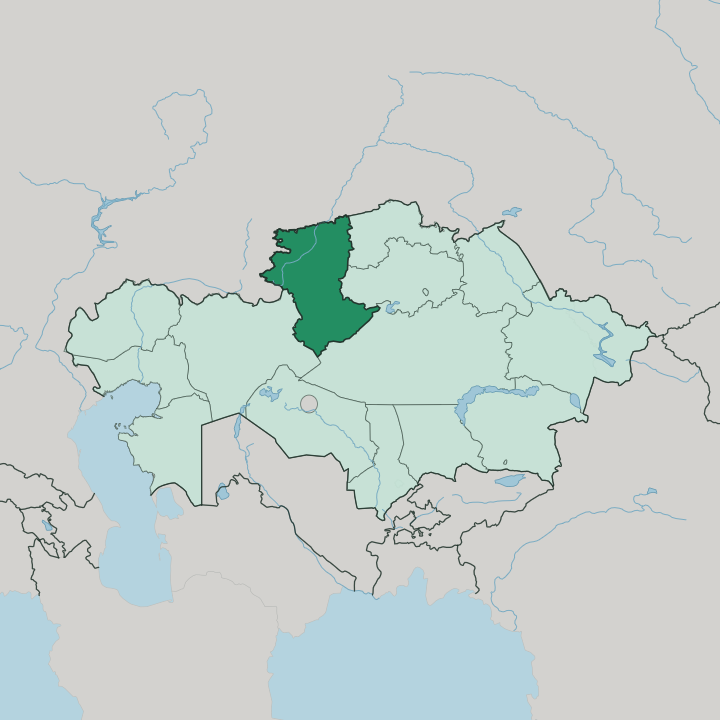
Towns & cities in Qostanay Oblysy
Pick a town or city — each links to where to stay.
Kostanay is the obvious base, the regional capital set on the Tobol River, holding the airport and most of the beds. Beyond it, choices thin out fast. Rudny, an hour to the south-west, is the town the Sokolovsko-Sarbay iron mines built, useful only if the ore country is your reason to come.
Deep in the southern steppe, the Naurzum Nature Reserve draws birdwatchers to its pine islands and lakes, but rooms out there are scarce. Stay in Kostanay for comfort; venture south only when the reserve or the mines pull you.
About Qostanay Oblysy
Two things define this region: wheat and iron.
What is Qostanay Oblysy known for?
Its northern plains were ploughed for grain during the Soviet Virgin Lands campaign, and they still run to the horizon in cereal. Underground lies the other fortune, the magnetite ore that built the mining town of Rudny around the Sokolovsko-Sarbay pits. Between the fields and the mines sits the Naurzum Nature Reserve, where islands of relict pine and shallow lakes draw migratory birds across the open steppe.
Where is Qostanay Oblysy?
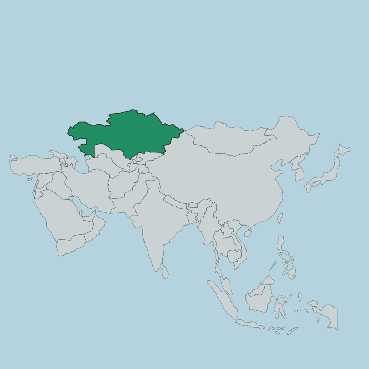
Qostanay Oblysy fills the far north of Kazakhstan, pressed against the Russian border along its whole upper edge. It is vast. The region spreads across the flat southern rim of the West Siberian Plain in the north and climbs onto the dry Turgai tableland toward the south.
That gradient sets the whole character of the land. Green West Siberian forest-steppe in the north gives way, band by band, to moderate steppe, then dry steppe, and finally semi-desert near the southern boundary. Two rivers thread this expanse.
The Tobol runs for some 800 kilometres inside the region, gathering the Ayat and the Uy before it crosses north into Russia and the Irtysh basin. The Torgai flows the other way, draining roughly 390 kilometres south into the closed Turgai depression where no water reaches the sea. Kostanay stands in the north on the Tobol, Rudny and Lisakovsk sit along the same river, and Arkalyk lies far to the south on the Turgai plateau.
Almost the entire region is open plain. Only the pine islands of Naurzum break the grass, a few stands of relict forest marooned in the steppe.
What is Qostanay Oblysy like?
Life here has always turned on the land, first as pasture for Kazakh herders, then as one of the great grain baskets the Soviet Union carved out of the steppe. The Virgin Lands campaign of the mid-twentieth century pulled settlers by the trainload to break the northern sod for wheat. That resettlement left the region unusually mixed.
Kazakhs and Russians together make up most of the population, but Ukrainians and Germans arrived in numbers with the ploughs and the mines, and their villages still dot the plains. The result is a working farming and mining country rather than a monument-lined one. Its proudest native son is Ybyrai Altynsarin, the nineteenth-century Kazakh educator born on the Turgai steppe who wrote the first Kazakh grammar and opened the region's first schools.
A museum in Kostanay keeps his memory. Culture here reads in grain elevators, mine headframes, and the low horizon far more than in old stone. The steppe itself is the presiding fact of daily life, and the seasons on it govern everything from the harvest to the birds passing over Naurzum.
What is the history of Qostanay Oblysy?
The regional capital began in 1879 as Nikolaevsk, a Russian settlers' town on the Tobol that grew into a busy grain-trading centre on the northern steppe. Qostanay Oblysy itself was drawn up as an administrative region in 1936. Then came iron.
Survey flights over the Sarbay ground in 1949 traced a magnetic anomaly, and geologists digging beneath the grass uncovered some of the largest magnetite deposits in the whole Soviet Union. To work them the state raised a wholly new town, Rudny, chartered in 1957 beside the Sokolovsko-Sarbay pits. Grain and iron have anchored the region ever since.
What is the climate of Qostanay Oblysy?
The climate here is sharply continental and dry. Winters are long and bitterly cold, bringing little snow but fierce winds that scour the open plain and pack the thin drifts into blizzards that can bury a road for days. Summers swing the other way entirely, turning hot and parched as the grass burns off across the southern dry steppe while the northern grain fields ripen.
Rain is thin and falls mostly in the warmer months. No coast or mountain shelters it.
How do you get to Qostanay Oblysy?
Most travellers reach the region through Kostanay, where the international airport handles flights to Astana and other Kazakh cities as well as a few destinations abroad. Rail matters just as much here. The regional capital sits on the northern lines that link it to Astana and across the border into Russia, and freight trains haul Rudny's ore along the same network.
On the ground, roads run out from Kostanay south across the steppe toward Arkalyk and the Turgai country. Distances between towns are long and empty.
Good for
Updated July 2026