Kazakhstan
East Kazakhstan, Kazakhstan — Towns & Travel Guide


East Kazakhstan is Kazakhstan's mountain corner, where the Irtysh drains the Altai and Öskemen sits at the confluence.
About East Kazakhstan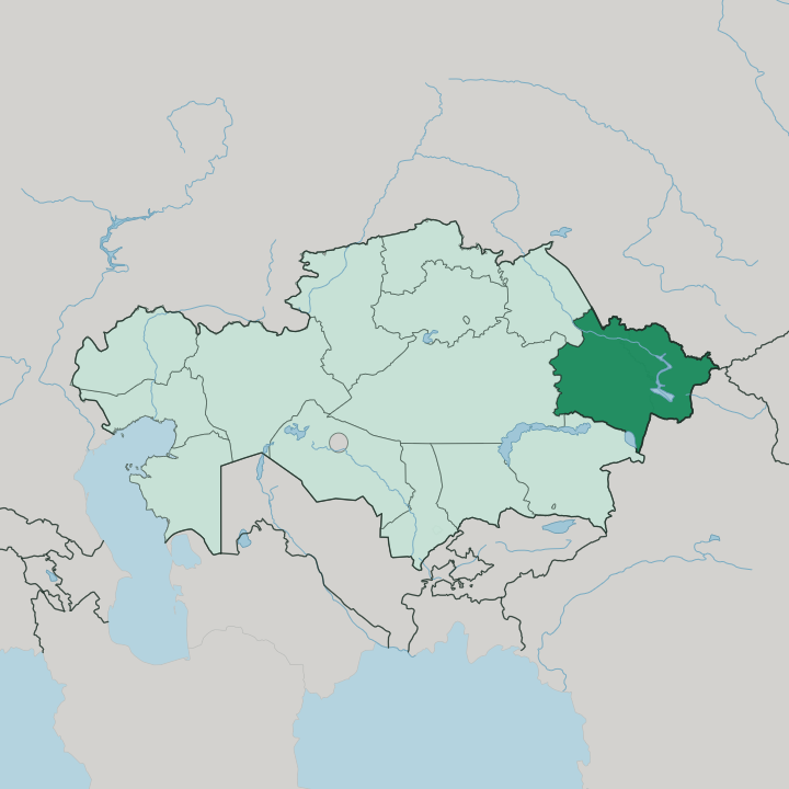
Towns & cities in East Kazakhstan
Pick a town or city — each links to where to stay.
Öskemen is the practical base, the one city with hotels, an airport and the roads out to everything else. Ridder sits higher in the Rūdnyy Altai, a mining town that doubles as a trailhead for the ranges above it. The lakes are different country.
At Lake Marqaköl the beds are family guesthouses in the village of Urunkhayka, reachable only in summer, and around Lake Zaysan you sleep in fishing settlements like Akshuat rather than anything resembling a resort. Base yourself in Öskemen for a first trip; head for the guesthouses only when you are set on the mountains and the water.
About East Kazakhstan
What is East Kazakhstan known for?
This is the country's high, forested east, pinned against the Altai Mountains along the borders with Russia and China. Öskemen anchors it. The smelters of that city and the mines at Ridder gave the region its wealth in lead, zinc and titanium, and the ore still moves down the valley. Away from the metallurgy, the draw is water and rock: the Irtysh cutting west out of the hills, the alpine bowl of Lake Marqaköl, and the fishing lake of Zaysan.
Few foreign travellers reach it. That emptiness is much of the appeal.
Where is East Kazakhstan?
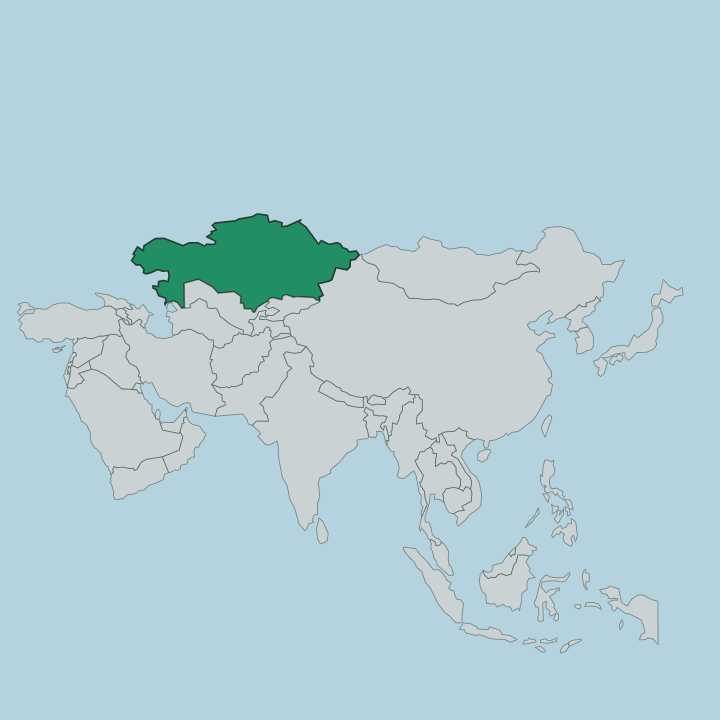
East Kazakhstan fills the easternmost corner of the country, wedged against the Altai Mountains where Kazakhstan, Russia and China come together. It is a land of ridges, not flat steppe. The Altai rise along its eastern edge, and Belukha, the highest summit of the whole range, stands just over the line on the Russian border.
Rivers define the rest. The Irtysh gathers meltwater off the mountains and swings west through the region, joined at Öskemen by the Ülbi, before it runs on toward Siberia. In the south that same river feeds Lake Zaysan, a shallow sheet of water reckoned among the oldest lakes on the continent, topped up by the Black Irtysh coming down from China.
Higher up, ringed by forested slopes, sits Lake Marqaköl. Altai Krai and the Altai Republic lie across the northern and north-eastern border in Russia, and Xinjiang presses in from the south and south-east in China. The far eastern tip comes within reach of Mongolia.
It never quite touches it, held apart by a thin wedge of the China-Russia frontier. This is the wettest and greenest part of Kazakhstan, the one that looks least like anyone's picture of the country.
What is East Kazakhstan like?
Life here is shaped by ore and mountains in almost equal measure. Öskemen grew up around metal. It began as a Russian fort on the Irtysh in 1720 and became a smelting city under the Soviets, drawing workers from across the union to process the lead, zinc and titanium dug out of the surrounding ranges. That industrial past gives the towns a mixed, Russian-inflected character, and Russian is heard on the street as readily as Kazakh, the state language.
Beyond the smelter towns the older rhythm survives. Herders still take their stock up to summer pastures in the Altai valleys, and the fishing villages on the shore of Lake Zaysan keep a working culture all their own. The Rūdnyy Altai, the ore-bearing Altai, has drawn prospectors since the eighteenth century, when the silver and polymetallic lodes around Ridder were first opened and set the pattern for everything the region became.
Mining and the mountains pull in opposite directions. One built the cities; the other keeps drawing people back out of them, toward the forests, the passes and the lakes.
What is the history of East Kazakhstan?
Russian expansion set the region's course. The fort of Ust-Kamennaya, the seed of modern Öskemen, went up at the meeting of the Irtysh and the Ülbi in 1720 to hold the imperial frontier and open trade with the interior. Silver and polymetallic ore turned that frontier into a mining district, with the Ridder lodes discovered in 1786 and worked hard ever after.
The Soviets made metallurgy the region's spine, and the East Kazakhstan Region itself was drawn up as an administrative unit in 1932. What began as a border stockade ended as the smelting heart of the Altai.
What is the climate of East Kazakhstan?
Expect extremes. The region sits deep in the interior, far from any sea, so its weather swings hard between a fierce continental winter and a short warm summer. In Öskemen the frost bites well below zero for months, the Irtysh ices at its edges, and snow lies long in the streets.
Summer flips the other way, dry and warm enough for the valleys to green up. Up in the Altai the cold is sharper still and the snow deeper, and the mountain roads to Lake Marqaköl close entirely outside the summer months. Pack for the season.
Here they barely resemble each other.
How do you get to East Kazakhstan?
Most arrivals fly into Öskemen. Its airport, a short run northwest of the city, links the region to Astana, Almaty and a handful of other cities, and it is the only quick way in for a visitor short on time. Trains and long-distance roads also reach Öskemen across the steppe from the rest of Kazakhstan, but the distances are long.
From the city, everything else is a road trip: south to Lake Zaysan, up into the Rūdnyy Altai to Ridder, or over the summer-only tracks to Lake Marqaköl. There is no shortcut to the mountains. You drive to them.
Good for
Updated July 2026