Kazakhstan
Mangistauskaya Oblast’, Kazakhstan — Towns & Travel Guide


Mangistauskaya Oblast' is Kazakhstan's desert corner on the Caspian Sea, where the Ustyurt Plateau breaks into canyons above the port of Aktau.
About Mangistauskaya Oblast’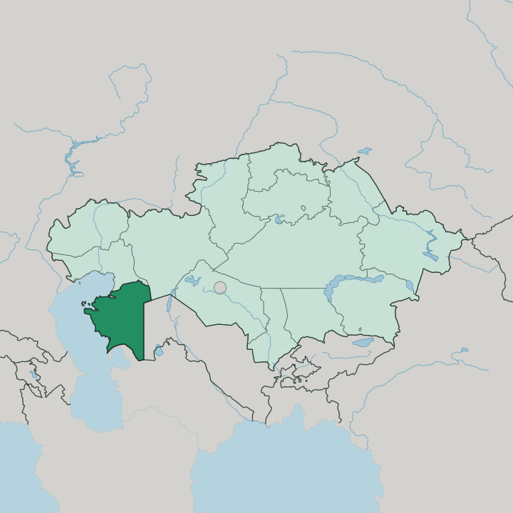
Towns & cities in Mangistauskaya Oblast’
Pick a town or city — each links to where to stay.
Aktau is where you sleep. The seaport capital holds almost every hotel in the region, strung along the Caspian shore, and its beaches face the water on the western edge of the Mangyshlak Peninsula. Inland there are few beds of any kind.
Zhanaozen, the oil town two hours south, is the last real supply stop before the Ustyurt Plateau, where nights are spent in tents on 4x4 desert expeditions rather than in hotels. Base yourself in Aktau, stock up, and drive out to the canyons by day.
About Mangistauskaya Oblast’
What is Mangistauskaya Oblast’ known for?
This is Kazakhstan's window onto the Caspian Sea. The region draws travellers for one thing above all: raw, near-empty desert. The Ustyurt Plateau splits into chalk canyons at Bozzhyra, and the Torysh valley is scattered with hundreds of spherical stone balls weathered out of the rock.
Aktau, the seaport capital, is the base for every trip inland. Oil and gas pay the region's bills, but pilgrims come too, to the underground mosques carved into the cliffs by Sufi teachers.
Where is Mangistauskaya Oblast’?
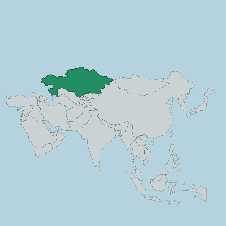
Mangistauskaya Oblast' fills the far south-west of Kazakhstan, a desert wedge pushed out against the Caspian Sea. The Mangyshlak Peninsula forms its western half, jutting into the water with the port of Aktau on its shore. Turkmenistan borders it to the south and Uzbekistan to the east, while the rest of the region runs inland across bare, waterless tableland far from either sea.
Almost none of it is green. The land is desert and semi-desert, without a single permanent river or a natural spring of fresh water. Two great plateaus rule the interior.
The Ustyurt Plateau spreads across the south and east, and the Mangyshlak tableland rises to the north, both of them former seabed of the vanished Tethys Ocean. Where the Ustyurt breaks off at Bozzhyra, chalk cliffs drop in sheer white walls above a flat desert floor, and the Torysh valley nearby is littered with round stone concretions the size of cars. The most striking feature sits east of Aktau.
The Karagiye depression plunges to about 132 metres below the level of the sea, the lowest point anywhere in Kazakhstan. Nothing here is gentle. Wind, heat, and dissolving limestone carved every canyon and hollow you see.
What is Mangistauskaya Oblast’ like?
Two lives share this desert. One is old and nomadic, the world of the Kazakh herders who crossed the Mangyshlak Peninsula on the caravan routes between the Aral and the Caspian Sea, leaving necropolises and shrines behind them. The other is Soviet and industrial, poured in concrete around oil derricks and the sea.
Faith holds the older world together. Mangistauskaya Oblast' is called the land of 362 saints, and its most sacred places are underground mosques cut into the cliffs, among them Shopan-ata and the shrine of Beket-Ata, still walked to by pilgrims from across Kazakhstan. The teacher Beket-Ata, born in the eighteenth century, built several of these rock mosques himself.
Kazakh is the everyday language, Russian the second tongue of the oil towns. The newer culture belongs to Aktau. The city went up from nothing in the Soviet decades as an atomic town named Shevchenko, and to this day its streets carry no names, an address here is three numbers, the district, the building, and the flat.
Desert and derrick sit side by side.
What is the history of Mangistauskaya Oblast’?
People crossed this desert for millennia, but almost no one stayed. With no springs and no rivers, the Mangyshlak Peninsula was a hard leg of the caravan roads rather than a place to settle, worked by nomadic Kazakh and Turkmen herders. Then came the drills.
Everything changed when Soviet geologists struck oil and uranium in the sands. Aktau rose from empty ground in the late 1950s as a closed atomic city. The province itself was carved out in 1973 as Mangyshlak Oblast, then renamed Mangystau in 1990 as independence neared.
What is the climate of Mangistauskaya Oblast’?
Mangistauskaya Oblast' has a sharp desert climate. Rain is scarce, roughly a hand's depth across a whole year, and there is no river or spring to soften it. Summers on the Ustyurt Plateau bake.
Winters turn cold and windswept over the same bare ground, and the wind rarely lets up. The Caspian Sea moderates the coast at Aktau a little, but drive an hour inland and the desert extremes take over. Dust is the constant.
How do you get to Mangistauskaya Oblast’?
Most travellers fly into Aktau. Its airport links the Caspian port to Almaty and Astana across Kazakhstan, and to Istanbul and Dubai beyond, which makes it the only quick way into this far desert corner. The other approach is by sea: cargo ferries cross the Caspian Sea from Baku on the Azerbaijani side, landing near Aktau on irregular schedules.
Rail reaches the region but slowly, the line running many hours from the rest of the country. From Aktau, the canyons of the Ustyurt Plateau are a long drive by 4x4.
Updated July 2026