Romania
Argeş, Romania — Towns & Travel Guide


Argeș is a county of southern Romania, running from the Făgăraș peaks down to the plain, drained by the Argeș river.
About Argeş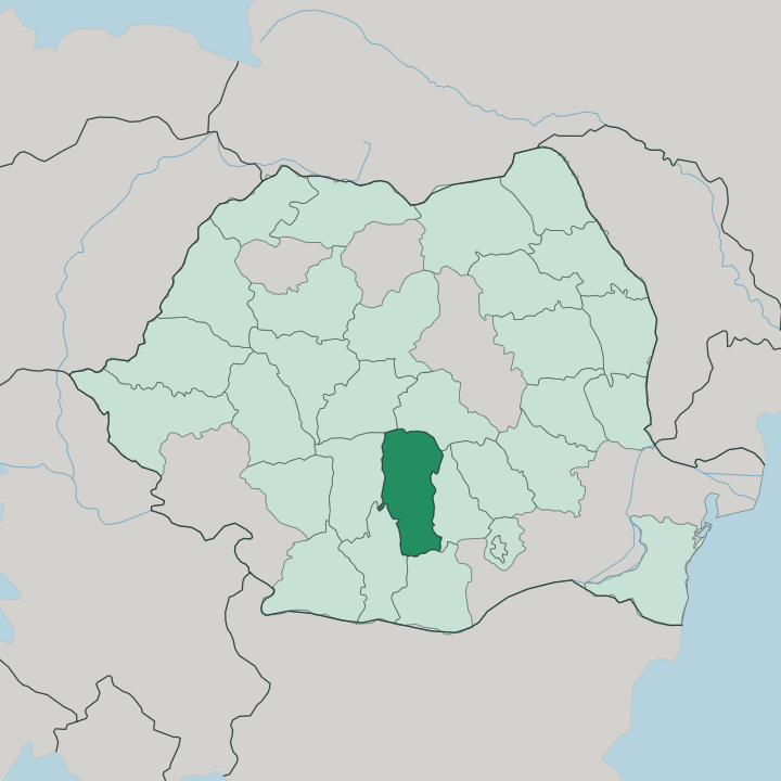
Towns & cities in Argeş
Pick a town or city — each links to where to stay.
Pitești is the practical base. The county capital sits on the Argeș river where the plain meets the hills, and it holds the beds, the shops and the transport links that the rest of the county lacks. Curtea de Argeș suits a slower stay closer to the mountains, within easy reach of the monastery, Poenari Castle and the start of the Transfăgărășan.
Câmpulung is quieter still, the oldest of the towns. Choose Pitești for road and rail; choose Curtea de Argeș when the peaks are the point.
About Argeş
What is Argeş known for?
Argeș stacks Romania's highest ground against its capital's medieval past. Two things pull travellers up the valley. The first is Curtea de Argeș, the old seat of Wallachia, whose monastery holds the tombs of Romanian kings.
The second is the road behind it: the Transfăgărășan climbs from near the town over the Făgăraș crest in a run of hairpins that tops out above the tree line. Between them stands Poenari Castle, the cliff fort tied to Vlad the Impaler, watching the Argeș river cut its gorge below.
Where is Argeş?
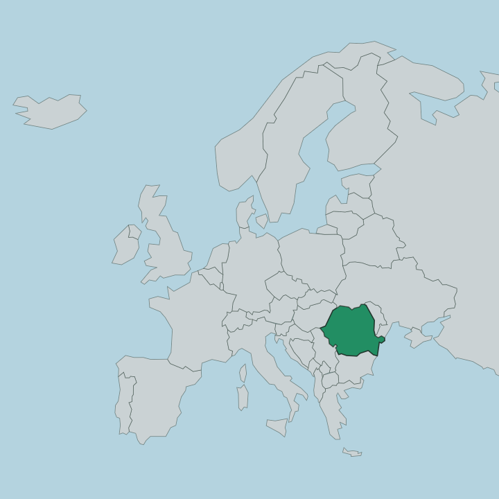
Argeș lies in southern Romania, in the historical region of Muntenia that older maps call Greater Wallachia. The county falls in three steps from north to south. The far north is high mountain: the Făgăraș range of the Southern Carpathians, where Moldoveanu Peak rises to 2,544 metres as the highest summit in the country.
Below the peaks come the sub-Carpathian hills, rounded ground near 800 metres cut by steep valleys. South of that the land flattens into the edge of the Wallachian plain. One river ties the whole county together.
The Argeș rises on the southern face of the Făgăraș, gathers the mountain streams as it drops, and runs south past Pitești before leaving the county for the Danube far downstream at Oltenița. Curtea de Argeș stands on its left bank where the water leaves the hills. Upstream the river is dammed to form Lake Vidraru, and the Transfăgărășan road climbs the slopes above it.
Bucharest lies a short way to the south-east, across the plain the Argeș crosses on its way to the Danube. The mountains close the county to the north; the plain opens it to the capital.
What is Argeş like?
Argeș carries the memory of an old capital. Curtea de Argeș was a princely seat of Wallachia in the fourteenth century, and its Metropolitan church made it the religious centre of the young state. The monastery that Neagoe Basarab raised there in 1512 became the burial place of Romanian kings, its pale stone facade one of the set pieces of the country.
A folk legend clings to it: the master builder Manole, walled his own wife into the fabric so the church would stand. That story is told across Romania, but it belongs first to this valley. Daily life divides between mountain and plant.
In the highland villages above Curtea de Argeș the old crafts and shepherding still shape the calendar. Down at Pitești and Mioveni the county turns industrial, built around the Dacia car works that has drawn people to the town since the late 1960s. Romanian is the common language throughout.
The result is a county that keeps its saints' feasts and its assembly lines side by side.
What is the history of Argeş?
This valley was where Wallachia began. Câmpulung served as the first seat of the young principality, and by the fourteenth century the court had moved to Curtea de Argeș, which held the capital until it passed to Târgoviște around 1418. From those two towns the rulers south of the Carpathians drew the surrounding lands together.
The county in its present shape is a later thing, drawn up in 1968 when Romania redrew its map, and named for the river that runs through all of it.
What is the climate of Argeş?
Argeș has a temperate continental climate that shifts with the land. Height decides the weather here. Summers are warm and largely clear down on the plain around Pitești, while the Făgăraș peaks stay cold and hold snow into the warmer months.
Winters are freezing across the county, hardest and longest in the mountains where the Transfăgărășan road shuts under snow for much of the cold season. Rain falls through the year, heavier against the high northern slopes than out on the southern flats.
How do you get to Argeş?
Most visitors come from Bucharest. The capital sits a short drive south-east across the plain, and its airports are the usual arrival point for the whole county. From there the motorway and the main railway run west to Pitești, which is the road and rail hub for Argeș.
North of Pitești the valley narrows and the roads climb toward Curtea de Argeș and the mountains beyond. The Transfăgărășan carries on over the Făgăraș crest, but only in the warm months, once the snow has cleared the pass.
Good for
Updated July 2026