Thailand
Changwat Mukdahan, Thailand — Towns & Travel Guide


Mukdahan is a province of northeastern Thailand, strung along the Mekong across from Savannakhet in Laos.
About Changwat Mukdahan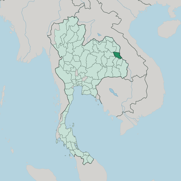


Towns & cities in Changwat Mukdahan
Pick a town or city — each links to where to stay.
Almost everyone bases in Mukdahan town, the provincial capital and its only real base on the Mekong. Rooms cluster a short walk from the riverfront promenade and the Indochina Market, where the day starts early. Travellers bound for Laos often pick a bed near the Second Thai-Lao Friendship Bridge, a few kilometres upriver from the centre, to shorten the morning border run.
If you want the Phu Phan uplands and the rock stacks of Phu Pha Thoep, the town still makes the practical base, since the park keeps no lodging of its own. Stay by the water.
About Changwat Mukdahan
What is Changwat Mukdahan known for?
Mukdahan faces the Laotian town of Savannakhet across the Mekong, and the two are linked by the Second Thai-Lao Friendship Bridge. Traders cross here. Its riverside Indochina Market piles up Thai, Lao, and Vietnamese goods along the water, and the province lies on the East-West Economic Corridor running from the Vietnamese coast toward Myanmar.
Inland, the sandstone pillars and mushroom-capped rocks of Phu Pha Thoep pull walkers into the Phu Phan hills. Eight ethnic groups, the Phu Thai among them, keep their own festivals and weaving.
Where is Changwat Mukdahan?
Mukdahan lies in the Isan region, the broad sandstone plateau that fills northeastern Thailand. Its eastern edge is water. The Mekong runs the whole length of that border, and beyond the far bank sits the Laotian province of Savannakhet, so the provincial capital looks straight across an international river into another country.
Upstream and down, the same water keeps Thailand apart from Laos. To the north lies Nakhon Phanom, the older province that Mukdahan was split from; Sakon Nakhon, Kalasin, Roi Et, Yasothon, and Amnat Charoen wrap around it to the west and south. The land tilts upward as it leaves the river.
Away from the Mekong lowlands, the western districts climb into the forested ridges of the Phu Phan mountains, whose thick timber still shades the sandstone country of Phu Pha Thoep. Small rivers such as the Bang Muk drain off those hills toward the Mekong, and it was at that stream's mouth that the first riverside settlement took hold. Mukdahan town keeps the flat ground by the water.
Rice fields spread behind it, and the wooded uplands close off the western horizon.
What is Changwat Mukdahan like?
Mukdahan counts eight peoples within its borders. The Phu Thai are the best known, hill-valley farmers who kept their own dialect, dress, and silk after migrating from the Lao side of the river generations ago. Alongside them live the So, the Kaleung, the Yo, the Saek, and others, each with its own speech.
Their calendar turns on the Bun Phawet merit-making, a days-long recital of the Buddha's penultimate life that the Phu Thai and Kaleung stage with cloth parades and, in some villages, elephants. Weaving matters here. Mudmee silk and cotton come off backstrap and frame looms in the villages behind the Mekong.
The border shapes daily life as much as any temple does. Lao is heard as readily as Thai in the lanes off the water, and the Indochina Market carries Vietnamese noodles beside Isan grilled meat and sticky rice. The province wears its name from the pearl: Mukda, a word for moonstone, a jewel the old chronicles tie to its founding, and the provincial seal still shows that gem resting on a tray inside the two-maiden shrine of Prasat Song Nang Sathit.
Faith runs Buddhist, with riverside temples strung through the capital. Merit, market, and river order the week.
What is the history of Changwat Mukdahan?
A river town came first. Chao Chanthakinnaree founded the settlement in 1770 at the mouth of the Bang Muk stream, and the place drew its name from the pearls said to have been found there. For most of the century that followed, the district answered to distant Monthon administrations, then to Nakhon Phanom, under whose province it was folded in 1907.
Full provincial status came late, on the twenty-seventh of September 1982, when Mukdahan became the seventy-third of Thailand's provinces.
What is the climate of Changwat Mukdahan?
Mukdahan runs on a tropical savanna climate, split into three plain seasons. The cool months around the turn of the year stay dry and mild, easy for walking the riverfront. Heat builds through the spring until April bakes the plateau, the hardest stretch to be outdoors.
Then the southwest monsoon breaks. From about late April into October the rains sweep in off the Mekong basin, greening the Phu Phan forests and cooling the days while the nights stay warm. Rain writes the farming year.
How do you get to Changwat Mukdahan?
Mukdahan keeps no airport. Most travellers fly into Nakhon Phanom, Sakon Nakhon, or Roi Et and finish the trip by road, or ride an overnight coach straight from Bangkok's northeastern terminal. Once here, the town is small enough to cross on foot or by songthaew.
Crossing into Laos is the other reason people come, and the Second Thai-Lao Friendship Bridge carries the road and the buses over the Mekong to Savannakhet. That span is a link in the East-West Economic Corridor, the trucking route that threads across the region.
Updated July 2026