Thailand
Changwat Nong Bua Lamphu, Thailand — Towns & Travel Guide


Nong Bua Lamphu is a small Isan province in upper northeastern Thailand, below the Phu Phan mountains on the western Khorat Plateau.
About Changwat Nong Bua Lamphu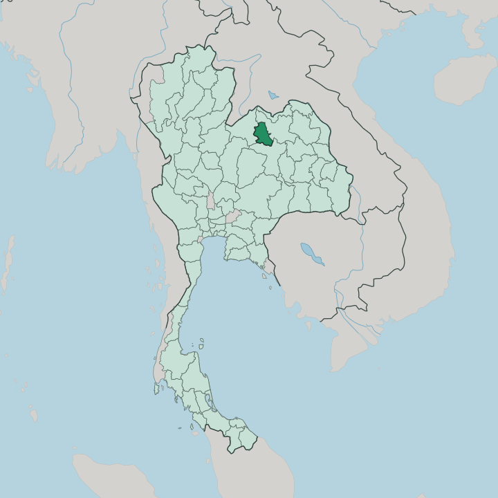


Towns & cities in Changwat Nong Bua Lamphu
Pick a town or city — each links to where to stay.
The provincial capital, Nong Bua Lam Phu, holds most of the beds, ranged along the lake and the King Naresuan shrine in the town centre. Stay there for services and quick connections. South toward Khon Kaen, the Ubolratana reservoir and Phu Kao-Phu Phan Kham National Park trade hotels for lakeside campsites and homestays, best when you want water and quiet over comfort.
The western foothills around Suwannakhuha and Erawan Cave keep only a scatter of guesthouses. Many travellers simply base in nearby Udon Thani and drive in for the day.
About Changwat Nong Bua Lamphu
What is Changwat Nong Bua Lamphu known for?
Nong Bua Lamphu answers the question of what draws visitors to one of Thailand's youngest provinces. The pull is the land itself. The Phu Phan mountains rise along its western and southern edges, and hillside cave shrines like Erawan Cave open above the plain, a large Buddha image reached by a long stairway.
Forest-monk temples sit in the wooded foothills. Down south the Ubolratana reservoir spreads below Phu Kao-Phu Phan Kham National Park, a place for camping and sunrise over the water.
Where is Changwat Nong Bua Lamphu?
Nong Bua Lamphu sits in Isan, the upper northeastern region of Thailand, landlocked on the western rim of the Khorat Plateau. It stays small. Udon Thani wraps around it to the north and east, Khon Kaen lies to the south, and Loei closes the western side against the ridges.
The Phu Phan mountains run along the province, dividing the plateau into basins and throwing up the limestone hills that hide its caves. Between the ranges the land flattens into farmed plain, rice and cane worked by villages that trace their families back to the Lao who crossed the Mekong. Water gives the province its name and its shape.
A lake sits at the heart of the capital, fed by the plateau and never drying through the hot months. To the south the land drops toward the Ubolratana reservoir, the great impoundment behind the dam on the Nam Phong river that Nong Bua Lamphu shares with Khon Kaen. Phu Kao-Phu Phan Kham National Park guards its northern shore, nine hills above open water.
The plateau lifts the whole province a little above the flatter plains east of it, enough to cool the nights.
What is Changwat Nong Bua Lamphu like?
The province is Lao country. Its people came across the Mekong from the left bank generations ago, and they still speak Isan, the Lao dialect of the northeast, alongside central Thai. That heritage shows in the sticky rice and grilled dishes of the table, in the mor lam singing of festival nights, and in the weaving that village workshops still turn out by hand.
Buddhism runs deep in these hills. The wooded slopes gave shelter to the forest-monk tradition, and Wat Tham Klong Phen, at the foot of the Phu Phan mountains, honours one of its noted meditation masters. History here is celebrated as much as faith.
Each dry season the town fills for the Naresuan fair, named for the prince who mustered troops here, with parades, market stalls and a Red Cross fête beside his shrine. Songkran brings water and processions to the streets in April. The older layer is Lao and animist, still felt at the archaeological sites and cave shrines scattered through the fields and hills of the province.
Craft, cave and chant hold the whole place together through the year.
What is the history of Changwat Nong Bua Lamphu?
Long before it was a province, this was a Lao town on the Khorat Plateau, held under the Lan Xang kingdom and granted to its crown prince. Its old name was a mouthful. In 1574 the young Naresuan mustered soldiers here on a march toward Vientiane, and a shrine in the capital still marks the campaign that later folk memory tied to Siam's liberation from Burma.
Centuries on, the modern province is young. Thailand carved it from Udon Thani in 1993, its seventy-sixth and one of its newest.
What is the climate of Changwat Nong Bua Lamphu?
Nong Bua Lamphu keeps three seasons, like most of Isan. The cool, dry months from November to February are the kind ones, when nights on the plateau can turn genuinely cold. Then the heat builds.
March into May bakes the plain, and April can climb into the low forties before the pre-monsoon storms break. The southwest monsoon brings the rains from about June to October, greening the rice and filling the Ubolratana reservoir. Dawns are the reward.
How do you get to Changwat Nong Bua Lamphu?
The province has no airport. Most travellers fly into Udon Thani, the regional hub about an hour to the north-east, then pick up Route 210 southwest into Nong Bua Lam Phu. Buses grind up from Bangkok overnight, several hundred kilometres to the south-southwest, and cross-country services thread through from Loei, Khon Kaen and the Mekong towns.
The nearest railway runs to Udon Thani, not here. From the town, songthaews and hired cars reach the caves and the reservoir.
Good for
Updated July 2026