Thailand
Changwat Nonthaburi, Thailand — Towns & Travel Guide


Nonthaburi is the small province wrapped around Bangkok's northern edge, split by the Chao Phraya and known for durian orchards and Ko Kret.
About Changwat Nonthaburi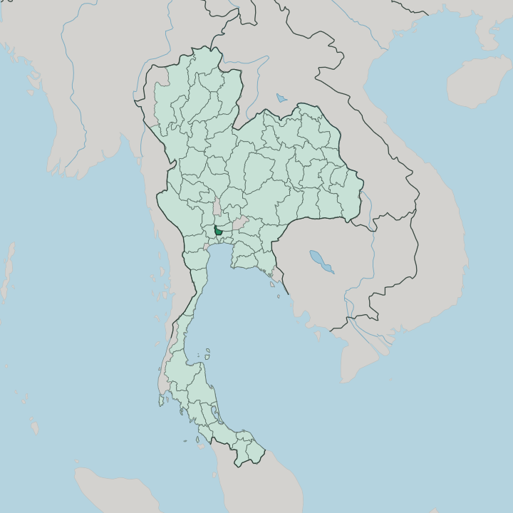


Towns & cities in Changwat Nonthaburi
Pick a town or city — each links to where to stay.
Most visitors sleep in Nonthaburi town, the provincial seat on the Chao Phraya where the express boat and the Purple Line both reach the capital. Pak Kret sits upstream, the mainland foot of the ferry to Ko Kret. Bang Yai spreads inland to the west, a newer world of malls and housing estates strung along the Purple Line and set well back from the water.
Bang Kruai presses straight against Bangkok. The river is the divide. Pick the riverfront town for temples and boats; pick the inland districts when you want malls, space and a quick line into the city.
About Changwat Nonthaburi
What is Changwat Nonthaburi known for?
Two things carry Nonthaburi's name. The first is durian, the orchards along the Chao Phraya have grown the fruit for four centuries, and connoisseurs pay steeply for a Nonthaburi-grown durian. The second is Ko Kret, an island in the river where a Mon community has thrown unglazed earthenware pots for generations.
Beyond both, the province is Bangkok's quieter northern extension, close enough that the MRT Purple Line runs straight into it. Temples line the water. The provincial seat sits on the Chao Phraya's west bank, a short express-boat ride upstream from the capital.
Where is Changwat Nonthaburi?
Nonthaburi wraps around the northern side of Bangkok, close enough that the two run together without a visible seam. It is one of the smallest provinces in the country, yet the Chao Phraya cuts clean through the middle of it, north to south. The river is the organising fact.
Its six districts, Mueang Nonthaburi, Pak Kret, Bang Kruai, Bang Yai, Bang Bua Thong and Sai Noi, sit spread across both banks. To the south and east the province meets Bangkok itself; Pathum Thani and Phra Nakhon Si Ayutthaya lie to the north, and Nakhon Pathom to the west. This is flat delta country, laced with canals the Thai call khlong, and orchards still crowd the riverbanks where the durian grows.
One of those canals made an island. In 1722, during the Ayutthaya era, diggers cut Khlong Lat Kret across the neck of a river bend to straighten the shipping channel, and the loop it bypassed became Ko Kret. The southern districts have filled in with the capital's sprawl, while durian groves and paddy hold on toward the province's northern and western rim.
In Nonthaburi water sets the terms of life, the Chao Phraya and its web of khlong flooding, draining and flooding again with each monsoon as they have for four centuries. The land floods, drains and floods again with the monsoon, and the province has lived by that rhythm for four centuries.
What is Changwat Nonthaburi like?
Nonthaburi keeps a foot in two worlds. Along the Chao Phraya it stays a province of temples, orchards and river markets, the older Thailand that Bangkok has mostly paved over. The durian is a point of local pride here, grown on the same banks for four centuries and guarded jealously by growers who can name every cultivar.
The great flood of 2011 drowned many of the old groves, and the growers have been coaxing them back tree by tree. Its worth is cultural as much as culinary. The provincial seal even carries an earthenware pot, a nod to the potters of Ko Kret.
That pot is no accident. Ko Kret's Mon community has shaped unglazed clay by hand since the Ayutthaya years, and on weekends the island fills with visitors buying pots, sweets and fried snacks along its lanes. Thai is the everyday language, spoken with the Mon inheritance still audible in the island's temples.
Away from the river, the province wears a different face, condominium towers, malls and the Purple Line, a commuter belt for the capital next door. Both faces are Nonthaburi. The old orchard province and the new suburb share the same flat, water-cut ground, and neither has fully given way to the other.
What is the history of Changwat Nonthaburi?
Nonthaburi's story begins as a river town of the Ayutthaya Kingdom. In 1665 King Narai raised a fort at the mouth of the Om Canal, guarding the shortened channel that had brought enemy boats too near the capital upstream. Rama III later pulled down that fort and reused its bricks to build Wat Chaloem Phra Kiat, the riverside temple he dedicated to his mother's family, in 1849.
Its heart kept moving. The town hall shifted again in 1928 to Bang Khwang on the Chao Phraya, and the province itself was drawn up in 1946.
What is the climate of Changwat Nonthaburi?
Nonthaburi runs hot and humid the year round, a tropical wet-and-dry climate rather than a four-season one. Three seasons order the year. The heat builds through March and April, when the still air over the delta turns punishing before the rains arrive.
From May into October the southwest monsoon soaks the province, swelling the Chao Phraya and testing the canals and flood banks that hold the water back. Cooler, drier months follow, from November to February. Water rules everything.
The same rains that feed the durian can, in a bad year, drown the old orchards outright.
How do you get to Changwat Nonthaburi?
Nonthaburi has no airport of its own; travellers land at Bangkok's Don Mueang or Suvarnabhumi and carry on into the province from there. The everyday way in is the MRT Purple Line, which runs from the Tao Poon interchange out across the province to its inland terminus at Khlong Bang Phai. Prettier still is the river.
The Chao Phraya Express Boat threads up the river from the capital and ties up at Nonthaburi Pier, the northern end of the line. Bridges and highways close the rest. The only way onto Ko Kret is a short cross-river ferry from Pak Kret.
Good for
Updated July 2026