Thailand
Changwat Pattani, Thailand — Towns & Travel Guide


Changwat Pattani is a small Malay-Muslim province on Thailand's Gulf coast, the old heart of the Patani Sultanate on the Malay Peninsula.
About Changwat Pattani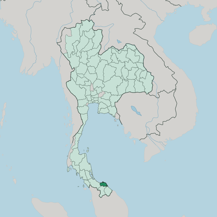


Towns & cities in Changwat Pattani
Pick a town or city — each links to where to stay.
Rooms in Pattani are scarce, with nearly all the province's hotels gathered in the town near the river mouth and the old quarter. Pattani town holds nearly all of the province's hotels, gathered near the Pattani River mouth and the old quarter, and it makes the obvious base for reaching Krue Se and the coast. Many travellers skip an overnight stay and come in from Hat Yai instead, the big regional city just west in Songkhla, where the nearest airport and the widest range of rooms sit together.
Along the Gulf, the fishing towns of Panare and Sai Buri keep a handful of simple guesthouses. Choose the town for convenience. Choose the coast for quiet.
About Changwat Pattani
Its name carries centuries of history.
What is Changwat Pattani known for?
Long before it was a Thai province, this was the seat of the Patani Sultanate, a Malay Muslim trading state on the Gulf of Thailand whose merchants dealt across the whole peninsula. The unfinished brick walls of the Krue Se Mosque still stand near the provincial capital. Pattani town sits where the Pattani River empties into the sea.
Malay is the everyday language here, Islam the everyday faith, and the fishing boats of the coast set the rhythm of the province.
Where is Changwat Pattani?
Changwat Pattani lies near the southern tip of Thailand, on the eastern side of the Malay Peninsula. The Gulf of Thailand washes its northern shore. Inland it is small and mostly flat, a low coastal plain of rice fields, rubber smallholdings, and coconut groves that has always drawn its living from the sea and the river.
The Pattani River runs down from the hills of neighbouring Yala and reaches the Gulf at Pattani town, where it has built a wide bay and the long sandy hook of the Laem Tachi cape. A second river, the Sai Buri, drains the eastern districts to the coast. To the west lies Songkhla, to the south Yala, and to the southeast Narathiwat, the last two carrying the land up into the Sankalakhiri range that walls off the border with Malaysia.
Pattani keeps almost none of that high ground. Most of the province stays within a short drive of the water, and the coast, not the mountains, is where its towns and fishing harbours gather. Six of its districts front the Gulf.
The result is a compact, sea-facing province, one of the smallest in the country.
What is Changwat Pattani like?
This is a Malay corner of a Thai kingdom, and it feels it. Most people here are Muslim, and the everyday tongue is Pattani Malay, a dialect written for centuries in the looping Jawi script rather than in Thai letters. Mosques and village pondok religious schools anchor daily life, and the calls to prayer, the songket weaving, and the fermented budu fish sauce all mark the province as part of the wider Malay world that runs on south into Malaysia.
Thai is the language of school and office. Both are heard on the street. Yet Pattani has long called itself a land of three faiths.
Beside the Muslim majority sit a Thai Buddhist minority and an old Chinese trading community, and their shrines stand within a few kilometres of one another. The unfinished Krue Se Mosque and the nearby Leng Chu Kiang shrine, dedicated to the Chinese heroine Lim Ko Niao, are bound together by a bitter local legend of a brother, a sister, and a curse. Out in Khok Pho, the Buddhist temple of Wat Chang Hai draws pilgrims to the memory of the revered monk Luang Pu Thuat.
Faith is worn openly here. It is the thread that runs through the whole province.
What is the history of Changwat Pattani?
Pattani's story begins as a kingdom, not a province. From the early sixteenth century the Patani Sultanate ruled here as one of the great Malay Muslim ports of the peninsula, trading in pepper and gold and long paying tribute to the Siamese court to the north. Siam took direct control in 1786 and later split the old sultanate into smaller pieces.
The Thai province of Pattani was drawn from those fragments in the early twentieth century. The kingdom was gone. Its language, faith, and grievances stayed on.
What is the climate of Changwat Pattani?
Pattani is hot the year round. It sits in the tropics, close to the sea, so the air stays warm and heavy from one month to the next. The wet season is long and the dry season short.
Rain is heaviest late in the year, when the northeast monsoon drives in off the Gulf of Thailand and can flood the low ground along the Pattani River. The driest, hottest stretch comes before the rains return, around April. Storms off the Gulf shape the calendar more than temperature ever does.
How do you get to Changwat Pattani?
Getting here takes effort. Pattani lies at the far southern end of Thailand, most of the length of the country from Bangkok, and it has no airport of its own for ordinary travellers. Most people fly instead to Hat Yai, the southern hub in neighbouring Songkhla, and drive the last stretch east by road or shared van.
The airport at Narathiwat, down the coast, is the other way in by air. Long-distance trains and buses grind south from Bangkok along the peninsula, but the nearest stations sit outside the town. From Hat Yai it is a short road hop.
Good for
Updated July 2026