Thailand
Changwat Samut Sakhon, Thailand — Towns & Travel Guide


Samut Sakhon is a coastal Thai province just southwest of Bangkok, where the Tha Chin River empties into the Gulf of Thailand past its salt pans.
About Changwat Samut Sakhon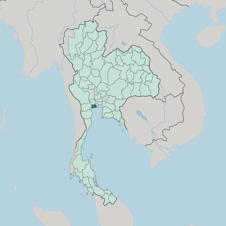


Towns & cities in Changwat Samut Sakhon
Pick a town or city — each links to where to stay.
Few travellers sleep here. The province works as a day trip from Bangkok, an hour northeast up Rama II Road, and its hotels cater to seafood traders and factory business rather than tourists. Mahachai still makes the closest base.
Rooms cluster near the Tha Chin river mouth by the fishing docks and the Mahachai market, while inland Ban Phaeo keeps only a scattering of guesthouses among its orchards and canals. Most just base in the capital.
About Changwat Samut Sakhon
Seafood built this province.
What is Changwat Samut Sakhon known for?
Its capital, Mahachai, runs one of Thailand's largest fishing ports and its biggest traditional seafood market, spread along the Tha Chin River where the trawlers unload their catch each morning. Salt is the other trade. Flat pans line the coast toward the Gulf of Thailand, and the province ranks as Thailand's leading producer of sea salt raked from that shallow water.
Factories crowd the rest, part of the Bangkok Metropolitan Region on the capital's doorstep.
Where is Changwat Samut Sakhon?
In Samut Sakhon, water dictates everything. The province spreads across the flat delta of the lower Tha Chin, a distributary that carries part of the Chao Phraya's flow south to the Gulf of Thailand. That river splits the land in two as it nears the sea, dropping the silt that built these plains and still feeds the mudflats offshore.
The land barely rises above the tide. Salt pans, shrimp ponds, and low mangrove take up the coastal fringe, cut through by a dense grid of tidal canals that farmers open and close with the sea. Forest covers barely a twentieth of the ground.
Neighbours ring it on three sides. Bangkok presses against the eastern edge, Nakhon Pathom lies inland to the north, and Samut Songkhram runs down the coast to the west, with Ratchaburi touching the far inland corner. Only the Gulf of Thailand fills the fourth, southern side.
All of it falls inside the Bangkok Metropolitan Region. Three districts divide the province: the port at Mahachai on the river mouth, Krathum Baen with its factories inland to the north, and rural Ban Phaeo among the orchards and coconut groves. Nowhere in the province stands far from the Gulf.
What is Changwat Samut Sakhon like?
Work here smells of the sea. Mahachai's markets move mountains of shrimp, crab, and fish before dawn, and much of the country's canned and frozen seafood is cleaned, sorted, and packed in the factories behind the docks. Out on the salt flats, workers still rake and heap sea salt by hand as the ponds dry under the sun.
Seafood defines the local table, from grilled river prawns to the fish sauce and shrimp paste cured along the coast. The days run long and start before light. The people reflect that trade.
Samut Sakhon holds one of Thailand's largest communities of migrant workers from Myanmar, so many that the streets around the port are nicknamed Little Myanmar, with Burmese shop signs, teashops, and temples among the Thai ones. Lao and Cambodian families work the docks too. Together they keep the port running through the night.
The Chinese came first. Their trading junks gave the river its old name, Tha Chin, the Chinese pier, and their descendants still keep riverside shrines and the seafood trade that grew up around them. Thai is the common tongue.
What is the history of Changwat Samut Sakhon?
Its story starts at a Chinese pier. River traders from China once moored at the river mouth, and their landing gave the whole place its oldest name, Tha Chin, meaning the Chinese pier. A walled town rose in 1548.
It was renamed Mahachai in 1704, and later King Mongkut gave the province its present name, Samut Sakhon. The modern province dates only from 1946.
What is the climate of Changwat Samut Sakhon?
The climate runs hot and wet. Heat builds from March, then the southwest monsoon sweeps in off the Gulf of Thailand and drops heavy rain from about May through October across the Tha Chin delta. Flat ground floods easily then.
A drier, cooler spell settles in from November to February, the pleasantest stretch, before the heat returns. The sea keeps the air humid year round.
How do you get to Changwat Samut Sakhon?
Bangkok sits right next door. Most people simply drive southwest from the capital on Rama II Road, the main highway that links the city to the Gulf coast and the south. There is also an old railway.
A short commuter line of the Maeklong Railway runs from Wongwian Yai in Bangkok down to Mahachai, where a ferry crosses the Tha Chin to Ban Laem and a second stretch carries on to Samut Songkhram. The nearest airports are Bangkok's.
Updated July 2026