Vietnam
Ca Mau, Vietnam — Towns & Travel Guide


Cà Mau is Vietnam's southernmost province, a mangrove peninsula narrowing to Mũi Cà Mau, the final cape of the mainland.
About Ca Mau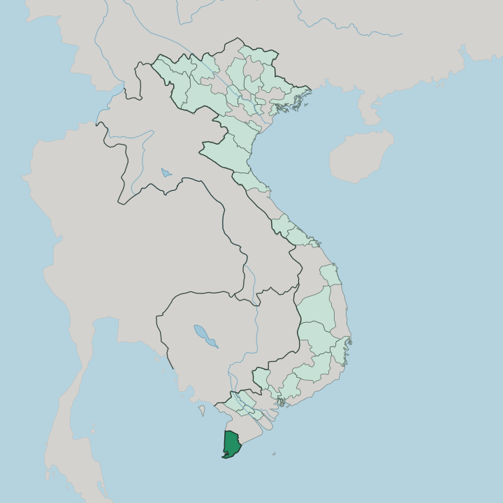


Towns & cities in Ca Mau
Pick a town or city — each links to where to stay.
Almost everyone bases in Cà Mau. It is the one real city, the site of the province's only airport, and the base for every trip out to the coast and the forest. Đất Mũi sits at the very tip, a knot of stilt houses and boardwalks inside Mũi Cà Mau National Park. Sông Đốc, on the Gulf of Thailand, ranks among the biggest fishing ports on the coast.
For the tràm forest, homestays scatter through U Minh Hạ to the north. Base in the city, ride out from there.
About Ca Mau
What is Ca Mau known for?
Cà Mau is the southernmost province of Vietnam, and the far tip of the mainland is its signature. That tip is Mũi Cà Mau. Travellers ride out to the cape to stand where the country runs out of land, watching the sun rise over the South China Sea and set over the Gulf of Thailand from a single shore.
Behind the cape spread the largest mangrove forests in the country, protected within Mũi Cà Mau National Park, while inland the cajuput swamp forest of U Minh Hạ covers waterlogged peat. Shrimp ponds and fishing boats fill the space between.
Where is Ca Mau?
Cà Mau caps the far southern end of the Vietnamese mainland, the flat peninsula where the country finally runs out into open sea. The Cà Mau Peninsula pushes out below the Mekong Delta, and three of its four sides face open water. To the west lies the Gulf of Thailand.
The South China Sea, which Vietnamese charts name the East Sea, works against the eastern edge. Where they meet, the land pinches to a single spit: Mũi Cà Mau, the southern cape of the mainland. Land is never far off.
This is young, low ground. The peninsula rises barely two metres above the tide, laid down from silt that the Mekong River carries downstream and drops along the coast, and it still edges outward into the Gulf of Thailand as fresh mud gathers among the mangrove roots. Salt water and river water braid through it in a mesh of channels and canals, the Gành Hào, the Ông Đốc and the Bảy Háp among them, so that boats reach corners no road ever will.
Mangroves grip the seaward fringe. Cajuput swamp forest covers the peaty interior at U Minh Hạ. Very little of the province sits dry or far from water.
What is Ca Mau like?
Life here is lived on the water. Houses stand on stilts along the canals, markets trade from sampans, and a boat still does the work a road would do elsewhere in the country. Three communities share the delta: the Kinh majority, the Khmer whose pagodas dot the countryside, and the Hoa of Chinese descent who keep the trade and temples of the towns.
Their music is Đờn ca tài tử, the amateur chamber song of the southern delta that UNESCO lists as intangible heritage. Fishing towns keep their own rite. At Sông Đốc, the Nghinh Ông festival honours the whale, and the fleet crowds the river mouth for the procession.
The kitchen runs on salt and mud. Cooks build lẩu mắm, the fermented-fish hotpot of the delta, and pull ba khía, the salted fiddler crab, from the mangrove mud, while the cajuput forest yields wild honey and its own smoked field fish. Shrimp and crab from the ponds anchor almost every meal.
This is frontier country. The southern peninsula was among the last land the Vietnamese settled, cleared from swamp and mangrove only a few centuries ago, and that pioneer streak still marks the food, the speech and the temper of the place. Buddhist pagodas and Chinese temples close the picture.
What is the history of Ca Mau?
For much of the first millennium this coast lay within Funan, the early trading kingdom centred on the Mekong Delta. The mangrove edge stayed thinly peopled for centuries afterwards. Vietnamese and Chinese settlers pushed south into the swamps under the Nguyễn lords in the 1600s, draining and clearing as they came.
French administrators carved out a Cà Mau district in 1867. The province was folded into Minh Hải in 1976, then split off again as Cà Mau in 1997. Land, slowly won from water.
What is the climate of Ca Mau?
Cà Mau runs hot and wet. A tropical monsoon climate splits the year into two plain seasons, and both are warm, since the far southern tip of the country never really cools. The rains ride the south-west monsoon from about May to November, heaviest at midseason, when storms off the Gulf of Thailand flood the low peninsula for days at a time.
The drier stretch runs from December to April. Sea air on three sides holds the heat steady and the humidity high. Cool is not a word for it.
How do you get to Ca Mau?
Cà Mau is the end of the road, the last provincial capital before the mainland gives out. Most travellers come from Ho Chi Minh City, either flying into Cà Mau Airport or driving the long delta highway south. National Route 1 runs the length of the country and finally stops at Năm Căn, and from there the Hồ Chí Minh Highway carries on across the bridges and mangrove channels all the way to the cape at Đất Mũi.
Buses make the run south from the city. Fast boats still thread the back channels to the fishing ports, but the cape itself is reached by road. Everything funnels through Cà Mau.
Updated July 2026