Vietnam
Lao Cai, Vietnam — Towns & Travel Guide


Lào Cai is Vietnam's mountainous far north-west, where the Red River enters from China and Fansipan rises above the terraced valleys of Sa Pa.
About Lao Cai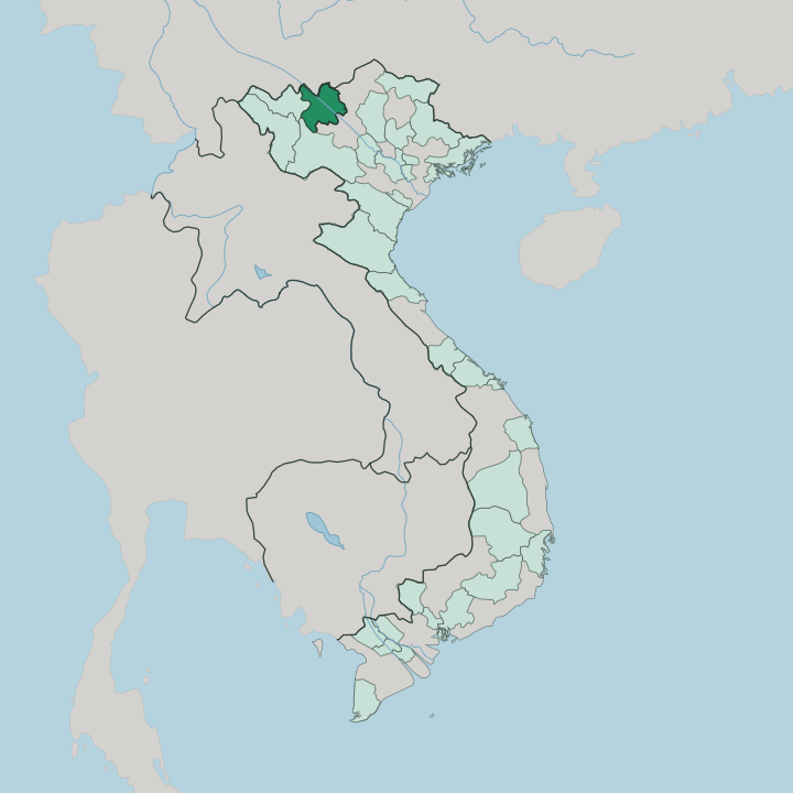


Towns & cities in Lao Cai
Pick a town or city — each links to where to stay.
Sa Pa is the usual base. The old hill station sits on a ridge above the Muong Hoa valley, within reach of both the Fansipan cable car and the trailheads down into the rice terraces. Lào Cai city, an hour's drive north at the border, is mainly a place to spend the first night off the Hanoi train.
For the Sunday market and the Flower Hmong villages, Bắc Hà lies further east, though it keeps only a handful of guesthouses. Pick a valley homestay in Tả Van if you want to wake among the terraces themselves.
About Lao Cai
Sa Pa draws nearly everyone.
What is Lao Cai known for?
The mountain town sits high in the Hoàng Liên Sơn range, ringed by terraced rice fields that climb the slopes of the Muong Hoa valley toward Fansipan, the highest peak in Vietnam. Hmong, Dao and Tày villages fill the hills around it. Farther east, the Sunday market at Bắc Hà pulls Flower Hmong traders down from the surrounding valleys.
Trekking is the reason most people stay.
Where is Lao Cai?
Lào Cai occupies the mountainous far north of Vietnam, pressed against the Chinese border. The frontier follows the water. The Red River crosses out of Yunnan here and runs south-east through the province toward Hanoi, and the provincial city of Lào Cai stands at the point where the Nanxi River joins it, looking straight across the water at the Chinese town of Hekou.
Lai Châu lies to the west, Hà Giang to the east, and Yên Bái downstream to the south. East across the Chảy River the highlands roll on toward Bắc Hà, drier and lower than the Sa Pa side. South-west of the river the land climbs hard.
The Hoàng Liên Sơn range walls off that side of the province, and Fansipan, the highest summit in Vietnam and in all of Indochina, tops it. Sa Pa clings to a shelf below the peak, above the deep Muong Hoa valley where rice terraces are cut step by step into the slopes. Streams off the high ridges feed those paddies through the dry months.
Gorges and switchbacks define the rest. Little of the province is flat.
What is Lao Cai like?
More than twenty ethnic groups share these mountains, and their villages, not the towns, are what most trekkers come to see. Hmong make up the largest of them, split among Black, Flower and Red Hmong who differ by the dye and embroidery of their dress. Red Dao women shave their hairlines and wear heavy scarlet headscarves.
Tày and Giáy farm the lower valleys. Each group keeps its own language, and Vietnamese is the tongue they hold in common. Markets are the pulse of highland life.
The Sunday gathering at Bắc Hà brings Flower Hmong down from the hills to trade buffalo, cloth and maize spirit, and smaller markets rotate through the valleys by the day of the week. Hemp is grown, spun and dyed with indigo for the clothes people still wear to them. Above Sa Pa the terraces themselves are the other inheritance, hand-cut over generations and reflooded each spring.
The looms still clatter in the villages. The French left a stone church and a scatter of villas, but the older culture of the slopes has long outlasted them.
What is the history of Lao Cai?
France took Lào Cai in 1889 and ran it as a border garrison, then laid out Sa Pa above it as a hill station in 1903 to escape the lowland heat. Both grew around the metre-gauge railway pushed up from Hanoi to the frontier. War undid most of it.
When Chinese forces crossed the border in 1979, they levelled Lào Cai town almost completely, and the crossing stayed shut until 1993. Little of the French quarter survived, though Sa Pa kept its stone church.
What is the climate of Lao Cai?
Altitude splits the province in two. Down on the Red River at Lào Cai the air stays hot and sticky like the rest of northern Vietnam, but Sa Pa, more than a kilometre higher, runs cool the year round. Winters there turn cold and grey, with fog settling for days and frost creeping over the terraces.
Snow dusts the summit of Fansipan in the coldest spells, a rarity anywhere else in the country. The heaviest rain comes with the summer monsoon, between May and September.
How do you get to Lao Cai?
The classic approach is the overnight sleeper train from Hanoi. It grinds up the Red River valley through the dark and reaches Lào Cai near dawn, and from the station the road switches back and forth for an hour up to Sa Pa. Faster sleeper buses run the same route on the Nội Bài-Lào Cai expressway.
The province has no airport. Fansipan itself is a cable-car ride from Sa Pa, or a hard two-day climb for anyone who walks it.
Good for
Updated July 2026