Vietnam
Quang Tri, Vietnam — Towns & Travel Guide


Quảng Trị is central Vietnam's old war frontier, split for two decades by the Bến Hải river and the DMZ along the 17th parallel.
About Quang Tri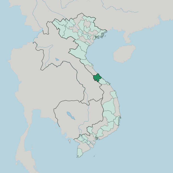


Towns & cities in Quang Tri
Pick a town or city — each links to where to stay.
Đông Hà is the practical base, a small town on the Hiếu river with the widest choice of beds and every DMZ tour setting off from its centre. Most visitors sleep there and drive out by day. The coast offers a quieter alternative.
Cửa Tùng, once dubbed the queen of the beaches by the French, sits near the mouth of the Bến Hải, while the island of Cồn Cỏ lies an hour offshore by boat for anyone wanting real isolation. Pick Đông Hà for war history and easy logistics; take the coast when you want sand and open sea.
About Quang Tri
What is Quang Tri known for?
Quảng Trị carries the weight of the Vietnam War like nowhere else in the country. For twenty years the Bến Hải river marked the line between North and South, and the surrounding DMZ soaked up some of the heaviest bombing of the entire conflict. The scars remain.
Travellers come for the Vịnh Mốc tunnels, the reunification bridge at Hiền Lương, and the shattered citadel at the centre of Quảng Trị town. Đông Hà, the main travel base, is where the DMZ tours begin.
Where is Quang Tri?
Quảng Trị occupies a narrow waist of central Vietnam, one of the slimmest stretches of the entire country. From the Trường Sơn mountains along the border with Laos, the land falls quickly through forested hills and red-earth uplands to a thin coastal plain and the South China Sea. Ridge and shore sit close together.
That compression shapes everything about the province. Sand dunes, tidal lagoons, and shifting river mouths line the low coast. The Hiếu river runs through Đông Hà and joins the Thạch Hãn, which drains the central lowland and reaches the sea at Cửa Việt.
Further north, the Bến Hải river traces a nearly straight course inland from the coast at Cửa Tùng, and for two decades that channel was the border between North and South Vietnam. Huế lies a short drive south. Inland, Highway 9 climbs west from Đông Hà through Khe Sanh to the Lao Bảo crossing into Laos, using one of the few low passes across the Trường Sơn range.
The mountains stay thinly settled. Out at sea, the small volcanic island of Cồn Cỏ marks the province's furthest reach.
What is Quang Tri like?
Memory is the province's real inheritance. More than any monument, the land itself records the war, and cemeteries, tunnel complexes, and old firebases sit within an easy drive of one another across the former DMZ. The Vịnh Mốc tunnels tell it plainly.
Whole villages moved underground there to survive the bombing, digging a warren on three levels where children were born and families lived for years. Old shells still surface in the fields. The citadel in Quảng Trị town held through an eighty-one-day siege in 1972 before it fell to rubble, and its shattered brick outline now stands as a memorial.
Reverence, not spectacle, sets the tone. Faith runs just as deep beside the war memory here. The pilgrimage shrine at La Vang, a Marian basilica in the countryside outside Quảng Trị town, draws Catholic pilgrims from across Vietnam and beyond.
In the western hills, the Bru-Vân Kiều people keep their own language, gong music, and brocade weaving, set apart from the lowland Kinh majority near the coast. Lantern floats on the Thạch Hãn honour soldiers lost crossing its currents in 1972. Village festivals and boat races follow the lunar calendar along the rivers.
Kitchens lean on the sea and the paddy. Life keeps a slow pace.
What is the history of Quang Tri?
Quảng Trị came into Vietnamese hands late, absorbed from the old kingdom of Champa as the Việt pushed south down the coast. Its modern story turns on one date. The 1954 Geneva accords fixed the border at the Bến Hải river, and for the next twenty-one years the province was cut in two, its northern bank in one Vietnam and its southern bank in another.
The 1972 offensive levelled the citadel and the town around it. Reunification came in 1975, but the mines and scars stayed in the ground.
What is the climate of Quang Tri?
Quảng Trị has one of the harshest climates in Vietnam. Through summer, a dry wind known as the gió Lào pours over the Trường Sơn from Laos and bakes the coastal plain for weeks on end. Then the rains arrive.
The autumn monsoon drives some of the heaviest downpours in the country, and typhoons off the South China Sea flood the low ground along the Thạch Hãn and Bến Hải each autumn. Winters stay mild but grey and wet.
How do you get to Quang Tri?
Most travellers reach Quảng Trị overland. National Highway 1 and the North-South railway both run straight through Đông Hà, linking the province to Huế an hour south and onward to Đà Nẵng and Hà Nội. Flights land elsewhere.
Air travellers use the airports at Phú Bài near Huế or Đồng Hới up the coast, each about a two-hour drive from Đông Hà. Highway 9 runs the other way, west from Đông Hà to the Lao Bảo border and on into Laos.
Good for
Updated July 2026