Vietnam
Tay Ninh, Vietnam — Towns & Travel Guide


Tây Ninh is a flat borderland province of southeastern Vietnam, marked by the lone peak of Núi Bà Đen and the Cao Đài Holy See.
About Tay Ninh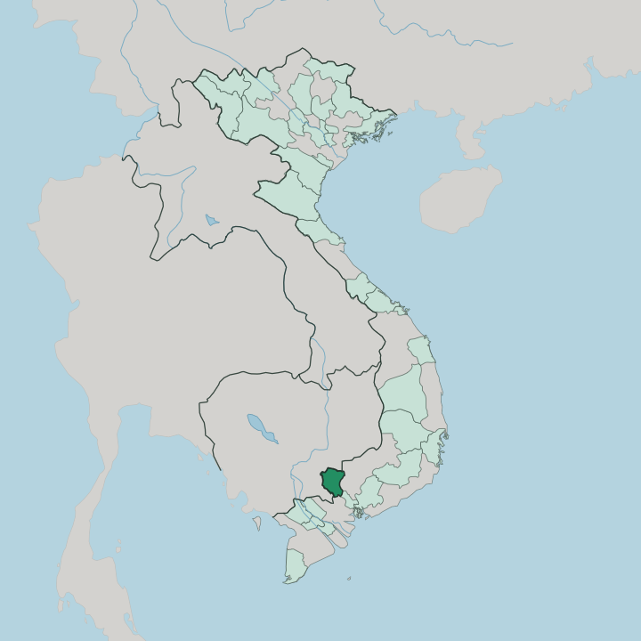


Towns & cities in Tay Ninh
Pick a town or city — each links to where to stay.
Tây Ninh city is the practical base, close to both Núi Bà Đen and the Cao Đài Holy See, with the province's fullest run of hotels and guesthouses. Many travellers skip an overnight altogether and come on a single long day from Ho Chi Minh City, roughly two hours down National Route 22. Outside town the choice narrows.
If you want water and quiet rather than pilgrims and temples, the shore of the Dầu Tiếng reservoir in the province's east offers a slower stop. Stay in the city for the sights; drive out to the lake to escape them.
About Tay Ninh
Two landmarks define the province.
What is Tay Ninh known for?
Núi Bà Đen rises straight off the surrounding plain as the highest point in southern Vietnam, an extinct volcano whose shrines draw pilgrims up a cable car and a long stone stairway. The other draw is the Cao Đài Holy See, seat of a faith founded here in 1926, where white-robed adherents gather at noon inside the pastel Great Divine Temple beneath its single Divine Eye. Both lie within a day's round trip of Ho Chi Minh City.
That proximity is how most travellers meet them.
Where is Tay Ninh?
Tây Ninh spreads across the flat southeastern corner of Vietnam, between Ho Chi Minh City and the Cambodian frontier. Its long northern and western edges run against Cambodia, provinces such as Svay Rieng and Prey Veng lie just over the line, and the Mộc Bài crossing carries the main road on toward Phnom Penh. The land is overwhelmingly flat.
Broad alluvial plains, planted in rubber, cassava and sugar cane, roll toward the horizon in almost every direction. One thing breaks that flatness. Núi Bà Đen stands alone above the fields, a single dark cone that can be seen from far across the plain.
Rivers do the rest of the shaping. The Vàm Cỏ Đông enters from Cambodia in the north and threads south through the province, one of the two rivers that drain it. Along the eastern boundary runs the Saigon River, and on it sits the Dầu Tiếng reservoir, one of the largest artificial lakes in Vietnam, its water fanning out through canals to irrigate the surrounding farmland.
Nearer the border, the wetlands and forest of Lò Gò, Xa Mát fill the province's north-western corner. It is a province of plains, rivers and one mountain.
What is Tay Ninh like?
Faith runs the calendar here. The Cao Đài religion took shape in Tây Ninh in 1926, and the province remains its spiritual capital, drawing followers to the great temple for four services a day. Their creed folds Buddhism, Taoism, Confucianism and Christianity into one, and its single all-seeing eye looks out from temple façades across the region.
Núi Bà Đen carries an older devotion. Buddhist pilgrims have climbed it for centuries to the shrine of the Black Lady, and a towering statue of the Buddha crowns the summit above the spring pilgrimage crowds. The table is just as distinctive.
Tây Ninh is known across Vietnam for its rice paper, and the town of Trảng Bàng gave its name to bánh canh and to a dew-dried rice paper eaten with herbs and pork. Shrimp-and-chilli salt, muối tôm, is the province's signature seasoning, sprinkled on fruit and sold as a common souvenir. Cao Đài practice also makes vegetarian cooking unusually widespread here.
Vietnamese is the everyday language, though Khmer is still heard in villages near the Cambodian border. Food, faith and the mountain define daily life.
What is the history of Tay Ninh?
For centuries this was Khmer borderland, on the frontier of the old Cambodian world before Vietnamese settlers pushed south and farmed the plains. The province took its modern shape under the Nguyễn dynasty. In 1926 it became the birthplace of the Cao Đài religion, which soon commanded its own following and militia.
War marked the century that followed. Against the Cambodian border and astride a supply route south, Tây Ninh saw heavy fighting during the Vietnam War, and Khmer Rouge units later raided across the line into its villages.
What is the climate of Tay Ninh?
Tây Ninh runs hot the year round, with two seasons rather than four. The dry months, roughly December to April, bring clear skies and dusty roads, and this is when pilgrims crowd Núi Bà Đen. Then the monsoon turns.
From May into November the rains sweep in from the south-west, greening the plains and filling the Dầu Tiếng reservoir, whose stored water carries the farms through the next dry spell. Humidity stays high throughout.
How do you get to Tay Ninh?
Tây Ninh has no airport of its own. Almost everyone arrives overland from Ho Chi Minh City, which lies about two hours to the south-east along National Route 22, whether by tour coach, local bus or car. Day trips are the norm.
The same highway runs the other way to the Mộc Bài border post, the busiest land route between southern Vietnam and Cambodia on the way to Phnom Penh. Once in the province, a cable car and a winding road carry visitors up Núi Bà Đen, while the sights around the Cao Đài Holy See sit within easy reach of Tây Ninh city.
Good for
Updated July 2026