Vietnam
Tỉnh Quảng Ninh, Vietnam — Towns & Travel Guide


Quảng Ninh is Vietnam's coal-rich northeastern province, where the limestone towers of Hạ Long Bay rise from the Gulf of Tonkin near the China border.
About Tỉnh Quảng Ninh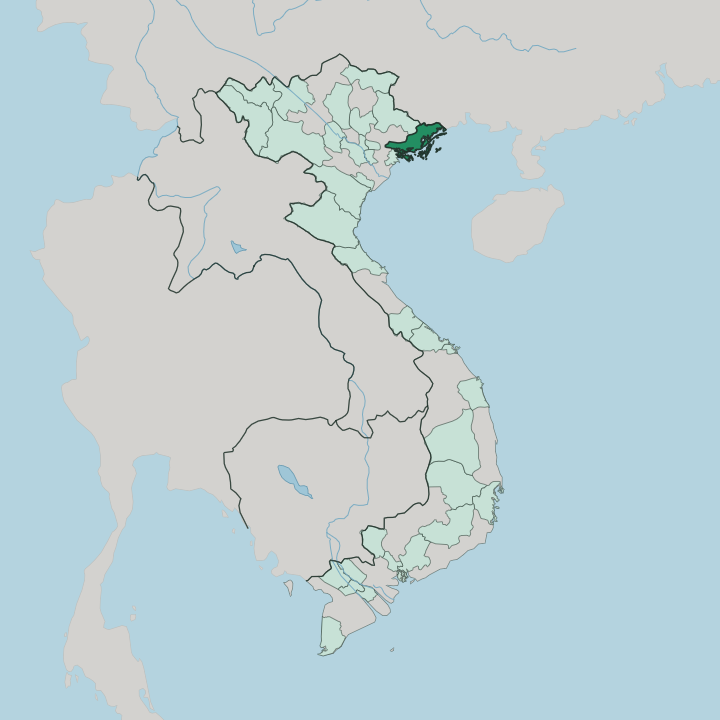


Towns & cities in Tỉnh Quảng Ninh
Pick a town or city — each links to where to stay.
Most beds cluster around Hạ Long Bay. Hạ Long city strings its hotels along the Bãi Cháy waterfront, where a cable car crosses the harbour and cruise boats leave each morning for the islands offshore. Many visitors skip land entirely and sleep aboard a junk on the bay.
Quieter options sit east toward Vân Đồn and the Cô Tô islands. Choose the waterfront for your first trip.
About Tỉnh Quảng Ninh
Coal and karst define Quảng Ninh.
What is Tỉnh Quảng Ninh known for?
Its most famous sight is Hạ Long Bay, a maze of nearly 2,000 limestone islands rising straight out of the Gulf of Tonkin, 989 of them named. Beneath the province lie the anthracite seams that yield most of Vietnam's coal. Pilgrims climb Yên Tử, the mountain where Vietnamese Zen Buddhism was born.
Traders cross into China at Móng Cái.
Where is Tỉnh Quảng Ninh?
Quảng Ninh occupies Vietnam's far northeastern corner. It lies about 153 km east of Hanoi, fronting the Gulf of Tonkin along a crooked, island-strewn coast that runs southwest to northeast toward the land border with China. That border follows the Ka Long River at Móng Cái, the province's easternmost town, where a road bridge crosses into the Chinese city of Dongxing.
Tidal flats and river mouths break the shoreline the whole way down. Water frames almost every edge. Inland the land climbs fast.
Close to four-fifths of Quảng Ninh is hills and mountains, and the Yên Tử range in the west carries the pagodas where Vietnamese Zen Buddhism took shape. Beneath the eastern towns of Hạ Long and Cẩm Phả lies the anthracite basin that supplies most of the country's coal. Offshore, the drowned karst of Hạ Long Bay and the quieter Bái Tử Long scatter more than 2,000 islands across the gulf.
The Vân Đồn islands and, far out, Cô Tô mark the seaward limit of the province. In the southwest, the Bạch Đằng River drains into the sea at Quảng Yên, where stakes once sank a Mongol fleet. The coal made its name.
What is Tỉnh Quảng Ninh like?
Coal shaped the people here as much as the land. Generations of miners built the towns of Hạ Long and Cẩm Phả, and the French dug the first open pits at Hòn Gai in the 1880s, leaving brick colliery offices that still stand. The miner remains a local hero.
Kinh Vietnamese fill the coast, while Tày, Dao and Sán Dìu communities keep their own festivals in the hill country inland. Fishing families once lived their whole lives afloat in the villages of the bay, and some still do. Faith centers on one mountain.
On Yên Tử, the thirteenth-century king Trần Nhân Tông gave up his throne to become a monk and founded the Trúc Lâm school, Vietnam's own line of Zen Buddhism. Each spring, pilgrims climb its stone paths to the Bronze Pagoda on the summit. At Cửa Ông, a hillside temple honours a general of the Trần dynasty and draws crowds each lunar new year.
The kitchens lean on the sea, and Hạ Long is known for chả mực, squid pounded and fried into cakes. Vietnamese is the everyday language.
What is the history of Tỉnh Quảng Ninh?
The Bạch Đằng River decided everything. In 1288, on its tidal channels near Quảng Yên, Trần Hưng Đạo staked the riverbed with iron-tipped poles and destroyed the retreating fleet of Kublai Khan's Yuan navy. It ended the third Mongol invasion of Vietnam.
Centuries later, French companies opened the coal mines that made Hòn Gai an industrial port of colonial Indochina. The modern province was drawn in 1963, when Hải Ninh province and the Hồng Quảng zone were joined into one.
What is the climate of Tỉnh Quảng Ninh?
Two seasons really matter here. From May into September the coast turns hot and wet, and typhoons spinning off the Gulf of Tonkin can shut the bay to boats for days. Winter, from November to March, is cool and dry, with grey drizzle the locals call mưa phùn.
The hills inland run colder than the shore. Clear autumn days suit the islands best.
How do you get to Tỉnh Quảng Ninh?
Most travellers still come from Hanoi. A coastal expressway runs the length of the province, linking Hải Phòng through Hạ Long and Vân Đồn out to the Chinese border at Móng Cái. Vân Đồn International Airport handles the province's own flights, east of Hạ Long.
Many arrivals still land at Hanoi's Nội Bài and drive east. Others cross from China at Móng Cái.
Good for
Updated July 2026