Vietnam
Tỉnh Sơn La, Vietnam — Towns & Travel Guide


Sơn La is a mountainous province of northwestern Vietnam, where the Đà River is dammed to power Southeast Asia's largest hydroelectric station.
About Tỉnh Sơn La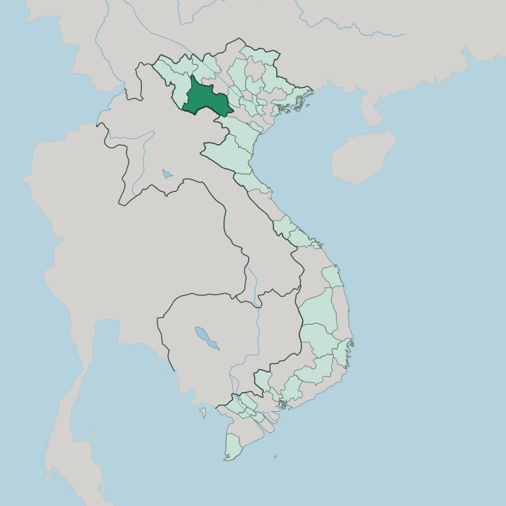


Towns & cities in Tỉnh Sơn La
Pick a town or city — each links to where to stay.
Most trips base themselves on the Mộc Châu plateau. Its tea terraces, dairy pasture and pine-shaded Bản Áng village make it the one part of Sơn La set up for overnight visitors, with rooms in the town and in Thái stilt homestays around it. Sơn La City, the largest town, sits further west on National Highway 6, the practical stop for the Sơn La Prison museum.
Mường La lies north, in the valley beneath the great dam on the Đà River. Choose Mộc Châu first. The other two suit a longer loop through the northwest.
About Tỉnh Sơn La
Two things define Sơn La for travellers.
What is Tỉnh Sơn La known for?
The first is the Mộc Châu plateau, a cool tableland of tea terraces and dairy pasture that turns white and pink with plum and peach blossom at the close of winter. The second is water: the Đà River, better known as the Black River, is held back at Mường La by Southeast Asia's largest hydroelectric dam. Around both live the Thái, Hmong and Mường communities whose stilt villages give the northwest its character. Hanoi lies a day's drive east.
Where is Tỉnh Sơn La?
Sơn La spreads across the mountains of northwestern Vietnam, and by area it ranks among the larger provinces in the country. Hanoi lies a day east. Phú Thọ adjoins it on the east, the lowland side of the range, and Lào Cai runs along the north. Điện Biên and Lai Châu climb away to the northwest. The entire southwestern flank of the province is an international frontier, a long, folded mountain border shared with the Lao provinces of Houaphanh and Luang Prabang.
More than four-fifths of it is upland. The Đà River, known in English as the Black River, is the spine of that upland. It runs down from the northwest and is walled at Mường La, where the water floods back into the long reservoir behind Southeast Asia's largest hydroelectric dam.
The Mã River drains the province's southern valleys. Between the two, the ground heaves up into limestone tablelands, and the broadest of them is the Mộc Châu plateau, a cool grassland shelf that carries the province's tea estates and dairy herds toward the Laos line. Little of Sơn La sits low.
That height, far more than any border, governs how the province farms, when its rains come and where its roads can run.
What is Tỉnh Sơn La like?
Sơn La counts more distinct peoples than any other province in Vietnam, and the daily life of the highlands is shaped far more by that mix than by anything the state capital sends up the road. The Thái are the largest group. Their wooden stilt houses, raised over the valley floors, still line the roads through Mộc Châu and Mường La.
Alongside them live Kinh incomers from the delta, Hmong villages on the higher slopes, and Mường and Kháng communities in between. The weekly markets bring them together. That variety shows in the things travellers actually encounter: indigo-dyed Thái brocade, the slow rượu cần rice wine drawn from a communal jar through bamboo straws, and grilled stream fish eaten with sticky rice pressed in bamboo.
The Xòe dance of the Thái, a slow circle of linked hands, carries UNESCO recognition of its own. The Hmong answer with the khèn. Their reed pipes and courtship songs fill the spring festivals, when peach and plum blossom whiten the Mộc Châu plateau.
Even the province's hardest chapter draws visitors, at the French colonial prison above Sơn La City.
What is the history of Tỉnh Sơn La?
French administrators drew Sơn La onto the map in 1886, carving it out of the older province of Hưng Hóa and seating it at Mường La. Twenty-two years later they built a prison on a hill above the town, and it filled with Vietnamese revolutionaries through the fight for independence; the inmate Tô Hiệu is remembered by the peach tree he planted in the prison yard. The next great upheaval came from water.
Damming the Đà River for the Mường La hydroelectric scheme forced the largest resettlement Vietnam has known, moving whole Thái and Kháng villages off the flooded valley floor.
What is the climate of Tỉnh Sơn La?
Height keeps Sơn La cooler than the Vietnamese lowlands. The year splits in two: a warm, wet monsoon from around May to September, then a dry, cool season that runs through winter into the spring blossom. Mornings are the giveaway.
On the Mộc Châu plateau, fog settles over the pastures at dawn, and in the hardest winters frost whitens the highest ridges while the valleys stay mild. That same chill is what lets the tea bushes and the temperate plum and peach thrive. Rain is heaviest in summer, when storms swell the Đà River.
How do you get to Tỉnh Sơn La?
Sơn La has no working passenger airport; the old airfield at Nà Sản, near Mai Sơn, sits idle. So almost everyone comes by road. National Highway 6 is the artery, climbing west out of Hanoi through Hòa Bình, up onto the Mộc Châu plateau and on to Sơn La City, a run of roughly 300 kilometres and the better part of a day.
Beyond the city the same road crosses the Pha Đin Pass, one of Vietnam's great mountain passes, toward Điện Biên. Buses leave from Hanoi's Mỹ Đình terminal. On the water, boats also work the long reservoir behind the Đà River dam.
Good for
Updated July 2026