Vietnam
Tuyen Quang, Vietnam — Towns & Travel Guide


Tuyên Quang is a mountainous province in northern Vietnam, where the Lô and Gâm rivers wind past limestone peaks toward the forest of Nà Hang.
About Tuyen Quang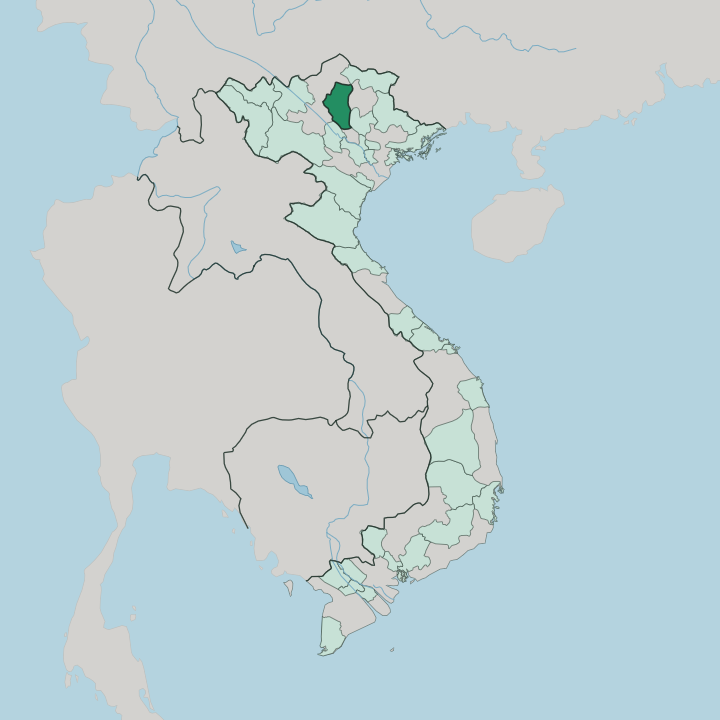


Towns & cities in Tuyen Quang
Pick a town or city — each links to where to stay.
Most beds cluster in Tuyên Quang city, the riverside provincial seat on the Lô River, within reach of the Tân Trào memorial complex at Sơn Dương. Choose it for a first trip. Serious lake and forest travellers push north instead to Nà Hang and Lâm Bình, where guesthouses and Tày stilt-house homestays sit beside the reservoir and the boat piers.
Beds thin quickly once the road climbs into the karst.
About Tuyen Quang
What is Tuyen Quang known for?
Two things carry Tuyên Quang's name. The first is Tân Trào, the forest base where Hồ Chí Minh directed the Việt Minh before the August Revolution of 1945, which makes the province a pilgrimage of Vietnamese national memory. The second is Nà Hang, a reservoir of jade-green water hemmed by limestone towers that boat operators sell as a Hạ Long Bay in the mountains.
Waterfalls, caves and terraced Tày villages fill the country between them.
Where is Tuyen Quang?
Tuyên Quang sits in the mountainous north of Vietnam, a long day's drive up the Lô River from Hanoi. The Lô is the spine of the province. It rises in Yunnan in China, crosses Hà Giang, and runs south through Tuyên Quang toward its meeting with the Red River down in Phú Thọ.
A second river, the Gâm, pours in from the northeast out of Cao Bằng and joins the Lô inside the province. The Phó Đáy drains the eastern hills toward Thái Nguyên. Together the three rivers carve the valleys that hold almost every town, road and rice terrace here.
The land rises toward the north. Broad valleys in the south around Sơn Dương give way to steep limestone country in Chiêm Hóa, Nà Hang and Lâm Bình, where forested towers climb past a thousand metres and Cham Chu, the highest, reaches 1,587 metres. Much of that upland is still under rainforest and monsoon forest.
The Nà Hang reservoir floods the northern gorges, drowning the lower Gâm and Năng into a maze of green-walled channels. It is karst, water and forest, stacked from the plain to the peaks.
What is Tuyen Quang like?
Tuyên Quang is one of Vietnam's most ethnically mixed provinces. Kinh Vietnamese fill the towns and the Lô valley floor, but more than half the province belongs to upland peoples. The Tày are the largest of them, a lowland-valley people of wet rice and stilt houses, followed by the Dao on the slopes above and smaller communities of Sán Chay and Mông.
Each keeps its own dress, language and calendar of rites. Markets are where the difference shows. On market mornings the Tày, Dao and Mông come down from scattered hamlets to trade, and the squares fill with indigo cloth, forest herbs and four or five languages at once.
Music carries much of that identity. The Tày are known for Then, a sung ritual poetry accompanied by the gourd-bodied tính lute, inscribed by UNESCO as intangible heritage. The Dao answer with páo dung, their own courtship and work songs.
Spring brings the Lồng Tông festival, when Tày villages open the farming year with offerings, songs and games in the paddies. Over all of it lies the province's other inheritance, its revolutionary past, kept in the shrines and relic houses that ring Tân Trào.
What is the history of Tuyen Quang?
Tuyên Quang's fame was made in the summer of 1945. In late May, Hồ Chí Minh moved his headquarters from Pác Bó down to the village of Tân Trào in Sơn Dương, and for three months the Việt Minh ran the revolution from a thatched hut in the forest there. That hut is a shrine now.
A national congress met at the Tân Trào communal house in August and ordered the general uprising that became the August Revolution. Tuyên Quang has been called the capital of the liberation zone ever since. The town on the Lô is far older than that, a garrison guarding the river road since imperial times.
What is the climate of Tuyen Quang?
Tuyên Quang is warm and wet. A monsoon shapes its climate. Tuyên Quang's calendar breaks cleanly into a wet half and a dry one.
From May to October the southwest monsoon brings heat, heavy afternoon downpours and almost all of the province's rain, swelling the Lô and the Gâm. The winter half is cooler and much drier, when dry northeasterly winds slide down from China and morning fog settles in the limestone valleys around Nà Hang. The high country in the north stays several degrees colder than the river towns year-round.
How do you get to Tuyen Quang?
There is no airport and no passenger train in Tuyên Quang. Almost everyone comes by road from Hanoi. The usual run takes the Nội Bài-Lào Cai expressway out past Nội Bài International Airport, then National Highway 2 and the Tuyên Quang-Phú Thọ Expressway north up the Lô valley to the provincial capital.
Reckon on half a day. Buses leave Hanoi's Mỹ Đình terminal through the day, and from Tuyên Quang city a slower mountain road climbs on to Nà Hang and the far north.
Good for
Updated July 2026