Argentina
Formosa Province, Argentina — Towns & Travel Guide


Formosa Province spreads across the flat Gran Chaco of northern Argentina, wedged between the Bermejo and Pilcomayo rivers.
About Formosa Province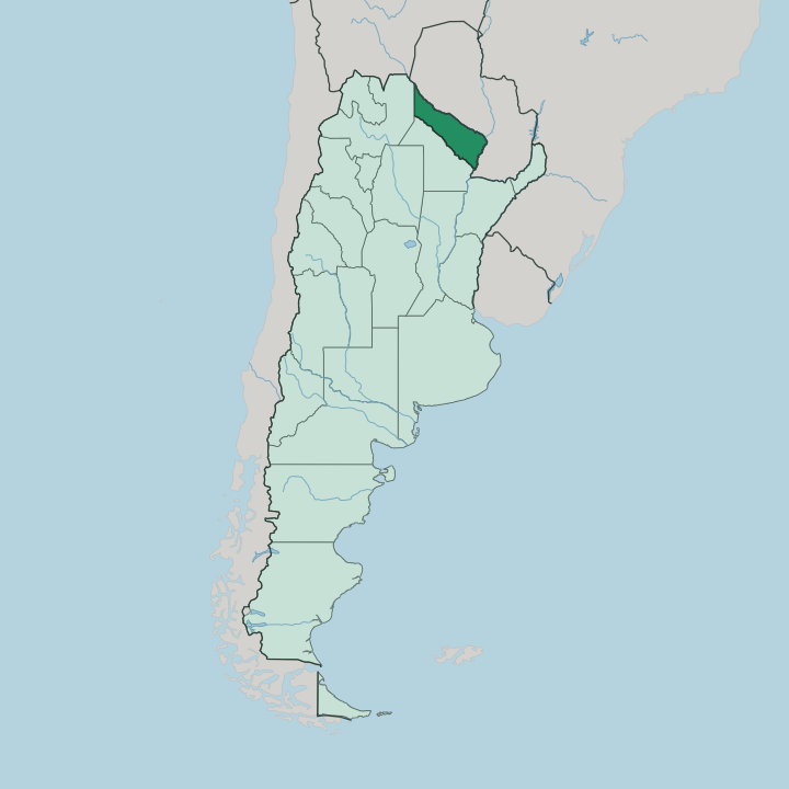
Towns & cities in Formosa Province
Pick a town or city — each links to where to stay.
Formosa city is the obvious first base. The provincial capital holds a full spread of hotels and the airport that most trips use, and it makes the natural hub before you strike out into the Chaco. Clorinda anchors the far north-east, a border town on the Pilcomayo facing Asunción and the closest bed to the crossing into Paraguay.
Out west, Las Lomitas is the launching point for Bañado La Estrella, with simple lodgings, fuel and food before the long road into the marsh. Choose Formosa for comfort; choose Clorinda for the border and Las Lomitas when the wetland is the whole reason you came.
About Formosa Province
Water and wilderness define Formosa.
What is Formosa Province known for?
The province is best known for Bañado La Estrella, a vast wetland of lagoons, palm groves and drowned trees where the Pilcomayo River spills across the plain. To the east lies Río Pilcomayo National Park, a mosaic of marsh, savanna and forest that shelters caimans, capybaras and hundreds of bird species. The capital city of Formosa sits on the Paraguay River, the working heart of a province given over to cattle, cotton and banana groves.
Where is Formosa Province?
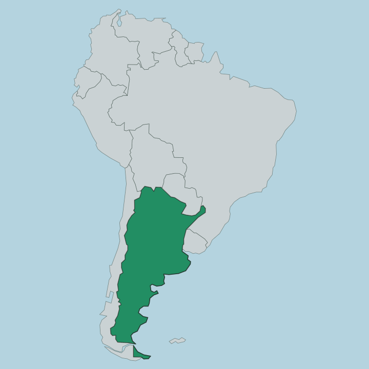
Formosa is a province of northern Argentina, a long strip of the Gran Chaco pressed against the frontier with Paraguay. Two rivers draw its edges. The Pilcomayo River runs along the north, marking the border with Paraguay, and the Bermejo River traces the southern boundary with Chaco Province. Salta Province lies to the west, up the widening gap between those two rivers.
The Paraguay River closes the eastern side, and the provincial capital of Formosa stands on its bank, looking across the water at the Paraguayan town of Alberdi. The land between the rivers is almost dead flat, tilting so gently toward the south-east that the streams wander and the rain has nowhere to drain. Where the Pilcomayo loses its channel it fans out into Bañado La Estrella, one of the largest wetlands in South America, a maze of lagoons and flooded palm forest.
Rainfall thins as you travel inland. The humid east carries subtropical forest and citrus groves, while the dry west fades into the thorny scrub of the Chaqueño woodland. It is a province with no mountains and no coast, shaped entirely by its rivers and by the water they leave behind.
What is Formosa Province like?
Formosa wears its frontier character openly. It is one of the most heavily Indigenous provinces of Argentina, and the Qom, Wichí and Pilagá peoples still live across the Chaco, their languages taught in schools alongside Spanish and their craft sold in the markets of the capital. Life here runs to the rhythm of cattle and the river.
Ranching built the province, and beef, cotton and citrus still move through it, joined by banana groves that supply much of the country's home-grown fruit. The border with Paraguay is a fact of daily life, not a distant line. At Clorinda the two countries trade across the Pilcomayo, and Guaraní words drift into the Spanish spoken in the streets.
Festivals lean on that mix, from riverside carnival to the harvest fairs of the interior towns. Beyond the settlements, the draw is the wild Chaco itself. Fishermen work the Paraguay River for surubí and dorado, birdwatchers fill the lodges near Río Pilcomayo National Park, and the flooded expanse of Bañado La Estrella pulls photographers into a landscape few outsiders ever see.
This is a hot, remote province close to nature, and that is precisely its appeal.
What is the history of Formosa Province?
This was Chaco frontier first. Spanish expeditions probed the rivers in the sixteenth century, but the interior stayed in Indigenous hands for generations more. Commander Luis Jorge Fontana founded the city of Formosa in 1879, and the surrounding territory was ruled for decades from Buenos Aires as a national territory rather than a province in its own right.
Full provincial status came only in 1955. That late arrival still marks Formosa as one of Argentina's youngest and least developed provinces.
What is the climate of Formosa Province?
Formosa is hot. It has a humid subtropical climate that ranks among the warmest in Argentina, and summer afternoons can climb toward the mid-forties Celsius. Rain falls heavily in the humid east near the Paraguay River, where the wet season soaks the land, and thins sharply toward the drier Chaco interior in the west.
Winters are short and mild, and hard frost is rare. The heat and the seasonal flood together decide when the wetlands fill and when the roads through them stay open.
How do you get to Formosa Province?
Air is the quick way in. Formosa city has the province's only significant airport, with the main flights running down to Buenos Aires. By road, National Route 11 climbs the Paraguay River from Chaco Province to the capital and on to Clorinda at the border, while National Route 81 cuts west across the Chaco toward Las Lomitas and Salta Province.
The Pilcomayo crossing at Clorinda is the busiest gateway between Argentina and Asunción, and buses use it daily. Distances inland are long and the roads run straight for hours.
Updated July 2026